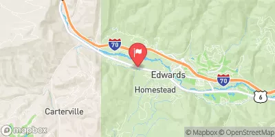
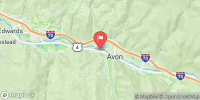
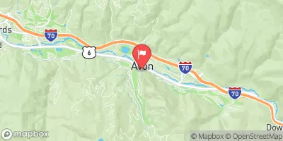
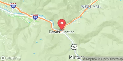
Lower Eagle (Edwards Water Plant To Eagle)
This is another good beginner kayak run unless the river is at high water or flooding. The scenery is scenic mixed with mainly class II rapids with a few class III's mixed in.
Suggested river levels for paddling this section of the Eagle River are between a bare minimum of 750cfs and a high of 5,500cfs.
River conditions sourced from USGS 09067020, the Eagle R Bl Wastewater Treatment Plant At Avon
Remember only watercraft are permitted
at Lower Eagle (Edwards Water Plant to Eagle).
Run Stats
Status | Too Low |
Class Level | III- to III+ |
Elevation | 7,398 ft |
Run Length | 17.0 Mi |
Gradient | 36 FPM |
Streamflow Discharge | 144 cfs |
Gage Height | 3.2 ft |
Air Temperature | 56° |
River | Eagle River |
Reporting Streamgage |
Eagle R Bl Wastewater Treatment Plant At Avon
USGS 09067020 |
I-70 Rapid
Class II+ to III |
Dead Cow
Class II+ to III |
Dead Cow
Class II+ to III |
Rodeo Rapid
Class III- to IV- |
Trestle Rapid
Class II+ to III+ |
Gauge | Streamflow | Stage |
---|---|---|
Ef Arkansas R At Us Hiway 24
USGS 07079300 |
13 cfs | 2.6 ft |
Bemrose-Hoosier Diversion Near Hoosier Pass
USGS 09044300 |
1 cfs | 0.1 ft |
Castle Creek At Aspen
USGS 09075400 |
43 cfs | ft |
Roaring Fork River Near Emma
USGS 09081000 |
213 cfs | 4.8 ft |
Illinois Creek Near Rand
USGS 06617500 |
4 cfs | 1.2 ft |
Williams Fork Near Leal
USGS 09036000 |
40 cfs | 1.7 ft |
Blue River Below Dillon
USGS 09050700 |
54 cfs | 0.8 ft |
Fish Cr At Upper Sta Nr Steamboat Springs
USGS 09238900 |
20 cfs | 0.8 ft |
East Fork Eagle River Near Climax
USGS 09061600 |
54 cfs | 0.1 ft |
Straight Cr Blw Laskey Gulch Nr Dillon
USGS 09051050 |
7 cfs | 4.1 ft |
Snotel Site | Snowpack | 24hr Change |
---|---|---|
Roach
SNOTEL 718 |
43" | -2" |
gothic
SNOTEL GTHC2 |
38.7" | -0.41" |
Kiln
SNOTEL 556 |
25" | -2" |
Beaver Ck Village
SNOTEL 1041 |
18" | -1" |
Elliot Ridge
SNOTEL 1120 |
46" | 0" |
Nast Lake
SNOTEL 658 |
11" | -2" |
Summit Ranch
SNOTEL 802 |
19" | -1" |
Slumgullion
SNOTEL 762 |
37" | -1" |
Mccoy Park
SNOTEL 1040 |
22" | -3" |
Buffalo Park
SNOTEL 913 |
34" | -1" |
Old Battle
SNOTEL 673 |
78" | -1" |
Willow Creek Pass
SNOTEL 869 |
38" | 1" |
Vail Mountain
SNOTEL 842 |
31" | -1" |
Moon Pass
SNOTEL 1124 |
20" | 0" |
crested butte 6.2 n, co
SNOTEL CO-GN-18 |
33.42" | -1.14" |
Saint Elmo
SNOTEL 1100 |
25" | -1" |
silverthorne 2.1 wsw, co
SNOTEL CO-SU-6 |
13.77" | -0.87" |
Chapman Tunnel
SNOTEL 1101 |
32" | -1" |
fairplay 2.7 wnw, co
SNOTEL CO-PK-15 |
18.93" | -0.64" |
Porphyry Creek
SNOTEL 701 |
35" | -2" |
Sage Creek Basin
SNOTEL 1015 |
34" | -1" |
Buckskin Joe
SNOTEL 938 |
28" | 0" |
Arapaho Ridge
SNOTEL 1030 |
54" | -1" |
Webber Springs
SNOTEL 852 |
46" | -2" |
Little Snake River
SNOTEL 1047 |
50" | -2" |
Sandstone Rs
SNOTEL 732 |
25" | -3" |
co st forest st park
SNOTEL CSFC2 |
1.41" | -1.46" |
pitkin 1.1 sw, co
SNOTEL CO-GN-59 |
2.17" | -1.29" |
Brumley
SNOTEL 369 |
35" | -1" |
Blackhall Mtn
SNOTEL 1119 |
69" | -4" |
Columbine
SNOTEL 408 |
39" | -2" |
climax coop
SNOTEL CLXC2 |
34.33" | -0.77" |
Ivanhoe
SNOTEL 547 |
46" | 0" |
Rawah
SNOTEL 1032 |
25" | -2" |
South Brush Creek
SNOTEL 772 |
19" | -2" |
Elk River
SNOTEL 467 |
31" | -2" |
Whiskey Park
SNOTEL 859 |
56" | -3" |
Hoosier Pass
SNOTEL 531 |
39" | -2" |
frisco 0.5 n, co
SNOTEL CO-SU-4 |
2.52" | -1.29" |
Cinnabar Park
SNOTEL 1046 |
45" | -2" |
yampa 5.1 s, co
SNOTEL CO-RT-26 |
5.28" | -1.24" |
Trapper Lake
SNOTEL 827 |
12" | -1" |
North Lost Trail
SNOTEL 669 |
29" | -2" |
Divide Peak
SNOTEL 449 |
38" | -2" |
Sargents Mesa
SNOTEL 1128 |
39" | -1" |
Copper Mountain
SNOTEL 415 |
32" | -1" |
Rough And Tumble
SNOTEL 939 |
28" | -1" |
Upper Taylor
SNOTEL 1141 |
30" | -1" |
Butte
SNOTEL 380 |
26" | 0" |
Dry Lake
SNOTEL 457 |
26" | -3" |
North French Creek
SNOTEL 668 |
69" | -1" |
Crosho
SNOTEL 426 |
18" | -50" |
Lost Dog
SNOTEL 940 |
44" | -1" |
Independence Pass
SNOTEL 542 |
39" | -1" |
Zirkel
SNOTEL 1033 |
38" | -3" |
Brooklyn Lake
SNOTEL 367 |
60" | -2" |
Med Bow
SNOTEL 1196 |
91" | -3" |
Middle Fork Camp
SNOTEL 1014 |
21" | -2" |
Tower
SNOTEL 825 |
82" | -1" |
vail 3.5 e, co
SNOTEL CO-EG-53 |
20.25" | -0.79" |
Park Cone
SNOTEL 680 |
27" | -1" |
Bear River
SNOTEL 1061 |
27" | 0" |
Cochetopa Pass
SNOTEL 1059 |
9" | -2" |
Schofield Pass
SNOTEL 737 |
57" | -1" |
Rabbit Ears
SNOTEL 709 |
36" | -2" |
Fremont Pass
SNOTEL 485 |
47" | 0" |
Lynx Pass
SNOTEL 607 |
18" | -2" |
Sand Lake
SNOTEL 731 |
82" | -4" |
Campground | Campsites | Reservations | Toilets | Showers | Elevation |
---|---|---|---|---|---|
Sylvan Lake State Park | 44 | 8,535 ft | |||
Chapman | 84 | 8,598 ft | |||
Elk Wallow | 7 | 8,829 ft | |||
Radium - Kremmling RMA - Rafting ramp | None | 6,867 ft | |||
Lynx Pass | 11 | 8,987 ft | |||
Gore Pass | 12 | 9,554 ft | |||
Pumphouse | 14 | 7,491 ft | |||
Wolcott | None | 6,979 ft | |||
Blacktail Creek | 8 | 8,997 ft | |||
Dearhamer | 13 | 7,792 ft | |||
Fulford Cave | 7 | 9,422 ft | |||
Yeoman Park | 24 | 9,062 ft |
Ski Area | Snowpack | Air Temperature | 5 Day Forecast |
---|---|---|---|
Aspen Mountain | 39" | 45° | 11.37" |
Ski Cooper | 28" | 42° | 9.32" |
Steamboat Ski Resort | 26" | 43° | 4.21" |
Aspen Highlands | 30" | 45° | 11.69" |
Crested Butte Mountain Resort | 26" | 42° | 10.75" |
Snowmass | 30" | 45° | 11.69" |
Buttermilk Mountain | 30" | 45° | 11.69" |
Vail | 31" | 41° | 10.93" |
Beaver Creek Resort | 22" | 53° | 9.58" |
River Run | Streamflow | Length | Class |
---|---|---|---|
Lower (Bottom Four) | 16.3cfs | 1.0 Mi | V to V+ |
Pumphouse | 701.0cfs | 14.0 Mi | II- to III+ |
Upper Gore Creek | 57.6cfs | 4.0 Mi | II+ to III |
The Upper | 16.3cfs | 8.0 Mi | V to V+ |
Lower Eagle (Edwards Water Plant to Eagle) | 144.0cfs | 17.0 Mi | III- to III+ |
State Bridge to Two Bridges | 701.0cfs | 4.8 Mi | I to II+ |
Lower Blue (Green Mountain to Spring Creek) | 265.0cfs | 3.8 Mi | II+ to III |
Dowd Chute | 67.0cfs | 1.0 Mi | III+ to IV+ |
Castle Creek | 140.0cfs | 2.0 Mi | IV+ to V- |
Lower Eagle (Edwards Water Plant to Eagle) | 144.0cfs | 17.0 Mi | III- to III+ |
Lower Blue (Green Mountain to Spring Creek) | 265.0cfs | 3.8 Mi | II+ to III |
Gore Canyon | 701.0cfs | 9.0 Mi | IV to V+ |
Clear Creek of the Arkansas | 15.0cfs | 2.5 Mi | IV+ to V- |
Lower Blue (Green Mountain to Spring Creek) | 265.0cfs | 3.8 Mi | II+ to III |
State Bridge to Burns | 701.0cfs | 20.0 Mi | I to II+ |
Lower Blue (Green Mountain to Spring Creek) | 265.0cfs | 3.8 Mi | II+ to III |
Upper Gore Creek | 57.6cfs | 4.0 Mi | II+ to III |
Burns to Dotsero | 1290.0cfs | 29.0 Mi | I to IV |