Segment B--Bridge On Sh 19 To Confluence With Lake George River Run
Community Reviews
Been here? Share the conditions.
Reviews, ratings & photos are added in the free Snoflo iOS app — rate a spot, tag the conditions, and your visit is verified by location. Add or manage your reviews from the app.
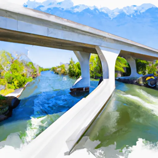
Segment B--Bridge On Sh 19 To Confluence With Lake George
The ideal streamflow for this segment of the river ranges from 250 to 1,000 cfs, making it perfect for spring and early summer runs. During periods of high rainfall, the streamflow can exceed 1,000 cfs, making it more challenging and potentially dangerous.
The segment is filled with various rapids, including Staircase, Devil's Elbow, and Bowlegs. These rapids are fast and technical, requiring paddlers to make quick decisions and maneuvers to navigate through them. Additionally, the river has a few obstacles such as fallen trees and rocks that require careful attention.
To ensure the safety of all paddlers, specific regulations have been put in place. All paddlers must wear a personal flotation device, and no alcohol is allowed on the river. Additionally, paddlers must obtain a permit from the Florida Fish and Wildlife Conservation Commission, which can be obtained online or at various local vendors.
In conclusion, the Whitewater River Run, Segment B, is a thrilling stretch of the river that requires skill and experience to navigate. Paddlers must be aware of the ideal streamflow range, the class rating, specific river rapids/obstacles, and specific regulations to the area to ensure a safe and enjoyable experience.
Plan your run down to the hour
Same weather feed Snoflo's iOS app uses -- updated continuously from NOAA / yr.no. Watch the precipitation column on the meteogram; rain ahead of a run typically lifts flows 12-48 hours later depending on the basin.
Next 5 days, hour by hour
Temperature line with weather symbols on top, snow + rain accumulation as columns, humidity as a dotted line.
5-day forecast table
Every 3 hours, broken out across temperature, snow, rain, humidity, and wind. Each cell is colour-coded relative to the column min/max.
| Time | Condition | Temp (°F) | Snow (in) | Rain (in) | Humidity (%) | Wind (mps) | Wind dir |
|---|---|---|---|---|---|---|---|
| Loading detailed forecast… | |||||||
15-day temperature & precipitation
Daily temperatures, snow, and rain projected over the next two weeks -- the upstream story that drives next week's flows.
Regional streamflow levels
USGS streamgauges around Segment B--Bridge On Sh 19 To Confluence With Lake George -- useful for spotting upstream pulses and gauging which tributary is contributing what.
| Streamgauge | Discharge | View |
|---|---|---|
| St. Johns River At Astor | 3,180 cfs | → |
| Ocklawaha R At Moss Bluff | 25 cfs | → |
| St. Johns River Nr Deland | 1,180 cfs | → |
| Haw Creek Ab Russells Landing Nr St Johns Park Fl | 113 cfs | → |
| Ocklawaha River At Eureka | 420 cfs | → |
| Ocklawaha River Nr Conner | 396 cfs | → |
Plan a longer trip
The closest boat launches, other paddle runs, and campgrounds so a day on the water can grow into a full weekend.
Boat launches
- Lake George - Volusia Wharf - Blue Creek Lodge Road Public Boat Ramp
- Ocala National Forest - Wildcat Lake Park And Boat Ramp
- Ocala National Forest - Gobbler Lake Access
- Ocala National Forest - Crooked Lake Access
- South Moon Fish Camp
- Ocala National Forest - Grasshopper Lake Public Boat Ramp
Other river runs
- Segment A--Mouth Of Spring On Ocala Nf (At Juniper Springs Wilderness) To Bridge On Sh 19 (At Wilderness Boundary)
- Segment A--Mouth Of Spring On Ocala Nf To Alexander Springs Wilderness Boundary
- Segment B--Alexander Springs Wilderness Boundary To Confluence With St. Johns River
- The First Powerline Crossing The Ichetuckee River To The Confluence With The Santa Fe River, Down The Santa Fe River To The Suwannee River
Campgrounds
- Juniper Springs Run Take Out
- Juniper Springs Run Put In
- Hopkins Prairie Campground
- Hopkins Prairie
- Buck Lake Group Camp
- Alexander Springs Campground
Fishing spots
- Wildcat Lake
- Silver Glen Springs Run
- North Grasshopper Lake
- South Grasshopper Lake
- Grasshopper Lake
- Lake George
Whitewater safety
- Check the flow before you run
- Use the linked-gauge card and Regional Flow panel above. Class ratings change with flow -- a Class III at low water can become Class IV+ at high water.
- Know your skill ceiling
- Pick runs comfortably below your ceiling. Cold-water and big-water runs raise the consequences of any mistake.
- Wear the right gear
- Helmet, PFD, drysuit / wetsuit when water is below 60°F. Throw bag, knife, and whistle on your person, not in the boat.
- Scout, set safety, and run with a team
- Scout new rapids on foot, set safety with throw bags above the consequence pool, and run with at least one other competent paddler.
- Respect the river
- Strainers, undercuts, low-head dams, and wood can kill at any class rating. When in doubt, portage.
Set push alerts in the Snoflo app
Save Segment B--Bridge On Sh 19 To Confluence With Lake George as a favorite, set a discharge threshold (e.g. "alert me when flow hits 600 cfs"), and the iOS app pushes the moment the linked gauge crosses.
About Segment B--Bridge On Sh 19 To Confluence With Lake George
What's the optimal flow for Segment B--Bridge On Sh 19 To Confluence With Lake George?
The optimal flow depends on the section and the craft. Check the Run Details panel for the linked gauge and current status.
How fresh is the cfs reading on this page?
The linked USGS streamgauge reports continuously (every 15 minutes); Snoflo refreshes throughout the day. Hover the streamflow sparkline to read individual datapoints.
What's the whitewater class?
See the Run Details panel for the class rating Snoflo tracks for this run. Class ratings change with flow -- a Class III at low water can become Class IV in high water.
Where do I put in / take out?
Tap Directions in the hero above to open driving directions to the put-in. For shuttle planning, check the Nearby Boat Launches panel and the river run operator's site.
Can I get alerts when flows hit the optimal range?
Yes -- alerts are managed in the Snoflo iOS app. Favorite this run, set a discharge threshold, and you'll get a push the moment the gauge crosses.
Other runs near here
Snoflo-tracked paddle runs within driving distance of Segment B--Bridge On Sh 19 To Confluence With Lake George.