Hanna Lake Park Fishing
As of July 18, 2026, the nearest streamgauge to Hanna Lake Park — Pottsburg Creek Nr South Jacksonville — reports 15 cfs. Source: USGS gauge data, refreshed throughout the day.
Community Reviews
Been here? Share the conditions.
Reviews, ratings & photos are added in the free Snoflo iOS app — rate a spot, tag the conditions, and your visit is verified by location. Add or manage your reviews from the app.
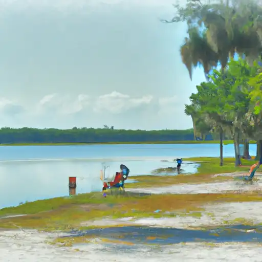
Hanna Lake Park
Hanna Lake Park is a fishing area in Florida tracked by Snoflo. This page combines live weather, USGS streamflow, and fish-species data with nearby campgrounds, parks, and boat launches so you can plan a trip from a single screen.
Tap any species below for techniques, target seasons, and other waters where it's been reported. For real-time push alerts when conditions cross a threshold, save this area as a favorite in the Snoflo iOS app.
What's biting at Hanna Lake Park
Species commonly reported here -- tap any card for techniques, target seasons, and other waters where it's been caught.
Plan your trip down to the hour
Same weather feed Snoflo's iOS app uses -- updated continuously from NOAA / yr.no.
Next 5 days, hour by hour
Temperature line with weather symbols on top, snow + rain accumulation as columns, humidity as a dotted line.
5-day forecast table
Every 3 hours, broken out across temperature, snow, rain, humidity, and wind. Each cell is colour-coded relative to the column min/max so trends jump out at a glance.
| Time | Condition | Temp (°F) | Snow (in) | Rain (in) | Humidity (%) | Wind (mps) | Wind dir |
|---|---|---|---|---|---|---|---|
| Loading detailed forecast… | |||||||
15-day temperature & precipitation
Daily temperatures, snow, and rain projected over the next two weeks. Hover any point for the full breakdown.
Nearby streamflow
USGS streamgauges within reach of Hanna Lake Park -- updated continuously from the National Water Information System.
| Streamgauge | Discharge | View |
|---|---|---|
| Pottsburg Creek Nr South Jacksonville | 15 cfs | → |
| St. Johns River At Jacksonville | 169,000 cfs | → |
| Julington Crk At Old St August Rd Nr Bayard | 36 cfs | → |
| Cedar River At San Juan Ave At Jacksonville | 30 cfs | → |
| Ortega River At Kirwin Rd Nr Jacksonville | 6 cfs | → |
| North Fork Black Creek Nr Middleburg | 18 cfs | → |
Plan a longer trip
The closest campgrounds, parks, boat launches, and reservoirs so a fishing run can grow into a weekend.
Campgrounds
- Hanna City Park
- Pelican Roost Rv Military - Mayport Ns
- Osprey Cove Military - Mayport Ns
- Huguenot City Park
- Little Talbot Island State Park
- Sandpiper Rv Park
Parks
- Modesky Park
- Johanson Park
- Donner Park
- Bull Park
- Aquatic Preserve Nassau River - St. Johns River Marshes
- Huguenot Memorial Park
Reservoirs
Boat launches
- Oak Harbor
- Michael B. Scanlon Mayport Boat Ramp
- Heckscher Drive 10877-10999, Jacksonville
- Joe Carlucci - Sisters Creek
- Fort George Island State Park Ribault Club
Points of interest
- Monty's Marina Deep-Sea Fishing
- Frog Hopper
- Kingsley Plantation
- Batting Cages
- Area 51 Laser Tag
- Adventure Landing
Paddle runs
- Begins Approximately 1 Mile Upstream Of Flea Hill, Georgia To The Bells River Confluence
- Begins Approximately 1 Mile Downstream Of U.S. 301 Crossing To Ends Approximately 1 Mile Upstream Of Flea Hill, Georgia
- Trader's Hill To Ends Approximately 1 Mile Downstream Of U.S. 301 Crossing
- The Confluence Of The North Prong And Middle Prong To Trader's Hill
Angling safety & ethics
- Know the regulations
- Check local fishing rules, seasons, size limits, and license requirements to ensure legal and sustainable angling.
- Handle fish responsibly
- Use wet hands, minimize air exposure, and release fish gently to improve survival rates when practicing catch-and-release.
- Choose the right gear
- Match your rod, line, and tackle to the species and conditions to increase success and reduce unnecessary harm to fish.
- Respect the waterway
- Avoid disturbing habitat, prevent bank erosion, and keep a safe distance from spawning areas to protect ecosystems.
- Keep it clean
- Pack out all line, hooks, bait containers, and trash. Discarded gear can injure wildlife and degrade waterways.
Set push alerts in the Snoflo app
Save Hanna Lake Park as a favorite, set a custom threshold (water temperature, streamflow, snowpack), and the iOS app will push the moment conditions cross.
About Hanna Lake Park
What fish species are found at Hanna Lake Park?
Snoflo tracks the species commonly reported at Hanna Lake Park -- see the Fish Species panel above for the live list with images and links to per-species pages.
How fresh is the weather data on this page?
The hourly forecast updates throughout the day from the NOAA / yr.no public feeds. Streamflow data comes live from USGS streamgauges, also refreshed continuously.
Can I get alerts when conditions change?
Yes -- alerts are managed through the Snoflo iOS app. Favorite this area, set a threshold (water temperature, streamflow, snowpack), and you'll get a push the moment it crosses.
Do I need a fishing license?
Yes. Check your state agency's regulations for license requirements, seasons, size limits, and any waterbody-specific rules before fishing Hanna Lake Park.
How do I get to Hanna Lake Park?
Tap Open in map in the hero above to center the Snoflo interactive map on this area, or grab the coordinates from the location facts panel.
Other angling spots near here
Snoflo-tracked fishing areas within driving distance of Hanna Lake Park.