Salmon River, Sec. 22, T28n, R1e To North And South Forks Of White Bird Creek River Run
Community Reviews
Been here? Share the conditions.
Reviews, ratings & photos are added in the free Snoflo iOS app — rate a spot, tag the conditions, and your visit is verified by location. Add or manage your reviews from the app.
Salmon River, Sec. 22, T28n, R1e To North And South Forks Of White Bird Creek
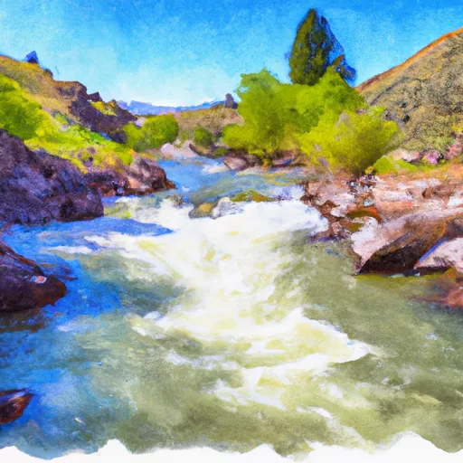
The class rating for this run is a IV-V, making it a difficult and technical course with significant rapids and obstacles. The segment mileage for this run is approximately 16 miles, with rapids such as Whiplash, The Needle, and Granite Creek Rapid providing challenging obstacles.
There are specific regulations to follow when kayaking or rafting in this area. All boaters are required to wear personal flotation devices (PFDs) at all times, and alcohol and drug use are strictly prohibited. Additionally, boaters are required to obtain a permit to access the Salmon River, and camping is only allowed in designated areas.
Overall, the Salmon River run from Sec. 22, T28N, R1E to the North and South Forks of White Bird Creek is a thrilling and challenging adventure for experienced kayakers and rafters. However, it is important to follow all regulations and safety guidelines to ensure a safe and enjoyable trip.
Plan your run down to the hour
Same weather feed Snoflo's iOS app uses -- updated continuously from NOAA / yr.no. Watch the precipitation column on the meteogram; rain ahead of a run typically lifts flows 12-48 hours later depending on the basin.
Next 5 days, hour by hour
Temperature line with weather symbols on top, snow + rain accumulation as columns, humidity as a dotted line.
5-day forecast table
Every 3 hours, broken out across temperature, snow, rain, humidity, and wind. Each cell is colour-coded relative to the column min/max.
| Time | Condition | Temp (°F) | Snow (in) | Rain (in) | Humidity (%) | Wind (mps) | Wind dir |
|---|---|---|---|---|---|---|---|
| Loading detailed forecast… | |||||||
15-day temperature & precipitation
Daily temperatures, snow, and rain projected over the next two weeks -- the upstream story that drives next week's flows.
Regional streamflow levels
USGS streamgauges around Salmon River, Sec. 22, T28n, R1e To North And South Forks Of White Bird Creek -- useful for spotting upstream pulses and gauging which tributary is contributing what.
| Streamgauge | Discharge | View |
|---|---|---|
| Salmon River At White Bird Id | 6,150 cfs | → |
| Little Salmon River At Riggins Id | 220 cfs | → |
| Imnaha River At Imnaha | 150 cfs | → |
| Sf Clearwater River At Stites Id | 207 cfs | → |
| Clear Ck At Kooskia National Fish Hatchery | 18 cfs | → |
| Snake River Bl Mcduff Rapids At China Gardens | 15,200 cfs | → |
Plan a longer trip
The closest boat launches, other paddle runs, and campgrounds so a day on the water can grow into a full weekend.
Boat launches
Other river runs
- Salmon River
- Hammer Creek To Heller Bar (Lower Salmon)
- Salmon River, Sec. 36, T27n, R1e To Gospel-Hump Wilderness Boundary, Sec. 31, T27n, R4e
- Pittsburg Landing To Heller Bar
- Wilderness Boundary To Headwaters
Whitewater safety
- Check the flow before you run
- Use the linked-gauge card and Regional Flow panel above. Class ratings change with flow -- a Class III at low water can become Class IV+ at high water.
- Know your skill ceiling
- Pick runs comfortably below your ceiling. Cold-water and big-water runs raise the consequences of any mistake.
- Wear the right gear
- Helmet, PFD, drysuit / wetsuit when water is below 60°F. Throw bag, knife, and whistle on your person, not in the boat.
- Scout, set safety, and run with a team
- Scout new rapids on foot, set safety with throw bags above the consequence pool, and run with at least one other competent paddler.
- Respect the river
- Strainers, undercuts, low-head dams, and wood can kill at any class rating. When in doubt, portage.
Set push alerts in the Snoflo app
Save Salmon River, Sec. 22, T28n, R1e To North And South Forks Of White Bird Creek as a favorite, set a discharge threshold (e.g. "alert me when flow hits 600 cfs"), and the iOS app pushes the moment the linked gauge crosses.
About Salmon River, Sec. 22, T28n, R1e To North And South Forks Of White Bird Creek
What's the optimal flow for Salmon River, Sec. 22, T28n, R1e To North And South Forks Of White Bird Creek?
The optimal flow depends on the section and the craft. Check the Run Details panel for the linked gauge and current status.
How fresh is the cfs reading on this page?
The linked USGS streamgauge reports continuously (every 15 minutes); Snoflo refreshes throughout the day. Hover the streamflow sparkline to read individual datapoints.
What's the whitewater class?
See the Run Details panel for the class rating Snoflo tracks for this run. Class ratings change with flow -- a Class III at low water can become Class IV in high water.
Where do I put in / take out?
Tap Directions in the hero above to open driving directions to the put-in. For shuttle planning, check the Nearby Boat Launches panel and the river run operator's site.
Can I get alerts when flows hit the optimal range?
Yes -- alerts are managed in the Snoflo iOS app. Favorite this run, set a discharge threshold, and you'll get a push the moment the gauge crosses.
Other runs near here
Snoflo-tracked paddle runs within driving distance of Salmon River, Sec. 22, T28n, R1e To North And South Forks Of White Bird Creek.