Wilderness Boundary To Headwaters River Run
Community Reviews
Been here? Share the conditions.
Reviews, ratings & photos are added in the free Snoflo iOS app — rate a spot, tag the conditions, and your visit is verified by location. Add or manage your reviews from the app.
Wilderness Boundary To Headwaters
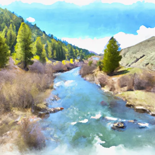
The segment mileage for this section is 20.2 miles, with several notable rapids and obstacles along the way. One of the most challenging rapids is called "Punch Bowl," which is a steep drop that requires precise navigation. Another significant obstacle is "Hell Hole," a large boulder that creates a powerful hydraulic that can trap paddlers.
There are specific regulations in place for the Whitewater River run, including a permit system and restrictions on group size. Paddlers must obtain a permit from the Forest Service before entering the wilderness area, and groups are limited to no more than 12 people. Additionally, all paddlers must carry a "leave no trace" ethic and pack out all trash.
Overall, the Wilderness Boundary to Headwaters section of the Whitewater River is a challenging and exciting run for experienced paddlers. It is important to follow all regulations and safety guidelines when paddling this section to ensure a safe and enjoyable trip.
Plan your run down to the hour
Same weather feed Snoflo's iOS app uses -- updated continuously from NOAA / yr.no. Watch the precipitation column on the meteogram; rain ahead of a run typically lifts flows 12-48 hours later depending on the basin.
Next 5 days, hour by hour
Temperature line with weather symbols on top, snow + rain accumulation as columns, humidity as a dotted line.
5-day forecast table
Every 3 hours, broken out across temperature, snow, rain, humidity, and wind. Each cell is colour-coded relative to the column min/max.
| Time | Condition | Temp (°F) | Snow (in) | Rain (in) | Humidity (%) | Wind (mps) | Wind dir |
|---|---|---|---|---|---|---|---|
| Loading detailed forecast… | |||||||
15-day temperature & precipitation
Daily temperatures, snow, and rain projected over the next two weeks -- the upstream story that drives next week's flows.
Regional streamflow levels
USGS streamgauges around Wilderness Boundary To Headwaters -- useful for spotting upstream pulses and gauging which tributary is contributing what.
| Streamgauge | Discharge | View |
|---|---|---|
| Salmon River At White Bird Id | 5,680 cfs | → |
| Little Salmon River At Riggins Id | 211 cfs | → |
| Sf Clearwater River Nr Elk City Id | 42 cfs | → |
| Sf Clearwater River At Stites Id | 195 cfs | → |
| Clear Ck At Kooskia National Fish Hatchery | 18 cfs | → |
| Selway River Nr Lowell Id | 1,180 cfs | → |
Plan a longer trip
The closest boat launches, other paddle runs, and campgrounds so a day on the water can grow into a full weekend.
Boat launches
- National Forest Development Road 103 Idaho County
- Vinegar Creek
- Us 95 Idaho County
- Twin Bridges
- Campbell Flat
Other river runs
- Salmon River, Sec. 36, T27n, R1e To Gospel-Hump Wilderness Boundary, Sec. 31, T27n, R4e
- Salmon River
- South Fork Clearwater River, Sec. 30, T29n, R5e To Headwaters
- Gospel-Hump Wilderness Boundary To Headwaters Near Hump Lake
- Salmon River, Sec. 22, T28n, R1e To North And South Forks Of White Bird Creek
Whitewater safety
- Check the flow before you run
- Use the linked-gauge card and Regional Flow panel above. Class ratings change with flow -- a Class III at low water can become Class IV+ at high water.
- Know your skill ceiling
- Pick runs comfortably below your ceiling. Cold-water and big-water runs raise the consequences of any mistake.
- Wear the right gear
- Helmet, PFD, drysuit / wetsuit when water is below 60°F. Throw bag, knife, and whistle on your person, not in the boat.
- Scout, set safety, and run with a team
- Scout new rapids on foot, set safety with throw bags above the consequence pool, and run with at least one other competent paddler.
- Respect the river
- Strainers, undercuts, low-head dams, and wood can kill at any class rating. When in doubt, portage.
Set push alerts in the Snoflo app
Save Wilderness Boundary To Headwaters as a favorite, set a discharge threshold (e.g. "alert me when flow hits 600 cfs"), and the iOS app pushes the moment the linked gauge crosses.
About Wilderness Boundary To Headwaters
What's the optimal flow for Wilderness Boundary To Headwaters?
The optimal flow depends on the section and the craft. Check the Run Details panel for the linked gauge and current status.
How fresh is the cfs reading on this page?
The linked USGS streamgauge reports continuously (every 15 minutes); Snoflo refreshes throughout the day. Hover the streamflow sparkline to read individual datapoints.
What's the whitewater class?
See the Run Details panel for the class rating Snoflo tracks for this run. Class ratings change with flow -- a Class III at low water can become Class IV in high water.
Where do I put in / take out?
Tap Directions in the hero above to open driving directions to the put-in. For shuttle planning, check the Nearby Boat Launches panel and the river run operator's site.
Can I get alerts when flows hit the optimal range?
Yes -- alerts are managed in the Snoflo iOS app. Favorite this run, set a discharge threshold, and you'll get a push the moment the gauge crosses.
Other runs near here
Snoflo-tracked paddle runs within driving distance of Wilderness Boundary To Headwaters.