Headwaters To Confluence With Salmon River river run
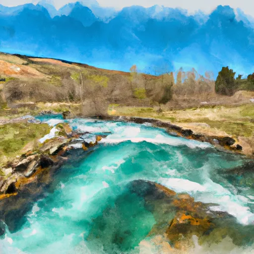
Headwaters To Confluence With Salmon River
The segment mileage for this run is approximately 6 miles, starting at the headwaters and ending at the confluence with the Salmon River. Along the way, paddlers will encounter a variety of rapids, including Tight Squeeze, Ladder, and Devil's Tooth. These rapids are known for their steep drops, large waves, and technical maneuvers, providing an adrenaline rush for those who dare to tackle them.
As with any river run, safety is a top priority. Paddlers must follow specific regulations for the area, such as wearing appropriate safety gear, carrying a first aid kit, and following Leave No Trace principles. Additionally, it is recommended that paddlers have prior experience with whitewater rafting and kayaking before attempting this run.
Overall, the Whitewater River Run from Headwaters to Confluence with Salmon River in Idaho offers a challenging and exciting adventure for experienced paddlers. With the right streamflow, class rating, and safety precautions, this run is sure to provide an unforgettable experience.
Plan your run down to the hour
Same weather feed Snoflo's iOS app uses -- updated continuously from NOAA / yr.no. Watch the precipitation column on the meteogram; rain ahead of a run typically lifts flows 12-48 hours later depending on the basin.
Next 5 days, hour by hour
Temperature line with weather symbols on top, snow + rain accumulation as columns, humidity as a dotted line.
5-day forecast table
Every 3 hours, broken out across temperature, snow, rain, humidity, and wind. Each cell is colour-coded relative to the column min/max.
| Time | Condition | Temp (°F) | Snow (in) | Rain (in) | Humidity (%) | Wind (mps) | Wind dir |
|---|---|---|---|---|---|---|---|
| Loading detailed forecast… | |||||||
15-day temperature & precipitation
Daily temperatures, snow, and rain projected over the next two weeks -- the upstream story that drives next week's flows.
Regional streamflow levels
USGS streamgauges around Headwaters To Confluence With Salmon River -- useful for spotting upstream pulses and gauging which tributary is contributing what.
| Streamgauge | Discharge | View |
|---|---|---|
| Salmon River Bl Yankee Fork Nr Clayton Id | 2,780 cfs | → |
| Yankee Fork Salmon River Nr Clayton Id | 811 cfs | → |
| Valley Creek At Stanley Id | 503 cfs | → |
| Thompson Creek Nr Clayton Id | 49 cfs | → |
| Squaw Creek Bl Bruno Creek Nr Clayton Id | 101 cfs | → |
| Mf Salmon River At Mf Lodge Nr Yellow Pine Id | 4,890 cfs | → |
Plan a longer trip
The closest boat launches, other paddle runs, and campgrounds so a day on the water can grow into a full weekend.
Other river runs
- Piece Of Cake Run (Sunbeam To Torreys)
- Headwaters To Confluence With Yankee Fork
- Torreys To East Fork
- Thompson Creek
Campgrounds
- Blind Creek
- Blind Creek Campground
- Elk Creek Campground - Hwy 21
- Dutchman Flat Campground
- Flat Rock Campground
- Flat Rock C/G
Fishing spots
Whitewater safety
- Check the flow before you run
- Use the linked-gauge card and Regional Flow panel above. Class ratings change with flow -- a Class III at low water can become Class IV+ at high water.
- Know your skill ceiling
- Pick runs comfortably below your ceiling. Cold-water and big-water runs raise the consequences of any mistake.
- Wear the right gear
- Helmet, PFD, drysuit / wetsuit when water is below 60°F. Throw bag, knife, and whistle on your person, not in the boat.
- Scout, set safety, and run with a team
- Scout new rapids on foot, set safety with throw bags above the consequence pool, and run with at least one other competent paddler.
- Respect the river
- Strainers, undercuts, low-head dams, and wood can kill at any class rating. When in doubt, portage.
Set push alerts in the Snoflo app
Save Headwaters To Confluence With Salmon River as a favorite, set a discharge threshold (e.g. "alert me when flow hits 600 cfs"), and the iOS app pushes the moment the linked gauge crosses.
About Headwaters To Confluence With Salmon River
What's the optimal flow for Headwaters To Confluence With Salmon River?
The optimal flow depends on the section and the craft. Check the Run Details panel for the linked gauge and current status.
How fresh is the cfs reading on this page?
The linked USGS streamgauge reports continuously (every 15 minutes); Snoflo refreshes throughout the day. Hover the streamflow sparkline to read individual datapoints.
What's the whitewater class?
See the Run Details panel for the class rating Snoflo tracks for this run. Class ratings change with flow -- a Class III at low water can become Class IV in high water.
Where do I put in / take out?
Tap Directions in the hero above to open driving directions to the put-in. For shuttle planning, check the Nearby Boat Launches panel and the river run operator's site.
Can I get alerts when flows hit the optimal range?
Yes -- alerts are managed in the Snoflo iOS app. Favorite this run, set a discharge threshold, and you'll get a push the moment the gauge crosses.
Other runs near here
Snoflo-tracked paddle runs within driving distance of Headwaters To Confluence With Salmon River.