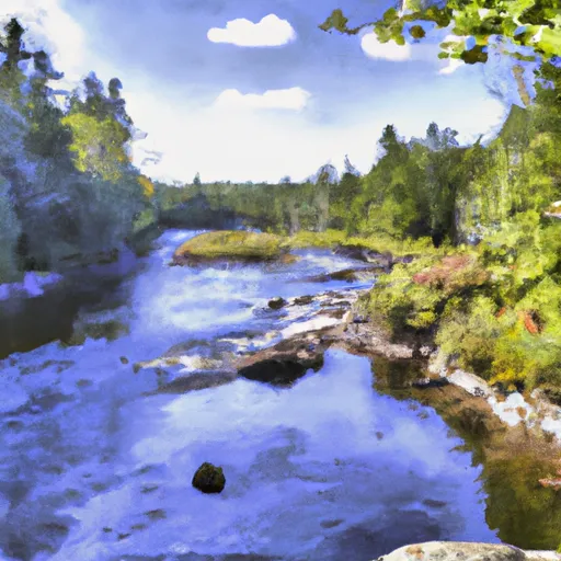
Lobster Lake To Confluence With West Branch River Run
Community Reviews
Been here? Share the conditions.
Reviews, ratings & photos are added in the free Snoflo iOS app — rate a spot, tag the conditions, and your visit is verified by location. Add or manage your reviews from the app.
Lobster Lake To Confluence With West Branch
The total length of this run is approximately 11 miles, with exhilarating rapids and obstacles scattered throughout the course. Some of the notable rapids include the Big Eddy, which is a Class III rapid, and the Big Mama, which is a Class IV rapid that requires technical paddling skills. Additionally, there are several Class V rapids in the area that should be approached with caution and only attempted by expert paddlers.
It's important to note that this section of the river is subject to specific regulations and permits. Paddlers must obtain a permit from the Maine Bureau of Parks and Lands to access the Lobster Lake area and must follow all rules regarding camping, fires, and littering. Additionally, paddlers must comply with all state fishing regulations in the area.
Overall, the Whitewater River Run from Lobster Lake to Confluence with West Branch is a rugged and challenging paddling experience that should only be attempted by experienced paddlers who are familiar with the area and its unique challenges.
Plan your run down to the hour
Same weather feed Snoflo's iOS app uses -- updated continuously from NOAA / yr.no. Watch the precipitation column on the meteogram; rain ahead of a run typically lifts flows 12-48 hours later depending on the basin.
Next 5 days, hour by hour
Temperature line with weather symbols on top, snow + rain accumulation as columns, humidity as a dotted line.
5-day forecast table
Every 3 hours, broken out across temperature, snow, rain, humidity, and wind. Each cell is colour-coded relative to the column min/max.
| Time | Condition | Temp (°F) | Snow (in) | Rain (in) | Humidity (%) | Wind (mps) | Wind dir |
|---|---|---|---|---|---|---|---|
| Loading detailed forecast… | |||||||
15-day temperature & precipitation
Daily temperatures, snow, and rain projected over the next two weeks -- the upstream story that drives next week's flows.
Regional streamflow levels
USGS streamgauges around Lobster Lake To Confluence With West Branch -- useful for spotting upstream pulses and gauging which tributary is contributing what.
| Streamgauge | Discharge | View |
|---|---|---|
| North Branch Penobscot River Nr Pittston Farm | 68 cfs | → |
| Piscataquis River At Blanchard | 16 cfs | → |
| Kennebec River At The Forks | 459 cfs | → |
| Kingsbury Stream At Abbot Village | 16 cfs | → |
| East Branch Penobscot River At Grindstone | 556 cfs | → |
| Piscataquis River Near Dover-Foxcroft | 41 cfs | → |
Plan a longer trip
The closest boat launches, other paddle runs, and campgrounds so a day on the water can grow into a full weekend.
Boat launches
- Poulin Road Maine
- Moosehead Lake (Norcross Brook)
- Moosehead Lake (Spencer Bay)
- Ragged Lake
- Moosehead Lake (Jewett Cove)
- First Roach Pond
Other river runs
- Golden Road Bridge (Approx. 2 Miles Below Lobster Stream) To Confluence With Pine Stream
- Headwaters To Mouth At West Branch Pleasant River
- Pittston Farm To Golden Road Bridge (Approx. 2 Miles Below Lobster Stream)
- Headwaters To Confluence With Penobscot River, East Branch
- Headwaters To Confluence With West Branch Penobscot River
Whitewater safety
- Check the flow before you run
- Use the linked-gauge card and Regional Flow panel above. Class ratings change with flow -- a Class III at low water can become Class IV+ at high water.
- Know your skill ceiling
- Pick runs comfortably below your ceiling. Cold-water and big-water runs raise the consequences of any mistake.
- Wear the right gear
- Helmet, PFD, drysuit / wetsuit when water is below 60°F. Throw bag, knife, and whistle on your person, not in the boat.
- Scout, set safety, and run with a team
- Scout new rapids on foot, set safety with throw bags above the consequence pool, and run with at least one other competent paddler.
- Respect the river
- Strainers, undercuts, low-head dams, and wood can kill at any class rating. When in doubt, portage.
Set push alerts in the Snoflo app
Save Lobster Lake To Confluence With West Branch as a favorite, set a discharge threshold (e.g. "alert me when flow hits 600 cfs"), and the iOS app pushes the moment the linked gauge crosses.
About Lobster Lake To Confluence With West Branch
What's the optimal flow for Lobster Lake To Confluence With West Branch?
The optimal flow depends on the section and the craft. Check the Run Details panel for the linked gauge and current status.
How fresh is the cfs reading on this page?
The linked USGS streamgauge reports continuously (every 15 minutes); Snoflo refreshes throughout the day. Hover the streamflow sparkline to read individual datapoints.
What's the whitewater class?
See the Run Details panel for the class rating Snoflo tracks for this run. Class ratings change with flow -- a Class III at low water can become Class IV in high water.
Where do I put in / take out?
Tap Directions in the hero above to open driving directions to the put-in. For shuttle planning, check the Nearby Boat Launches panel and the river run operator's site.
Can I get alerts when flows hit the optimal range?
Yes -- alerts are managed in the Snoflo iOS app. Favorite this run, set a discharge threshold, and you'll get a push the moment the gauge crosses.
Other runs near here
Snoflo-tracked paddle runs within driving distance of Lobster Lake To Confluence With West Branch.