Section 17, T48n, R17w (Boundary Of Pictured Rocks National Lakeshore Lands) To Mouth At Lake Superior River Run
Community Reviews
Been here? Share the conditions.
Reviews, ratings & photos are added in the free Snoflo iOS app — rate a spot, tag the conditions, and your visit is verified by location. Add or manage your reviews from the app.
Section 17, T48n, R17w (Boundary Of Pictured Rocks National Lakeshore Lands) To Mouth At Lake Superior
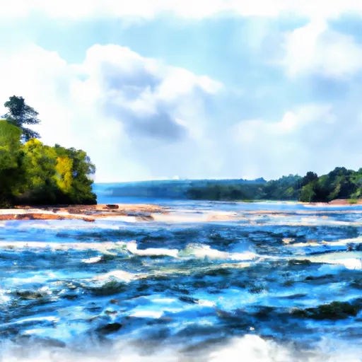
The Pictured Rocks National Lakeshore, where the river run begins, has specific regulations in place for visitors. Camping is only permitted in designated areas and fires are only allowed in established fire rings. Visitors are also required to pack out all trash and respect the natural environment.
It is important for visitors to come prepared with the proper gear and equipment for a safe and enjoyable experience on the river. Personal flotation devices (PFDs) are required for all individuals on the river and helmets are recommended. It is also recommended to have a guide or experienced paddler present, especially for those who are new to whitewater kayaking or rafting.
Plan your run down to the hour
Same weather feed Snoflo's iOS app uses -- updated continuously from NOAA / yr.no. Watch the precipitation column on the meteogram; rain ahead of a run typically lifts flows 12-48 hours later depending on the basin.
Next 5 days, hour by hour
Temperature line with weather symbols on top, snow + rain accumulation as columns, humidity as a dotted line.
5-day forecast table
Every 3 hours, broken out across temperature, snow, rain, humidity, and wind. Each cell is colour-coded relative to the column min/max.
| Time | Condition | Temp (°F) | Snow (in) | Rain (in) | Humidity (%) | Wind (mps) | Wind dir |
|---|---|---|---|---|---|---|---|
| Loading detailed forecast… | |||||||
15-day temperature & precipitation
Daily temperatures, snow, and rain projected over the next two weeks -- the upstream story that drives next week's flows.
Regional streamflow levels
USGS streamgauges around Section 17, T48n, R17w (Boundary Of Pictured Rocks National Lakeshore Lands) To Mouth At Lake Superior -- useful for spotting upstream pulses and gauging which tributary is contributing what.
| Streamgauge | Discharge | View |
|---|---|---|
| Au Train River At Forest Lake | 137 cfs | → |
| Manistique River Near Manistique | 919 cfs | → |
| Sturgeon River Near Nahma Junction | 89 cfs | → |
| Middle Branch Escanaba River Nr Princeton | 103 cfs | → |
| Escanaba River At Cornell | 370 cfs | → |
| Schweitzer Creek Near Palmer | 6 cfs | → |
Plan a longer trip
The closest boat launches, other paddle runs, and campgrounds so a day on the water can grow into a full weekend.
Boat launches
- Creighton Road Hiawatha Township
- Twin Lake Road Hiawatha Township
- Wwhite Pine Trail Burt Township
- Hiawatha Township
- Lake Superior
- Elm Avenue Munising
Other river runs
- County Road H-58 (Aka. Adams Trail/ Munising-Van Meer-Shingleton Rd.) To Mouth At Lake Superior
- From Sixteen Mile Lake To North Line Of Sec 26, T43n, R19w
- West Branch From Source In Sec 26, T46n, R23 W To Junction With County Road 444
- East Branch From Western Forest Boundary (Sec 19, T46n, R6w) To Confluence With Mainstem
- Source In Sec 21, T47n, R12w To Mouth At Whitefish Bay
Campgrounds
- Potato Patch Campsite
- Mosquito Group Campsite
- Mosquito River Campground
- Cliffs Group Campsite
- Chapel Campsite
- Cliffs Camp
Fishing spots
Parks
Whitewater safety
- Check the flow before you run
- Use the linked-gauge card and Regional Flow panel above. Class ratings change with flow -- a Class III at low water can become Class IV+ at high water.
- Know your skill ceiling
- Pick runs comfortably below your ceiling. Cold-water and big-water runs raise the consequences of any mistake.
- Wear the right gear
- Helmet, PFD, drysuit / wetsuit when water is below 60°F. Throw bag, knife, and whistle on your person, not in the boat.
- Scout, set safety, and run with a team
- Scout new rapids on foot, set safety with throw bags above the consequence pool, and run with at least one other competent paddler.
- Respect the river
- Strainers, undercuts, low-head dams, and wood can kill at any class rating. When in doubt, portage.
Set push alerts in the Snoflo app
Save Section 17, T48n, R17w (Boundary Of Pictured Rocks National Lakeshore Lands) To Mouth At Lake Superior as a favorite, set a discharge threshold (e.g. "alert me when flow hits 600 cfs"), and the iOS app pushes the moment the linked gauge crosses.
About Section 17, T48n, R17w (Boundary Of Pictured Rocks National Lakeshore Lands) To Mouth At Lake Superior
What's the optimal flow for Section 17, T48n, R17w (Boundary Of Pictured Rocks National Lakeshore Lands) To Mouth At Lake Superior ?
The optimal flow depends on the section and the craft. Check the Run Details panel for the linked gauge and current status.
How fresh is the cfs reading on this page?
The linked USGS streamgauge reports continuously (every 15 minutes); Snoflo refreshes throughout the day. Hover the streamflow sparkline to read individual datapoints.
What's the whitewater class?
See the Run Details panel for the class rating Snoflo tracks for this run. Class ratings change with flow -- a Class III at low water can become Class IV in high water.
Where do I put in / take out?
Tap Directions in the hero above to open driving directions to the put-in. For shuttle planning, check the Nearby Boat Launches panel and the river run operator's site.
Can I get alerts when flows hit the optimal range?
Yes -- alerts are managed in the Snoflo iOS app. Favorite this run, set a discharge threshold, and you'll get a push the moment the gauge crosses.
Other runs near here
Snoflo-tracked paddle runs within driving distance of Section 17, T48n, R17w (Boundary Of Pictured Rocks National Lakeshore Lands) To Mouth At Lake Superior .