Origin At Confluence Of Outlets Of Frenchman Lake And Carp Lake (Sec 26, T44n, R6w) To West Section Line Of Sec 30, T43n, R5w River Run
Community Reviews
Been here? Share the conditions.
Reviews, ratings & photos are added in the free Snoflo iOS app — rate a spot, tag the conditions, and your visit is verified by location. Add or manage your reviews from the app.
Origin At Confluence Of Outlets Of Frenchman Lake And Carp Lake (Sec 26, T44n, R6w) To West Section Line Of Sec 30, T43n, R5w
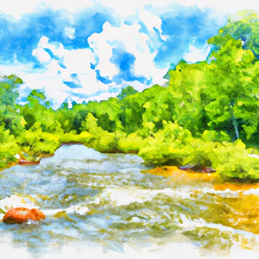
The segment mileage of the river run is approximately 10 miles, with several notable rapids and obstacles along the way. These include "The Diner", a Class III+ rapid that requires precise maneuvering to avoid rocks and ledges, as well as "Witch's Cauldron", a Class III drop that requires careful navigation of a narrow chute. Other notable rapids include "Lunch Counter", "Big Kahuna", and "Staircase".
There are specific regulations that apply to the Whitewater River Run, including restrictions on motorized vehicles, camping, and fires. Additionally, all paddlers are required to wear personal flotation devices (PFDs) and helmets, and are advised to carry appropriate safety equipment such as throw ropes and first aid kits. The river is also subject to seasonal closures and water level restrictions, which vary depending on weather and other factors.
Overall, the Whitewater River Run is a challenging and scenic river that offers intermediate-level paddlers a thrilling adventure through some of Michigan's most beautiful wilderness areas. It is important for paddlers to be aware of the specific regulations and safety requirements that apply to this area, and to be prepared for the challenges that they may encounter along the way.
Plan your run down to the hour
Same weather feed Snoflo's iOS app uses -- updated continuously from NOAA / yr.no. Watch the precipitation column on the meteogram; rain ahead of a run typically lifts flows 12-48 hours later depending on the basin.
Next 5 days, hour by hour
Temperature line with weather symbols on top, snow + rain accumulation as columns, humidity as a dotted line.
5-day forecast table
Every 3 hours, broken out across temperature, snow, rain, humidity, and wind. Each cell is colour-coded relative to the column min/max.
| Time | Condition | Temp (°F) | Snow (in) | Rain (in) | Humidity (%) | Wind (mps) | Wind dir |
|---|---|---|---|---|---|---|---|
| Loading detailed forecast… | |||||||
15-day temperature & precipitation
Daily temperatures, snow, and rain projected over the next two weeks -- the upstream story that drives next week's flows.
Regional streamflow levels
USGS streamgauges around Origin At Confluence Of Outlets Of Frenchman Lake And Carp Lake (Sec 26, T44n, R6w) To West Section Line Of Sec 30, T43n, R5w -- useful for spotting upstream pulses and gauging which tributary is contributing what.
| Streamgauge | Discharge | View |
|---|---|---|
| Black River Near Garnet | 8 cfs | → |
| Tahquamenon River Near Paradise | 400 cfs | → |
| Manistique River Near Manistique | 776 cfs | → |
| Sturgeon River At Wolverine | 214 cfs | → |
| Jordan River Near East Jordan | 183 cfs | → |
| Pigeon R At Sturgeon Valley Rd Near Vanderbilt | 88 cfs | → |
Plan a longer trip
The closest boat launches, other paddle runs, and campgrounds so a day on the water can grow into a full weekend.
Boat launches
- Frenchmans Lake Boat Ramp
- Little Brevoort Lake (North)
- Little Brevoort Lake (South)
- Park Lane Moran Township
- Trout Lake Boat Ramp
- Dukes Road Moran
Other river runs
- East Branch From Western Forest Boundary (Sec 19, T46n, R6w) To Confluence With Mainstem
- Source In Sec 21, T47n, R12w To Mouth At Whitefish Bay
- Section 17, T48n, R17w (Boundary Of Pictured Rocks National Lakeshore Lands) To Mouth At Lake Superior
- County Road H-58 (Aka. Adams Trail/ Munising-Van Meer-Shingleton Rd.) To Mouth At Lake Superior
- From Sixteen Mile Lake To North Line Of Sec 26, T43n, R19w
Campgrounds
- Little Brevort Lake-North State Forest Campground
- Little Brevoort Lake (North) - State Forest
- Little Brevoort Lake (South) - State Forest
- Little Brevort Lake-South State Forest Campground
- Brevort Lake
- Brevoort Lake Campground
Fishing spots
Whitewater safety
- Check the flow before you run
- Use the linked-gauge card and Regional Flow panel above. Class ratings change with flow -- a Class III at low water can become Class IV+ at high water.
- Know your skill ceiling
- Pick runs comfortably below your ceiling. Cold-water and big-water runs raise the consequences of any mistake.
- Wear the right gear
- Helmet, PFD, drysuit / wetsuit when water is below 60°F. Throw bag, knife, and whistle on your person, not in the boat.
- Scout, set safety, and run with a team
- Scout new rapids on foot, set safety with throw bags above the consequence pool, and run with at least one other competent paddler.
- Respect the river
- Strainers, undercuts, low-head dams, and wood can kill at any class rating. When in doubt, portage.
Set push alerts in the Snoflo app
Save Origin At Confluence Of Outlets Of Frenchman Lake And Carp Lake (Sec 26, T44n, R6w) To West Section Line Of Sec 30, T43n, R5w as a favorite, set a discharge threshold (e.g. "alert me when flow hits 600 cfs"), and the iOS app pushes the moment the linked gauge crosses.
About Origin At Confluence Of Outlets Of Frenchman Lake And Carp Lake (Sec 26, T44n, R6w) To West Section Line Of Sec 30, T43n, R5w
What's the optimal flow for Origin At Confluence Of Outlets Of Frenchman Lake And Carp Lake (Sec 26, T44n, R6w) To West Section Line Of Sec 30, T43n, R5w?
The optimal flow depends on the section and the craft. Check the Run Details panel for the linked gauge and current status.
How fresh is the cfs reading on this page?
The linked USGS streamgauge reports continuously (every 15 minutes); Snoflo refreshes throughout the day. Hover the streamflow sparkline to read individual datapoints.
What's the whitewater class?
See the Run Details panel for the class rating Snoflo tracks for this run. Class ratings change with flow -- a Class III at low water can become Class IV in high water.
Where do I put in / take out?
Tap Directions in the hero above to open driving directions to the put-in. For shuttle planning, check the Nearby Boat Launches panel and the river run operator's site.
Can I get alerts when flows hit the optimal range?
Yes -- alerts are managed in the Snoflo iOS app. Favorite this run, set a discharge threshold, and you'll get a push the moment the gauge crosses.
Other runs near here
Snoflo-tracked paddle runs within driving distance of Origin At Confluence Of Outlets Of Frenchman Lake And Carp Lake (Sec 26, T44n, R6w) To West Section Line Of Sec 30, T43n, R5w.