The Confluence Of The Prairie River To The Boundary Of Logan And Workman Townships River Run
Community Reviews
Been here? Share the conditions.
Reviews, ratings & photos are added in the free Snoflo iOS app — rate a spot, tag the conditions, and your visit is verified by location. Add or manage your reviews from the app.
The Confluence Of The Prairie River To The Boundary Of Logan And Workman Townships
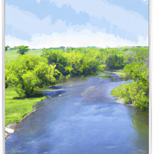
The segment mileage for the Whitewater River Run runs from the confluence of the Prairie River to the boundary of Logan and Workman Townships, covering a distance of approximately 25 miles. Along the way, paddlers will encounter several notable rapids and obstacles, including Pouquette Falls, which is a Class III rapid that features a steep drop and a tricky approach. Other notable rapids include the Red Bridge Rapid and the Zumbro Bottoms Rapid.
There are several regulations that paddlers must follow when exploring the Whitewater River Run. All paddlers must wear a personal flotation device (PFD) at all times while on the river, and it is also recommended that paddlers wear helmets to protect against head injuries. Additionally, paddlers must respect private property along the river and must follow all state and local regulations, including those related to camping and fires.
Overall, the Whitewater River Run offers a thrilling whitewater experience for adventurous paddlers. With its ideal streamflow range, challenging rapids and obstacles, and specific regulations, it is a must-visit destination for anyone looking for an exciting paddling adventure in Minnesota.
Plan your run down to the hour
Same weather feed Snoflo's iOS app uses -- updated continuously from NOAA / yr.no. Watch the precipitation column on the meteogram; rain ahead of a run typically lifts flows 12-48 hours later depending on the basin.
Next 5 days, hour by hour
Temperature line with weather symbols on top, snow + rain accumulation as columns, humidity as a dotted line.
5-day forecast table
Every 3 hours, broken out across temperature, snow, rain, humidity, and wind. Each cell is colour-coded relative to the column min/max.
| Time | Condition | Temp (°F) | Snow (in) | Rain (in) | Humidity (%) | Wind (mps) | Wind dir |
|---|---|---|---|---|---|---|---|
| Loading detailed forecast… | |||||||
15-day temperature & precipitation
Daily temperatures, snow, and rain projected over the next two weeks -- the upstream story that drives next week's flows.
Regional streamflow levels
USGS streamgauges around The Confluence Of The Prairie River To The Boundary Of Logan And Workman Townships -- useful for spotting upstream pulses and gauging which tributary is contributing what.
| Streamgauge | Discharge | View |
|---|---|---|
| Mississippi River At Grand Rapids | 243 cfs | → |
| Prairie River Near Taconite | 57 cfs | → |
| Mississippi River At Aitkin | 920 cfs | → |
| Mississippi River Near Bemidji | 167 cfs | → |
| St. Louis River At Scanlon | 803 cfs | → |
| Mississippi River At Brainerd | 1,480 cfs | → |
Plan a longer trip
The closest boat launches, other paddle runs, and campgrounds so a day on the water can grow into a full weekend.
Boat launches
- Mississippi River, Steamboat Landing
- Prairie River (N)
- Crystal Lake
- Hale Lake
- Mississippi River, Sylvan Bay
- Forest Lake
Other river runs
- Lake Winnigigoshish To Blackwater Lake
- The Boundary Between Logan And Workman Townships In Aitkin County To The Dam Entrance Of The Flood Diversion Channel
- Dora Lake To State Highway 6
- The Discharge Of The Flood Diversion Channel To Riverton
- Cass Lake To Lake Winnibigoshish
Campgrounds
- Itasca County Fairgrouds Campground
- Itasca County Fairgrounds
- Kom-On-In Beach Campground
- Pokegama Rec Area
- Pokegama-Coe
- American Legion Park
Fishing spots
Parks
Whitewater safety
- Check the flow before you run
- Use the linked-gauge card and Regional Flow panel above. Class ratings change with flow -- a Class III at low water can become Class IV+ at high water.
- Know your skill ceiling
- Pick runs comfortably below your ceiling. Cold-water and big-water runs raise the consequences of any mistake.
- Wear the right gear
- Helmet, PFD, drysuit / wetsuit when water is below 60°F. Throw bag, knife, and whistle on your person, not in the boat.
- Scout, set safety, and run with a team
- Scout new rapids on foot, set safety with throw bags above the consequence pool, and run with at least one other competent paddler.
- Respect the river
- Strainers, undercuts, low-head dams, and wood can kill at any class rating. When in doubt, portage.
Set push alerts in the Snoflo app
Save The Confluence Of The Prairie River To The Boundary Of Logan And Workman Townships as a favorite, set a discharge threshold (e.g. "alert me when flow hits 600 cfs"), and the iOS app pushes the moment the linked gauge crosses.
About The Confluence Of The Prairie River To The Boundary Of Logan And Workman Townships
What's the optimal flow for The Confluence Of The Prairie River To The Boundary Of Logan And Workman Townships ?
The optimal flow depends on the section and the craft. Check the Run Details panel for the linked gauge and current status.
How fresh is the cfs reading on this page?
The linked USGS streamgauge reports continuously (every 15 minutes); Snoflo refreshes throughout the day. Hover the streamflow sparkline to read individual datapoints.
What's the whitewater class?
See the Run Details panel for the class rating Snoflo tracks for this run. Class ratings change with flow -- a Class III at low water can become Class IV in high water.
Where do I put in / take out?
Tap Directions in the hero above to open driving directions to the put-in. For shuttle planning, check the Nearby Boat Launches panel and the river run operator's site.
Can I get alerts when flows hit the optimal range?
Yes -- alerts are managed in the Snoflo iOS app. Favorite this run, set a discharge threshold, and you'll get a push the moment the gauge crosses.
Other runs near here
Snoflo-tracked paddle runs within driving distance of The Confluence Of The Prairie River To The Boundary Of Logan And Workman Townships .