From The Headwaters Of The West Fork Of Quartz Creek Downstream For Three Miles To The Boundary Of The Flagstaff Mountain Inventoried Roadless Area #690 To River Run
Community Reviews
Been here? Share the conditions.
Reviews, ratings & photos are added in the free Snoflo iOS app — rate a spot, tag the conditions, and your visit is verified by location. Add or manage your reviews from the app.
From The Headwaters Of The West Fork Of Quartz Creek Downstream For Three Miles To The Boundary Of The Flagstaff Mountain Inventoried Roadless Area #690 To
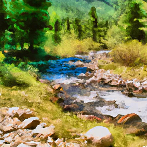
One of the most notable rapids on this run is called "The Maze," a narrow, technical section that requires precise navigation. Other notable rapids include "S-Turn," "Pinball," and "The Ledge." It's important to note that the Whitewater River run is located in a wilderness area, so there are specific regulations to follow. Visitors must obtain a permit to enter the Flagstaff Mountain Inventoried Roadless Area, and camping is only allowed in designated areas.
Overall, the Whitewater River run is a thrilling and challenging section of river that offers a unique wilderness experience for advanced kayakers. It's important to check the streamflow and weather conditions before embarking on this run, as conditions can change quickly in the wilderness.
Plan your run down to the hour
Same weather feed Snoflo's iOS app uses -- updated continuously from NOAA / yr.no. Watch the precipitation column on the meteogram; rain ahead of a run typically lifts flows 12-48 hours later depending on the basin.
Next 5 days, hour by hour
Temperature line with weather symbols on top, snow + rain accumulation as columns, humidity as a dotted line.
5-day forecast table
Every 3 hours, broken out across temperature, snow, rain, humidity, and wind. Each cell is colour-coded relative to the column min/max.
| Time | Condition | Temp (°F) | Snow (in) | Rain (in) | Humidity (%) | Wind (mps) | Wind dir |
|---|---|---|---|---|---|---|---|
| Loading detailed forecast… | |||||||
15-day temperature & precipitation
Daily temperatures, snow, and rain projected over the next two weeks -- the upstream story that drives next week's flows.
Regional streamflow levels
USGS streamgauges around From The Headwaters Of The West Fork Of Quartz Creek Downstream For Three Miles To The Boundary Of The Flagstaff Mountain Inventoried Roadless Area #690 To -- useful for spotting upstream pulses and gauging which tributary is contributing what.
| Streamgauge | Discharge | View |
|---|---|---|
| Yaak River Near Troy Mt | 156 cfs | → |
| Kootenai River At Leonia Id | 9,770 cfs | → |
| Kootenai River Bl Libby Dam Nr Libby Mt | 9,070 cfs | → |
| Kootenai River Bel Moyie River Nr Bonners Ferry Id | 9,910 cfs | → |
| Fisher River Near Libby Mt | 94 cfs | → |
| Kootenai River @ Tribal Hatchery Nr Bonners Ferry | 15,700 cfs | → |
Plan a longer trip
The closest boat launches, other paddle runs, and campgrounds so a day on the water can grow into a full weekend.
Boat launches
- Roosevelt Park - Troy
- National Forest Development Road 2394 Lincoln County
- Us 2 Lincoln County
- City Service Road Libby
- Dorr Skeels Road Lincoln County
- Osprey Landing
Other river runs
- From The Boundary Of The Flagstaff Mountain Inventoried Roadless Area #690 Downstream For Three Miles To The Confluence Of Main Quartz Creek To
- From The Junction Of Hennesey Creek Downstream For Nine Miles To The Confluence With The Kootenai River To
- 9 Miles From Quartz Creek To Surprise Gulch,Two Miles Below Kootenai Falls To 9 Miles From Quartz Creek To Surprise Gulch,Two Miles Below Kootenai Falls
- 10 Miles From Surprise Gulch To A Mile Below Kootenai Vista Estates To 10 Miles From Surprise Gulch To A Mile Below Kootenai Vista Estates
- 10 Miles From Tub Gulch To Quartz Creek To 10 Miles From Tub Gulch To Quartz Creek
Whitewater safety
- Check the flow before you run
- Use the linked-gauge card and Regional Flow panel above. Class ratings change with flow -- a Class III at low water can become Class IV+ at high water.
- Know your skill ceiling
- Pick runs comfortably below your ceiling. Cold-water and big-water runs raise the consequences of any mistake.
- Wear the right gear
- Helmet, PFD, drysuit / wetsuit when water is below 60°F. Throw bag, knife, and whistle on your person, not in the boat.
- Scout, set safety, and run with a team
- Scout new rapids on foot, set safety with throw bags above the consequence pool, and run with at least one other competent paddler.
- Respect the river
- Strainers, undercuts, low-head dams, and wood can kill at any class rating. When in doubt, portage.
Set push alerts in the Snoflo app
Save From The Headwaters Of The West Fork Of Quartz Creek Downstream For Three Miles To The Boundary Of The Flagstaff Mountain Inventoried Roadless Area #690 To as a favorite, set a discharge threshold (e.g. "alert me when flow hits 600 cfs"), and the iOS app pushes the moment the linked gauge crosses.
About From The Headwaters Of The West Fork Of Quartz Creek Downstream For Three Miles To The Boundary Of The Flagstaff Mountain Inventoried Roadless Area #690 To
What's the optimal flow for From The Headwaters Of The West Fork Of Quartz Creek Downstream For Three Miles To The Boundary Of The Flagstaff Mountain Inventoried Roadless Area #690 To ?
The optimal flow depends on the section and the craft. Check the Run Details panel for the linked gauge and current status.
How fresh is the cfs reading on this page?
The linked USGS streamgauge reports continuously (every 15 minutes); Snoflo refreshes throughout the day. Hover the streamflow sparkline to read individual datapoints.
What's the whitewater class?
See the Run Details panel for the class rating Snoflo tracks for this run. Class ratings change with flow -- a Class III at low water can become Class IV in high water.
Where do I put in / take out?
Tap Directions in the hero above to open driving directions to the put-in. For shuttle planning, check the Nearby Boat Launches panel and the river run operator's site.
Can I get alerts when flows hit the optimal range?
Yes -- alerts are managed in the Snoflo iOS app. Favorite this run, set a discharge threshold, and you'll get a push the moment the gauge crosses.
Other runs near here
Snoflo-tracked paddle runs within driving distance of From The Headwaters Of The West Fork Of Quartz Creek Downstream For Three Miles To The Boundary Of The Flagstaff Mountain Inventoried Roadless Area #690 To .