Tenderfoot Creek, Sec. 30, T14n, R4e To Deep Creek, Sec. 31, T16n, R4e River Run
Community Reviews
Been here? Share the conditions.
Reviews, ratings & photos are added in the free Snoflo iOS app — rate a spot, tag the conditions, and your visit is verified by location. Add or manage your reviews from the app.
Tenderfoot Creek, Sec. 30, T14n, R4e To Deep Creek, Sec. 31, T16n, R4e
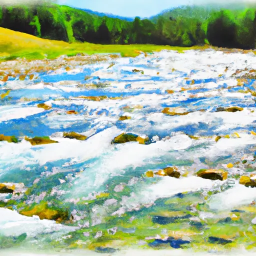
Some of the specific river rapids and obstacles that are encountered during this run include Hell's Half Acre, a large Class IV rapid, and a series of Class III rapids such as Powerline Rapid and Double D. The run also includes several tight canyons that provide stunning scenery and challenging rapids. It's essential to exercise caution while navigating through these sections.
Specific regulations to the area include a permit requirement for boaters, which can be obtained by contacting the Bureau of Land Management. Additionally, it's important to note that there are many private landowners along this stretch, so it's crucial to respect their property rights and stay on the river. Overall, the Tenderfoot Creek to Deep Creek run is a thrilling and challenging adventure that requires experience and skill to navigate successfully.
Plan your run down to the hour
Same weather feed Snoflo's iOS app uses -- updated continuously from NOAA / yr.no. Watch the precipitation column on the meteogram; rain ahead of a run typically lifts flows 12-48 hours later depending on the basin.
Next 5 days, hour by hour
Temperature line with weather symbols on top, snow + rain accumulation as columns, humidity as a dotted line.
5-day forecast table
Every 3 hours, broken out across temperature, snow, rain, humidity, and wind. Each cell is colour-coded relative to the column min/max.
| Time | Condition | Temp (°F) | Snow (in) | Rain (in) | Humidity (%) | Wind (mps) | Wind dir |
|---|---|---|---|---|---|---|---|
| Loading detailed forecast… | |||||||
15-day temperature & precipitation
Daily temperatures, snow, and rain projected over the next two weeks -- the upstream story that drives next week's flows.
Regional streamflow levels
USGS streamgauges around Tenderfoot Creek, Sec. 30, T14n, R4e To Deep Creek, Sec. 31, T16n, R4e -- useful for spotting upstream pulses and gauging which tributary is contributing what.
| Streamgauge | Discharge | View |
|---|---|---|
| Smith River Near Eden Mt | 154 cfs | → |
| Belt Creek Near Monarch Mt | 128 cfs | → |
| Smith River Bl Eagle Cr Nr Fort Logan Mt | 113 cfs | → |
| Smith River Near Ft Logan Mt | 74 cfs | → |
| Missouri River At Cascade Mt | 3,720 cfs | → |
| Missouri River Near Ulm Mt | 3,330 cfs | → |
Plan a longer trip
The closest boat launches, other paddle runs, and campgrounds so a day on the water can grow into a full weekend.
Other river runs
- Falls, Sec. 25, T14n, R4e To Smith River, Sec. 25, T14n, R3e
- Camp Baker To Eden Bridge
- Missouri River
- Hauser Dam, Sec. 29, T12n, R2w To Cochran Gulch, Sec. 18, T12n, R2w
- Town Of Nelson, Sec. 12, T12n, R2w To Missouri River, Sec. 19, T12n, R2w
Whitewater safety
- Check the flow before you run
- Use the linked-gauge card and Regional Flow panel above. Class ratings change with flow -- a Class III at low water can become Class IV+ at high water.
- Know your skill ceiling
- Pick runs comfortably below your ceiling. Cold-water and big-water runs raise the consequences of any mistake.
- Wear the right gear
- Helmet, PFD, drysuit / wetsuit when water is below 60°F. Throw bag, knife, and whistle on your person, not in the boat.
- Scout, set safety, and run with a team
- Scout new rapids on foot, set safety with throw bags above the consequence pool, and run with at least one other competent paddler.
- Respect the river
- Strainers, undercuts, low-head dams, and wood can kill at any class rating. When in doubt, portage.
Set push alerts in the Snoflo app
Save Tenderfoot Creek, Sec. 30, T14n, R4e To Deep Creek, Sec. 31, T16n, R4e as a favorite, set a discharge threshold (e.g. "alert me when flow hits 600 cfs"), and the iOS app pushes the moment the linked gauge crosses.
About Tenderfoot Creek, Sec. 30, T14n, R4e To Deep Creek, Sec. 31, T16n, R4e
What's the optimal flow for Tenderfoot Creek, Sec. 30, T14n, R4e To Deep Creek, Sec. 31, T16n, R4e?
The optimal flow depends on the section and the craft. Check the Run Details panel for the linked gauge and current status.
How fresh is the cfs reading on this page?
The linked USGS streamgauge reports continuously (every 15 minutes); Snoflo refreshes throughout the day. Hover the streamflow sparkline to read individual datapoints.
What's the whitewater class?
See the Run Details panel for the class rating Snoflo tracks for this run. Class ratings change with flow -- a Class III at low water can become Class IV in high water.
Where do I put in / take out?
Tap Directions in the hero above to open driving directions to the put-in. For shuttle planning, check the Nearby Boat Launches panel and the river run operator's site.
Can I get alerts when flows hit the optimal range?
Yes -- alerts are managed in the Snoflo iOS app. Favorite this run, set a discharge threshold, and you'll get a push the moment the gauge crosses.
Other runs near here
Snoflo-tracked paddle runs within driving distance of Tenderfoot Creek, Sec. 30, T14n, R4e To Deep Creek, Sec. 31, T16n, R4e.