Grave Creek System River Run
Community Reviews
Been here? Share the conditions.
Reviews, ratings & photos are added in the free Snoflo iOS app — rate a spot, tag the conditions, and your visit is verified by location. Add or manage your reviews from the app.
Grave Creek System
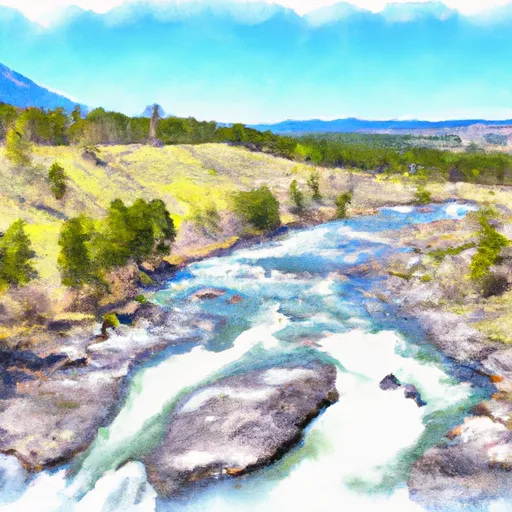
The Grave Creek System, located in western Montana, offers challenging whitewater rapids for experienced paddlers. The ideal streamflow range for this river run is between 1,500 and 3,000 cubic feet per second (cfs), which typically occurs during the spring snowmelt season. The river is rated as Class III-IV, with some sections reaching Class V during high water levels.
The Grave Creek System consists of three segments: The North Fork, Middle Fork, and South Fork, totaling approximately 25 miles in length. The North Fork is the most challenging of the three segments, with several Class V rapids, including "Kirby" and "The Gaping Maw." The Middle Fork is shorter and less challenging, with mostly Class III-IV rapids. The South Fork is the longest segment, with mostly Class III-IV rapids and a few Class V sections.
Specific obstacles on the Grave Creek System include large boulders, tight channels, and steep drops. Paddlers should be experienced and skilled in navigating technical rapids and reading water. It is recommended that paddlers wear appropriate safety gear, including helmets and personal flotation devices.
There are specific regulations in place for the Grave Creek System, including a permit system for commercial and private trips. Permits must be obtained through the Forest Service, and groups are limited to a maximum of 15 people per trip. Paddlers must also pack out all trash and follow Leave No Trace principles.
Plan your run down to the hour
Same weather feed Snoflo's iOS app uses -- updated continuously from NOAA / yr.no. Watch the precipitation column on the meteogram; rain ahead of a run typically lifts flows 12-48 hours later depending on the basin.
Next 5 days, hour by hour
Temperature line with weather symbols on top, snow + rain accumulation as columns, humidity as a dotted line.
5-day forecast table
Every 3 hours, broken out across temperature, snow, rain, humidity, and wind. Each cell is colour-coded relative to the column min/max.
| Time | Condition | Temp (°F) | Snow (in) | Rain (in) | Humidity (%) | Wind (mps) | Wind dir |
|---|---|---|---|---|---|---|---|
| Loading detailed forecast… | |||||||
15-day temperature & precipitation
Daily temperatures, snow, and rain projected over the next two weeks -- the upstream story that drives next week's flows.
Regional streamflow levels
USGS streamgauges around Grave Creek System -- useful for spotting upstream pulses and gauging which tributary is contributing what.
| Streamgauge | Discharge | View |
|---|---|---|
| Flathead River At Flathead British Columbia | 635 cfs | → |
| Tobacco River Near Eureka Mt | 388 cfs | → |
| N F Flathead River Nr Columbia Falls Mt | 2,660 cfs | → |
| Kootenai River Bl Libby Dam Nr Libby Mt | 9,070 cfs | → |
| Middle Fork Flathead River Nr West Glacier Mt | 2,710 cfs | → |
| Flathead River At Columbia Falls Mt | 8,770 cfs | → |
Plan a longer trip
The closest boat launches, other paddle runs, and campgrounds so a day on the water can grow into a full weekend.
Boat launches
- Glen Lake
- Canadian Border River Access Boating Site
- Tetrault Lake
- Sophie Lake
- Sophie Lake Road Lincoln County
Other river runs
- Beginning Of Clarence Creek To End Of Clarence Creek
- Beginning Of Stahl Creek To End Of Stahl Creek
- Beginning Of Blue Sky To End Of Blue Sky
- Border To Polebridge
- Polebridge To Big Creek
Whitewater safety
- Check the flow before you run
- Use the linked-gauge card and Regional Flow panel above. Class ratings change with flow -- a Class III at low water can become Class IV+ at high water.
- Know your skill ceiling
- Pick runs comfortably below your ceiling. Cold-water and big-water runs raise the consequences of any mistake.
- Wear the right gear
- Helmet, PFD, drysuit / wetsuit when water is below 60°F. Throw bag, knife, and whistle on your person, not in the boat.
- Scout, set safety, and run with a team
- Scout new rapids on foot, set safety with throw bags above the consequence pool, and run with at least one other competent paddler.
- Respect the river
- Strainers, undercuts, low-head dams, and wood can kill at any class rating. When in doubt, portage.
Set push alerts in the Snoflo app
Save Grave Creek System as a favorite, set a discharge threshold (e.g. "alert me when flow hits 600 cfs"), and the iOS app pushes the moment the linked gauge crosses.
About Grave Creek System
What's the optimal flow for Grave Creek System?
The optimal flow depends on the section and the craft. Check the Run Details panel for the linked gauge and current status.
How fresh is the cfs reading on this page?
The linked USGS streamgauge reports continuously (every 15 minutes); Snoflo refreshes throughout the day. Hover the streamflow sparkline to read individual datapoints.
What's the whitewater class?
See the Run Details panel for the class rating Snoflo tracks for this run. Class ratings change with flow -- a Class III at low water can become Class IV in high water.
Where do I put in / take out?
Tap Directions in the hero above to open driving directions to the put-in. For shuttle planning, check the Nearby Boat Launches panel and the river run operator's site.
Can I get alerts when flows hit the optimal range?
Yes -- alerts are managed in the Snoflo iOS app. Favorite this run, set a discharge threshold, and you'll get a push the moment the gauge crosses.
Other runs near here
Snoflo-tracked paddle runs within driving distance of Grave Creek System.