Gallatin Forest Boundary, Sec. 32, T7s, R7e To Yellowstone National Park, Sec. 23, T9s, R8e River Run
Community Reviews
Been here? Share the conditions.
Reviews, ratings & photos are added in the free Snoflo iOS app — rate a spot, tag the conditions, and your visit is verified by location. Add or manage your reviews from the app.
Gallatin Forest Boundary, Sec. 32, T7s, R7e To Yellowstone National Park, Sec. 23, T9s, R8e
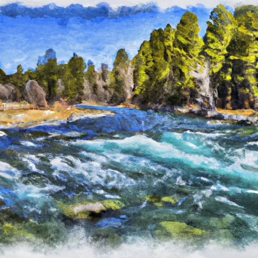
The ideal streamflow range for this section is between 1,000 and 5,000 cfs, which typically occurs during the spring snowmelt and after significant rainfall. The river rapids and obstacles include the House Rock, Screaming Left Turn, Mad Mile, and the notorious House Rock Rapid. These features provide a thrilling ride for experienced paddlers, but can be dangerous for novice kayakers or rafters.
There are specific regulations to the area, including a limit on the number of commercial outfitters and a prohibition on alcohol consumption while on the river. It is also important to note that the river flows through private land, so respect for property rights and responsible behavior are essential.
Plan your run down to the hour
Same weather feed Snoflo's iOS app uses -- updated continuously from NOAA / yr.no. Watch the precipitation column on the meteogram; rain ahead of a run typically lifts flows 12-48 hours later depending on the basin.
Next 5 days, hour by hour
Temperature line with weather symbols on top, snow + rain accumulation as columns, humidity as a dotted line.
5-day forecast table
Every 3 hours, broken out across temperature, snow, rain, humidity, and wind. Each cell is colour-coded relative to the column min/max.
| Time | Condition | Temp (°F) | Snow (in) | Rain (in) | Humidity (%) | Wind (mps) | Wind dir |
|---|---|---|---|---|---|---|---|
| Loading detailed forecast… | |||||||
15-day temperature & precipitation
Daily temperatures, snow, and rain projected over the next two weeks -- the upstream story that drives next week's flows.
Regional streamflow levels
USGS streamgauges around Gallatin Forest Boundary, Sec. 32, T7s, R7e To Yellowstone National Park, Sec. 23, T9s, R8e -- useful for spotting upstream pulses and gauging which tributary is contributing what.
| Streamgauge | Discharge | View |
|---|---|---|
| Yellowstone River At Corwin Springs Mt | 3,760 cfs | → |
| Gardner River Near Mammoth Ynp | 181 cfs | → |
| Boiling River At Mammoth | 22 cfs | → |
| Hyalite C At Hyalite R S Nr Bozeman Mt | 78 cfs | → |
| Gallatin River Near Gallatin Gateway Mt | 688 cfs | → |
| Tantalus Creek At Norris Junction | 3 cfs | → |
Plan a longer trip
The closest boat launches, other paddle runs, and campgrounds so a day on the water can grow into a full weekend.
Boat launches
- Carbella Boat Ramp
- Old Yellowstone Trail Park County
- Dailey Lake
- Daily Lake Road Park County
- Brogan's Landing
Other river runs
- Yankee Jim Canyon (Joe Brown To Miner)
- Gardiner Town Run
- Gallatin Canyon, Sec. 19, T4s, R4e To Yellowstone National Park, Sec. 27, T9s, R5e
- The Headwaters, In The Gallatin Range To Ends Downstream Of Osprey Falls
- Moose To Storm Castle
Campgrounds
Fishing spots
Whitewater safety
- Check the flow before you run
- Use the linked-gauge card and Regional Flow panel above. Class ratings change with flow -- a Class III at low water can become Class IV+ at high water.
- Know your skill ceiling
- Pick runs comfortably below your ceiling. Cold-water and big-water runs raise the consequences of any mistake.
- Wear the right gear
- Helmet, PFD, drysuit / wetsuit when water is below 60°F. Throw bag, knife, and whistle on your person, not in the boat.
- Scout, set safety, and run with a team
- Scout new rapids on foot, set safety with throw bags above the consequence pool, and run with at least one other competent paddler.
- Respect the river
- Strainers, undercuts, low-head dams, and wood can kill at any class rating. When in doubt, portage.
Set push alerts in the Snoflo app
Save Gallatin Forest Boundary, Sec. 32, T7s, R7e To Yellowstone National Park, Sec. 23, T9s, R8e as a favorite, set a discharge threshold (e.g. "alert me when flow hits 600 cfs"), and the iOS app pushes the moment the linked gauge crosses.
About Gallatin Forest Boundary, Sec. 32, T7s, R7e To Yellowstone National Park, Sec. 23, T9s, R8e
What's the optimal flow for Gallatin Forest Boundary, Sec. 32, T7s, R7e To Yellowstone National Park, Sec. 23, T9s, R8e?
The optimal flow depends on the section and the craft. Check the Run Details panel for the linked gauge and current status.
How fresh is the cfs reading on this page?
The linked USGS streamgauge reports continuously (every 15 minutes); Snoflo refreshes throughout the day. Hover the streamflow sparkline to read individual datapoints.
What's the whitewater class?
See the Run Details panel for the class rating Snoflo tracks for this run. Class ratings change with flow -- a Class III at low water can become Class IV in high water.
Where do I put in / take out?
Tap Directions in the hero above to open driving directions to the put-in. For shuttle planning, check the Nearby Boat Launches panel and the river run operator's site.
Can I get alerts when flows hit the optimal range?
Yes -- alerts are managed in the Snoflo iOS app. Favorite this run, set a discharge threshold, and you'll get a push the moment the gauge crosses.
Other runs near here
Snoflo-tracked paddle runs within driving distance of Gallatin Forest Boundary, Sec. 32, T7s, R7e To Yellowstone National Park, Sec. 23, T9s, R8e.