Hauser Dam, Sec. 29, T12n, R2w To Cochran Gulch, Sec. 18, T12n, R2w River Run
Community Reviews
Been here? Share the conditions.
Reviews, ratings & photos are added in the free Snoflo iOS app — rate a spot, tag the conditions, and your visit is verified by location. Add or manage your reviews from the app.
Hauser Dam, Sec. 29, T12n, R2w To Cochran Gulch, Sec. 18, T12n, R2w
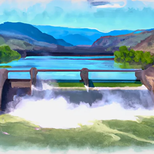
There are a few specific regulations to be aware of before embarking on this run. An access permit is required to launch from Hauser Dam. Additionally, boats must be self-bailing and equipped with a Type III or V PFD for each person on board. There is also a no-alcohol policy in effect for this stretch of river.
According to the American Whitewater website, this run is a popular destination for kayakers and rafters alike. The scenery is stunning, with the river flowing through a narrow canyon, and there are plenty of opportunities to catch waves and play in the rapids.
Overall, the Hauser Dam to Cochran Gulch river run is a thrilling and scenic option for whitewater enthusiasts. As with any outdoor activity, it is important to educate oneself on specific regulations and safety guidelines before embarking on the adventure.
Plan your run down to the hour
Same weather feed Snoflo's iOS app uses -- updated continuously from NOAA / yr.no. Watch the precipitation column on the meteogram; rain ahead of a run typically lifts flows 12-48 hours later depending on the basin.
Next 5 days, hour by hour
Temperature line with weather symbols on top, snow + rain accumulation as columns, humidity as a dotted line.
5-day forecast table
Every 3 hours, broken out across temperature, snow, rain, humidity, and wind. Each cell is colour-coded relative to the column min/max.
| Time | Condition | Temp (°F) | Snow (in) | Rain (in) | Humidity (%) | Wind (mps) | Wind dir |
|---|---|---|---|---|---|---|---|
| Loading detailed forecast… | |||||||
15-day temperature & precipitation
Daily temperatures, snow, and rain projected over the next two weeks -- the upstream story that drives next week's flows.
Regional streamflow levels
USGS streamgauges around Hauser Dam, Sec. 29, T12n, R2w To Cochran Gulch, Sec. 18, T12n, R2w -- useful for spotting upstream pulses and gauging which tributary is contributing what.
| Streamgauge | Discharge | View |
|---|---|---|
| Missouri River Bl Hauser Lake Nr Helena Mt | 3,550 cfs | → |
| Missouri River Bl Holter Dam Nr Wolf Cr Mt | 3,490 cfs | → |
| Tenmile Creek Near Helena Mt | 4 cfs | → |
| Little Prickly Pear Cr At Wolf Cr Mt | 34 cfs | → |
| Prickly Pear Creek Near Clancy Mt | 13 cfs | → |
| Tenmile Creek Near Rimini Mt | 2 cfs | → |
Plan a longer trip
The closest boat launches, other paddle runs, and campgrounds so a day on the water can grow into a full weekend.
Boat launches
- Hauser Dam Road Helena Valley Northeast
- White Sandy Boat Ramp
- Cross Drive Helena Valley Northeast
- Smith Road Helena Valley Northeast
- York Road Lewis And Clark County
- Devils Elbow Boat Ramp
Other river runs
- Missouri River
- Town Of Nelson, Sec. 12, T12n, R2w To Missouri River, Sec. 19, T12n, R2w
- Falls, Sec. 25, T14n, R4e To Smith River, Sec. 25, T14n, R3e
Campgrounds
- White Sandy
- Black Sandy State Park
- White Sandy Campground
- Beartooth Landing
- Devils Elbow Campground
- Spokane Bay
Fishing spots
- Missouri River Fishing Access Site
- Prickly Pear Creek
- Hauser Reservoir
- Helena Valley Regulating Reservoir
- Silver Creek
- Little Prickly Pear Creek
Whitewater safety
- Check the flow before you run
- Use the linked-gauge card and Regional Flow panel above. Class ratings change with flow -- a Class III at low water can become Class IV+ at high water.
- Know your skill ceiling
- Pick runs comfortably below your ceiling. Cold-water and big-water runs raise the consequences of any mistake.
- Wear the right gear
- Helmet, PFD, drysuit / wetsuit when water is below 60°F. Throw bag, knife, and whistle on your person, not in the boat.
- Scout, set safety, and run with a team
- Scout new rapids on foot, set safety with throw bags above the consequence pool, and run with at least one other competent paddler.
- Respect the river
- Strainers, undercuts, low-head dams, and wood can kill at any class rating. When in doubt, portage.
Set push alerts in the Snoflo app
Save Hauser Dam, Sec. 29, T12n, R2w To Cochran Gulch, Sec. 18, T12n, R2w as a favorite, set a discharge threshold (e.g. "alert me when flow hits 600 cfs"), and the iOS app pushes the moment the linked gauge crosses.
About Hauser Dam, Sec. 29, T12n, R2w To Cochran Gulch, Sec. 18, T12n, R2w
What's the optimal flow for Hauser Dam, Sec. 29, T12n, R2w To Cochran Gulch, Sec. 18, T12n, R2w?
The optimal flow depends on the section and the craft. Check the Run Details panel for the linked gauge and current status.
How fresh is the cfs reading on this page?
The linked USGS streamgauge reports continuously (every 15 minutes); Snoflo refreshes throughout the day. Hover the streamflow sparkline to read individual datapoints.
What's the whitewater class?
See the Run Details panel for the class rating Snoflo tracks for this run. Class ratings change with flow -- a Class III at low water can become Class IV in high water.
Where do I put in / take out?
Tap Directions in the hero above to open driving directions to the put-in. For shuttle planning, check the Nearby Boat Launches panel and the river run operator's site.
Can I get alerts when flows hit the optimal range?
Yes -- alerts are managed in the Snoflo iOS app. Favorite this run, set a discharge threshold, and you'll get a push the moment the gauge crosses.
Other runs near here
Snoflo-tracked paddle runs within driving distance of Hauser Dam, Sec. 29, T12n, R2w To Cochran Gulch, Sec. 18, T12n, R2w.