Muskrat Creek River Run
Community Reviews
Been here? Share the conditions.
Reviews, ratings & photos are added in the free Snoflo iOS app — rate a spot, tag the conditions, and your visit is verified by location. Add or manage your reviews from the app.
Muskrat Creek
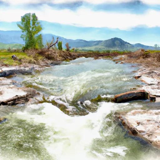
Muskrat Creek is a popular whitewater river run in Montana, known for its challenging rapids and scenic surroundings. The ideal streamflow range for Muskrat Creek is between 500 and 2000 cfs, although some experienced paddlers may be able to navigate the river at higher flow rates. The river is rated as Class III-IV, meaning that it includes challenging rapids with complex maneuvers required to avoid obstacles.
The segment mileage of Muskrat Creek is approximately 10 miles, starting from near the town of Ennis and flowing to its confluence with the Madison River. Along the way, paddlers can expect to encounter a variety of rapids, including drops, waves, and tight channels. Some of the most notable rapids on Muskrat Creek include the "Entrance Rapid," the "Jungle Rapid," and the "Cave Rapid."
There are specific regulations that apply to the Muskrat Creek area, including restrictions on the use of motorized boats and requirements for properly securing all equipment to prevent littering. Additionally, paddlers should be aware of potential hazards such as strainers and rocks in the river. It is recommended that paddlers have prior experience with whitewater rafting before attempting to navigate Muskrat Creek.
Plan your run down to the hour
Same weather feed Snoflo's iOS app uses -- updated continuously from NOAA / yr.no. Watch the precipitation column on the meteogram; rain ahead of a run typically lifts flows 12-48 hours later depending on the basin.
Next 5 days, hour by hour
Temperature line with weather symbols on top, snow + rain accumulation as columns, humidity as a dotted line.
5-day forecast table
Every 3 hours, broken out across temperature, snow, rain, humidity, and wind. Each cell is colour-coded relative to the column min/max.
| Time | Condition | Temp (°F) | Snow (in) | Rain (in) | Humidity (%) | Wind (mps) | Wind dir |
|---|---|---|---|---|---|---|---|
| Loading detailed forecast… | |||||||
15-day temperature & precipitation
Daily temperatures, snow, and rain projected over the next two weeks -- the upstream story that drives next week's flows.
Regional streamflow levels
USGS streamgauges around Muskrat Creek -- useful for spotting upstream pulses and gauging which tributary is contributing what.
| Streamgauge | Discharge | View |
|---|---|---|
| Boulder River Near Boulder Mt | 58 cfs | → |
| Prickly Pear Creek Near Clancy Mt | 17 cfs | → |
| Tenmile Creek Near Rimini Mt | 3 cfs | → |
| Tenmile Creek Near Helena Mt | 4 cfs | → |
| Missouri River At Toston Mt | 3,350 cfs | → |
| Missouri River Bl Hauser Lake Nr Helena Mt | 3,470 cfs | → |
Plan a longer trip
The closest boat launches, other paddle runs, and campgrounds so a day on the water can grow into a full weekend.
Other river runs
- Sec. 28, T8n, R7w To Ontario Creek, Sec. 12, T8n, R7w
- Trail #329, Sec. 15, T7n, R7w To Sec. 28, T8n, R7w
- Missouri River
- Town Of Nelson, Sec. 12, T12n, R2w To Missouri River, Sec. 19, T12n, R2w
Campgrounds
Fishing spots
Whitewater safety
- Check the flow before you run
- Use the linked-gauge card and Regional Flow panel above. Class ratings change with flow -- a Class III at low water can become Class IV+ at high water.
- Know your skill ceiling
- Pick runs comfortably below your ceiling. Cold-water and big-water runs raise the consequences of any mistake.
- Wear the right gear
- Helmet, PFD, drysuit / wetsuit when water is below 60°F. Throw bag, knife, and whistle on your person, not in the boat.
- Scout, set safety, and run with a team
- Scout new rapids on foot, set safety with throw bags above the consequence pool, and run with at least one other competent paddler.
- Respect the river
- Strainers, undercuts, low-head dams, and wood can kill at any class rating. When in doubt, portage.
Set push alerts in the Snoflo app
Save Muskrat Creek as a favorite, set a discharge threshold (e.g. "alert me when flow hits 600 cfs"), and the iOS app pushes the moment the linked gauge crosses.
About Muskrat Creek
What's the optimal flow for Muskrat Creek?
The optimal flow depends on the section and the craft. Check the Run Details panel for the linked gauge and current status.
How fresh is the cfs reading on this page?
The linked USGS streamgauge reports continuously (every 15 minutes); Snoflo refreshes throughout the day. Hover the streamflow sparkline to read individual datapoints.
What's the whitewater class?
See the Run Details panel for the class rating Snoflo tracks for this run. Class ratings change with flow -- a Class III at low water can become Class IV in high water.
Where do I put in / take out?
Tap Directions in the hero above to open driving directions to the put-in. For shuttle planning, check the Nearby Boat Launches panel and the river run operator's site.
Can I get alerts when flows hit the optimal range?
Yes -- alerts are managed in the Snoflo iOS app. Favorite this run, set a discharge threshold, and you'll get a push the moment the gauge crosses.
Other runs near here
Snoflo-tracked paddle runs within driving distance of Muskrat Creek.