Confluence With Harden Cienega Creek To Apache-Sitgreaves National Forest Boundary River Run
Community Reviews
Been here? Share the conditions.
Reviews, ratings & photos are added in the free Snoflo iOS app — rate a spot, tag the conditions, and your visit is verified by location. Add or manage your reviews from the app.
Confluence With Harden Cienega Creek To Apache-Sitgreaves National Forest Boundary
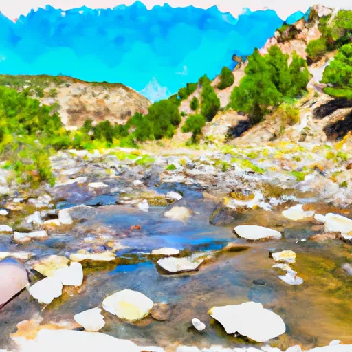
The Whitewater River Run Confluence with Harden Cienega Creek to Apache-Sitgreaves National Forest Boundary in New Mexico is a popular whitewater destination. The ideal streamflow range for this run is between 100 and 500 cfs, depending on the season and weather conditions. The class rating for this segment of the river ranges from Class II to Class III+, with some challenging rapids and obstacles such as rocks, drops, and eddies.
The segment mileage for this run is approximately 14 miles, and it takes around 4-5 hours to complete. Some notable rapids and obstacles along the way include the "Double Drop," "House Rock," and "Crusher Rapid."
Specific regulations to the area include permits, which are required for commercial outfitters and guides. Additionally, visitors must adhere to Leave No Trace principles and pack out all trash and waste. Camping is allowed in designated areas, but fires are only permitted in established fire rings.
Plan your run down to the hour
Same weather feed Snoflo's iOS app uses -- updated continuously from NOAA / yr.no. Watch the precipitation column on the meteogram; rain ahead of a run typically lifts flows 12-48 hours later depending on the basin.
Next 5 days, hour by hour
Temperature line with weather symbols on top, snow + rain accumulation as columns, humidity as a dotted line.
5-day forecast table
Every 3 hours, broken out across temperature, snow, rain, humidity, and wind. Each cell is colour-coded relative to the column min/max.
| Time | Condition | Temp (°F) | Snow (in) | Rain (in) | Humidity (%) | Wind (mps) | Wind dir |
|---|---|---|---|---|---|---|---|
| Loading detailed forecast… | |||||||
15-day temperature & precipitation
Daily temperatures, snow, and rain projected over the next two weeks -- the upstream story that drives next week's flows.
Regional streamflow levels
USGS streamgauges around Confluence With Harden Cienega Creek To Apache-Sitgreaves National Forest Boundary -- useful for spotting upstream pulses and gauging which tributary is contributing what.
| Streamgauge | Discharge | View |
|---|---|---|
| Blue River Near Clifton | 0 cfs | → |
| San Francisco River At Clifton | 44 cfs | → |
| San Francisco River Near Glenwood | 35 cfs | → |
| Gila River Near Clifton | 44 cfs | → |
| Eagle Creek Above Pumping Plant | 27 cfs | → |
| Mogollon Creek Near Cliff | · | → |
Plan a longer trip
The closest boat launches, other paddle runs, and campgrounds so a day on the water can grow into a full weekend.
Other river runs
- 0.5miles Above Confluence Of Left And Right Prongs Dix Creek On Left Prong To 0.1 Miles Above Diversion On Dix Creek
- 1.5 Miles Above Confluence Of Left And Right Creek On Left Prong To Confluence Of Left And Right Prongs Dix Creek
- 1/4 Mile Below The Power Lines To Confluence With The San Francisco River
- 1/4 Mile Above The Powerlines To 1/4 Mile Below The Powerlines
- Arizona/New Mexico State Line To Confluence With Harden Cienega Creek
Whitewater safety
- Check the flow before you run
- Use the linked-gauge card and Regional Flow panel above. Class ratings change with flow -- a Class III at low water can become Class IV+ at high water.
- Know your skill ceiling
- Pick runs comfortably below your ceiling. Cold-water and big-water runs raise the consequences of any mistake.
- Wear the right gear
- Helmet, PFD, drysuit / wetsuit when water is below 60°F. Throw bag, knife, and whistle on your person, not in the boat.
- Scout, set safety, and run with a team
- Scout new rapids on foot, set safety with throw bags above the consequence pool, and run with at least one other competent paddler.
- Respect the river
- Strainers, undercuts, low-head dams, and wood can kill at any class rating. When in doubt, portage.
Set push alerts in the Snoflo app
Save Confluence With Harden Cienega Creek To Apache-Sitgreaves National Forest Boundary as a favorite, set a discharge threshold (e.g. "alert me when flow hits 600 cfs"), and the iOS app pushes the moment the linked gauge crosses.
About Confluence With Harden Cienega Creek To Apache-Sitgreaves National Forest Boundary
What's the optimal flow for Confluence With Harden Cienega Creek To Apache-Sitgreaves National Forest Boundary?
The optimal flow depends on the section and the craft. Check the Run Details panel for the linked gauge and current status.
How fresh is the cfs reading on this page?
The linked USGS streamgauge reports continuously (every 15 minutes); Snoflo refreshes throughout the day. Hover the streamflow sparkline to read individual datapoints.
What's the whitewater class?
See the Run Details panel for the class rating Snoflo tracks for this run. Class ratings change with flow -- a Class III at low water can become Class IV in high water.
Where do I put in / take out?
Tap Directions in the hero above to open driving directions to the put-in. For shuttle planning, check the Nearby Boat Launches panel and the river run operator's site.
Can I get alerts when flows hit the optimal range?
Yes -- alerts are managed in the Snoflo iOS app. Favorite this run, set a discharge threshold, and you'll get a push the moment the gauge crosses.
Other runs near here
Snoflo-tracked paddle runs within driving distance of Confluence With Harden Cienega Creek To Apache-Sitgreaves National Forest Boundary.