2026-02-14T05:00:00-07:00
* WHAT...Snow expected. Total snow accumulations between 4 and 8 inches above 8,500ft with lesser amounts below. * WHERE...Northern and Southern Sangre de Cristo Mountains, and Tusas Mountains Including Chama. * WHEN...Until 5 AM MST Saturday. * IMPACTS...High mountain roads and passes will likely become slick and hazardous. Travel could be very difficult. Tire traction will be reduced. Extend the distance between your vehicle and the vehicle in front of you.
Summary
The ideal streamflow range for this run is between 500 and 3,000 cubic feet per second (cfs). This range ensures a good mix of challenging rapids and smooth sections.
The segment mileage for this run is approximately 9 miles. The class rating for this section of the river is Class III-IV. This means that the river is moderately difficult with moderate to high waves, difficult eddies, and strong currents. Some of the specific rapids and obstacles to watch out for include Pinball, Drop Zone, and the K-Drop.
There are specific regulations to the area, including a requirement for all boaters to wear a personal flotation device (PFD) at all times. Additionally, all boaters must have a whistle and a throw rope with them. The river is also closed during times of high water or when water levels exceed 3,500 cfs.
In conclusion, the Whitewater River Run Headwaters To Alamitos Diversion in New Mexico is a thrilling and challenging run for experienced kayakers and rafters. It offers a range of rapids and obstacles, and the ideal streamflow range is between 500 and 3,000 cfs. Boaters must follow specific regulations to ensure safety on the river.
°F
°F
mph
Wind
%
Humidity
15-Day Weather Outlook
River Run Details
| Last Updated | 2025-12-08 |
| River Levels | 133 cfs (4.02 ft) |
| Percent of Normal | 212% |
| Status | |
| Class Level | iii-iv |
| Elevation | ft |
| Streamflow Discharge | cfs |
| Gauge Height | ft |
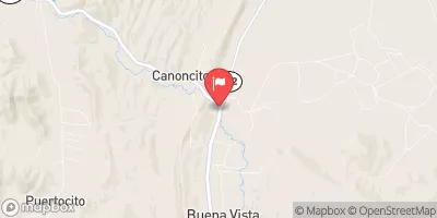
| Reporting Streamgage | USGS 08277470 |
5-Day Hourly Forecast Detail
Nearby Streamflow Levels
Area Campgrounds
| Location | Reservations | Toilets |
|---|---|---|
 La Junta Canyon
|
||
 Duran Canyon
|
||
 Duran
Duran
|
||
 Duran Canyon Campground
|
||
 Upper La Junta
|
||
 Upper La Junta Campground
|


 Headwaters To Alamitos Diversion
 Headwaters To Confluence With Rio Pueblo
 (La Cueva, Flechado, Gallegos, Tio Maes, La Presa) To Osha Diversion
 Headwaters To Santa Barbara Campground
 Santa Barbara Cg To Concrete Bridge On Fr 116