Headwaters To Comanche Point River Run
Community Reviews
Been here? Share the conditions.
Reviews, ratings & photos are added in the free Snoflo iOS app — rate a spot, tag the conditions, and your visit is verified by location. Add or manage your reviews from the app.
Headwaters To Comanche Point
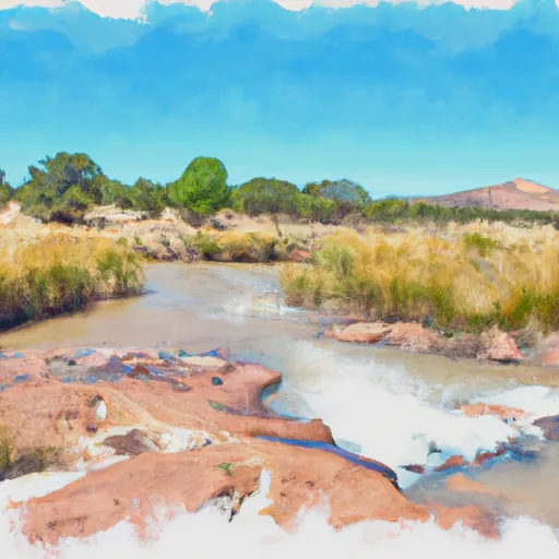
The ideal streamflow range for this segment of the Whitewater River is between 300-600 cubic feet per second (cfs). This flow level ensures that the rapids are challenging but still navigable. Flow levels above this range can create dangerous conditions, while lower flow levels may make the rapids less exciting.
The Class rating of this segment ranges from Class III to IV+. Class III rapids are characterized by moderately difficult water with moderate waves and obstacles, while Class IV rapids are challenging with large waves, powerful currents, and potentially hazardous obstacles.
Several notable rapids and obstacles are present along this segment of the river, including the "Squeeze," "Rockslide," and "Tres Rios." These rapids offer a thrilling experience for experienced whitewater paddlers.
When it comes to regulations, the Whitewater River is managed by the Bureau of Land Management (BLM) and requires a permit for all commercial outfitters. Additionally, paddlers should be aware of potential hazards such as low head dams, strainers, and other obstacles. Proper safety equipment and training are essential for a safe and enjoyable trip.
In conclusion, the Headwaters to Comanche Point segment of the Whitewater River is a challenging and exciting run for experienced whitewater paddlers. The ideal streamflow range, Class III to IV+ rapids, and specific hazards and regulations make it a unique and thrilling experience.
Plan your run down to the hour
Same weather feed Snoflo's iOS app uses -- updated continuously from NOAA / yr.no. Watch the precipitation column on the meteogram; rain ahead of a run typically lifts flows 12-48 hours later depending on the basin.
Next 5 days, hour by hour
Temperature line with weather symbols on top, snow + rain accumulation as columns, humidity as a dotted line.
5-day forecast table
Every 3 hours, broken out across temperature, snow, rain, humidity, and wind. Each cell is colour-coded relative to the column min/max.
| Time | Condition | Temp (°F) | Snow (in) | Rain (in) | Humidity (%) | Wind (mps) | Wind dir |
|---|---|---|---|---|---|---|---|
| Loading detailed forecast… | |||||||
15-day temperature & precipitation
Daily temperatures, snow, and rain projected over the next two weeks -- the upstream story that drives next week's flows.
Regional streamflow levels
USGS streamgauges around Headwaters To Comanche Point -- useful for spotting upstream pulses and gauging which tributary is contributing what.
| Streamgauge | Discharge | View |
|---|---|---|
| Costilla Creek Below Costilla Dam | 5 cfs | → |
| Santistevan Creek Near Costilla | 1 cfs | → |
| Casias Creek Near Costilla | 2 cfs | → |
| Costilla Creek Above Costilla Dam | 1 cfs | → |
| Costilla Creek Near Costilla | 5 cfs | → |
| Red River Near Questa | 15 cfs | → |
Plan a longer trip
The closest boat launches, other paddle runs, and campgrounds so a day on the water can grow into a full weekend.
Other river runs
Campgrounds
- Little Costilla Camp
- Little Costilla Low Impact Camp
- Ash Mountain Camp
- Cimarron Campground
- Nfs Cimarron Campground
- Middle Ponil Camp
Whitewater safety
- Check the flow before you run
- Use the linked-gauge card and Regional Flow panel above. Class ratings change with flow -- a Class III at low water can become Class IV+ at high water.
- Know your skill ceiling
- Pick runs comfortably below your ceiling. Cold-water and big-water runs raise the consequences of any mistake.
- Wear the right gear
- Helmet, PFD, drysuit / wetsuit when water is below 60°F. Throw bag, knife, and whistle on your person, not in the boat.
- Scout, set safety, and run with a team
- Scout new rapids on foot, set safety with throw bags above the consequence pool, and run with at least one other competent paddler.
- Respect the river
- Strainers, undercuts, low-head dams, and wood can kill at any class rating. When in doubt, portage.
Set push alerts in the Snoflo app
Save Headwaters To Comanche Point as a favorite, set a discharge threshold (e.g. "alert me when flow hits 600 cfs"), and the iOS app pushes the moment the linked gauge crosses.
About Headwaters To Comanche Point
What's the optimal flow for Headwaters To Comanche Point?
The optimal flow depends on the section and the craft. Check the Run Details panel for the linked gauge and current status.
How fresh is the cfs reading on this page?
The linked USGS streamgauge reports continuously (every 15 minutes); Snoflo refreshes throughout the day. Hover the streamflow sparkline to read individual datapoints.
What's the whitewater class?
See the Run Details panel for the class rating Snoflo tracks for this run. Class ratings change with flow -- a Class III at low water can become Class IV in high water.
Where do I put in / take out?
Tap Directions in the hero above to open driving directions to the put-in. For shuttle planning, check the Nearby Boat Launches panel and the river run operator's site.
Can I get alerts when flows hit the optimal range?
Yes -- alerts are managed in the Snoflo iOS app. Favorite this run, set a discharge threshold, and you'll get a push the moment the gauge crosses.
Other runs near here
Snoflo-tracked paddle runs within driving distance of Headwaters To Comanche Point.