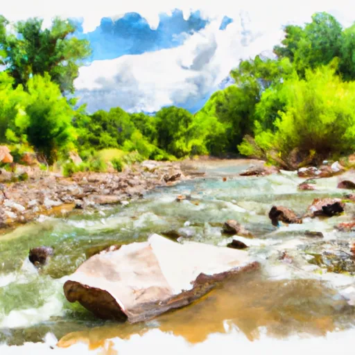
Rio Bonito river run
Community Reviews
Been here? Share the conditions.
Reviews, ratings & photos are added in the free Snoflo iOS app — rate a spot, tag the conditions, and your visit is verified by location. Add or manage your reviews from the app.
Rio Bonito
The Rio Bonito is rated as a class III-IV river, which means it is suitable for experienced paddlers who are comfortable navigating technical rapids at higher flows. The segment of the river used for whitewater rafting is approximately 7 miles long, offering a great mix of exciting rapids and calmer sections.
One of the most challenging rapids on the Rio Bonito is known as "The Narrows." This rapid is a class IV section that requires precise navigation and technical skill to navigate. Other notable rapids on the Rio Bonito include "Horseshoe Bend," "The Slide," and "The Chute."
There are specific regulations in place for those looking to run the Rio Bonito. The river falls under the jurisdiction of the New Mexico State Parks Department, which requires all boaters to obtain a permit before launching. Additionally, all boaters must wear a personal flotation device (PFD) at all times while on the river.
In conclusion, the Rio Bonito is a challenging and scenic whitewater river located in New Mexico. Its ideal streamflow range is between 200 and 700 cfs, and it is rated as a class III-IV river. There are specific regulations in place to ensure the safety of all boaters, including the requirement of a permit and PFD use.
Plan your run down to the hour
Same weather feed Snoflo's iOS app uses -- updated continuously from NOAA / yr.no. Watch the precipitation column on the meteogram; rain ahead of a run typically lifts flows 12-48 hours later depending on the basin.
Next 5 days, hour by hour
Temperature line with weather symbols on top, snow + rain accumulation as columns, humidity as a dotted line.
5-day forecast table
Every 3 hours, broken out across temperature, snow, rain, humidity, and wind. Each cell is colour-coded relative to the column min/max.
| Time | Condition | Temp (°F) | Snow (in) | Rain (in) | Humidity (%) | Wind (mps) | Wind dir |
|---|---|---|---|---|---|---|---|
| Loading detailed forecast… | |||||||
15-day temperature & precipitation
Daily temperatures, snow, and rain projected over the next two weeks -- the upstream story that drives next week's flows.
Regional streamflow levels
USGS streamgauges around Rio Bonito -- useful for spotting upstream pulses and gauging which tributary is contributing what.
| Streamgauge | Discharge | View |
|---|---|---|
| Rio Ruidoso At Hollywood | 5 cfs | → |
| Eagle Creek Below South Fork Near Alto | 0 cfs | → |
| Rio Ruidoso At Ruidoso | 1 cfs | → |
| Rio Hondo At Diamond A Ranch Nr Roswell | · | → |
| Tularosa Creek Near Bent | 8 cfs | → |
| Rio Hondo Blw Diamond A Dam Nr Roswell | · | → |
Plan a longer trip
The closest boat launches, other paddle runs, and campgrounds so a day on the water can grow into a full weekend.
Other river runs
- Headwaters (Sec 27, T8s, R17e) To Confluence Of Streams In Sec 34, T8s, R17e
- Headwaters (Hale Canyon) To Nf Boundary
- Headwaters To Eastern Boundary Private Land
Whitewater safety
- Check the flow before you run
- Use the linked-gauge card and Regional Flow panel above. Class ratings change with flow -- a Class III at low water can become Class IV+ at high water.
- Know your skill ceiling
- Pick runs comfortably below your ceiling. Cold-water and big-water runs raise the consequences of any mistake.
- Wear the right gear
- Helmet, PFD, drysuit / wetsuit when water is below 60°F. Throw bag, knife, and whistle on your person, not in the boat.
- Scout, set safety, and run with a team
- Scout new rapids on foot, set safety with throw bags above the consequence pool, and run with at least one other competent paddler.
- Respect the river
- Strainers, undercuts, low-head dams, and wood can kill at any class rating. When in doubt, portage.
Set push alerts in the Snoflo app
Save Rio Bonito as a favorite, set a discharge threshold (e.g. "alert me when flow hits 600 cfs"), and the iOS app pushes the moment the linked gauge crosses.
About Rio Bonito
What's the optimal flow for Rio Bonito?
The optimal flow depends on the section and the craft. Check the Run Details panel for the linked gauge and current status.
How fresh is the cfs reading on this page?
The linked USGS streamgauge reports continuously (every 15 minutes); Snoflo refreshes throughout the day. Hover the streamflow sparkline to read individual datapoints.
What's the whitewater class?
See the Run Details panel for the class rating Snoflo tracks for this run. Class ratings change with flow -- a Class III at low water can become Class IV in high water.
Where do I put in / take out?
Tap Directions in the hero above to open driving directions to the put-in. For shuttle planning, check the Nearby Boat Launches panel and the river run operator's site.
Can I get alerts when flows hit the optimal range?
Yes -- alerts are managed in the Snoflo iOS app. Favorite this run, set a discharge threshold, and you'll get a push the moment the gauge crosses.
Other runs near here
Snoflo-tracked paddle runs within driving distance of Rio Bonito.