
Summary
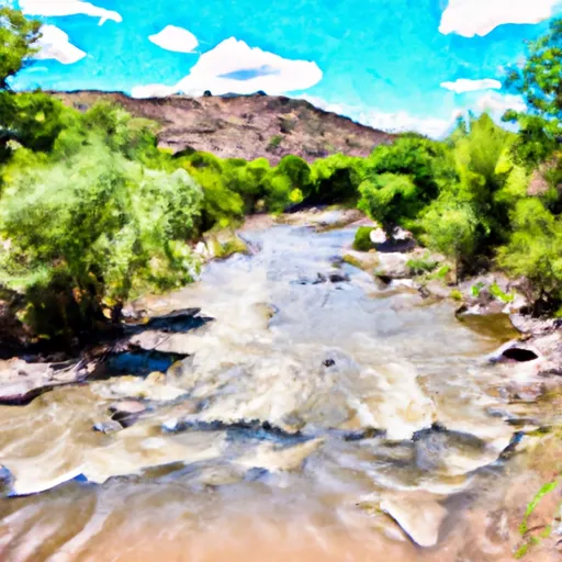
The ideal streamflow range for the Gila River run is between 400-1,000 cubic feet per second (cfs). The river is classified as a Class II-IV according to the International Scale of River Difficulty, which means it is suitable for intermediate and experienced paddlers who have a good understanding of river safety techniques.
The Gila River run is divided into two segments: the Upper Gila and the Lower Gila. The Upper Gila is 16.6 miles long and offers Class II-IV rapids, including the "Twisted Ankle" and "Little Whirlpool." The Lower Gila is 23.8 miles long and offers Class II-III rapids, including the "Cottonwood Cliffs" and "The Essential." Paddlers seeking a more challenging run can opt to combine both segments for a 40-mile run.
Specific regulations for the area include obtaining a permit from the Bureau of Land Management (BLM) before embarking on the river run. The BLM limits the number of permits issued per day to maintain the natural environment and protect the river's ecosystem. Additionally, it is essential to follow Leave No Trace principles and pack out all trash and waste.
In conclusion, the Gila River run in New Mexico provides a range of challenging Class II-IV rapids suitable for experienced paddlers. The ideal streamflow range is between 400-1,000 cfs, and the river is divided into two segments with specific rapids and obstacles. Paddlers must obtain a permit from the BLM and adhere to specific regulations to protect the river's ecosystem.
River Run Details
| Last Updated | 2025-06-28 |
| River Levels | 51 cfs (4.71 ft) |
| Percent of Normal | 3% |
| Status | |
| Class Level | ii-iv |
| Elevation | ft |
| Streamflow Discharge | cfs |
| Gauge Height | ft |
| Reporting Streamgage | USGS 09432000 |

Weather Forecast
Nearby Streamflow Levels
 Gila River Below Blue Creek
|
59cfs |
 Gila River At Duncan
|
33cfs |
 Gila River Near Redrock
|
65cfs |
 Gila River Near Clifton
|
53cfs |
 San Francisco River At Clifton
|
8cfs |
 Gila River Near Gila
|
60cfs |
 Gila
Gila