Confluence With Castle Creek To Confluence With Dry Blue Creek river run
Confluence With Castle Creek To Confluence With Dry Blue Creek
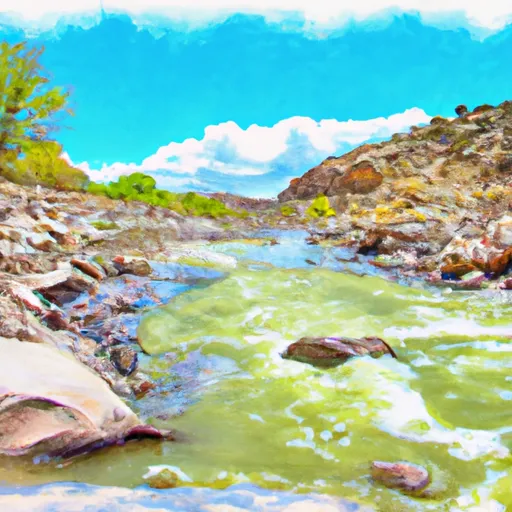
This stretch of the Whitewater River has several rapids and obstacles, including The Narrows, a narrow channel with fast-moving water and large boulders. Other notable rapids include The Squeeze, The Cauldron, and The Grotto. It's important to note that some of these rapids can be dangerous and require experienced paddlers to navigate safely.
There are specific regulations in place for this area, including a permit requirement for commercial outfitters. Additionally, all boaters are required to wear a personal flotation device and carry a whistle, and motorized vehicles are prohibited on the river.
Sources for information on the Whitewater River Run Confluence with Castle Creek to Confluence with Dry Blue Creek include the Bureau of Land Management and various whitewater guidebooks. It's important to note that streamflow conditions can change rapidly, and it's essential to check current conditions before embarking on any whitewater adventure.
Plan your run down to the hour
Same weather feed Snoflo's iOS app uses -- updated continuously from NOAA / yr.no. Watch the precipitation column on the meteogram; rain ahead of a run typically lifts flows 12-48 hours later depending on the basin.
Next 5 days, hour by hour
Temperature line with weather symbols on top, snow + rain accumulation as columns, humidity as a dotted line.
5-day forecast table
Every 3 hours, broken out across temperature, snow, rain, humidity, and wind. Each cell is colour-coded relative to the column min/max.
| Time | Condition | Temp (°F) | Snow (in) | Rain (in) | Humidity (%) | Wind (mps) | Wind dir |
|---|---|---|---|---|---|---|---|
| Loading detailed forecast… | |||||||
15-day temperature & precipitation
Daily temperatures, snow, and rain projected over the next two weeks -- the upstream story that drives next week's flows.
Regional streamflow levels
USGS streamgauges around Confluence With Castle Creek To Confluence With Dry Blue Creek -- useful for spotting upstream pulses and gauging which tributary is contributing what.
| Streamgauge | Discharge | View |
|---|---|---|
| Nutrioso Cr. Ab. Nelson Res Nr Springerville | 0 cfs | → |
| San Francisco River Near Reserve | 3,350 cfs | → |
| Filler Ditch At Greer | 1 cfs | → |
| Little Colorado River At Greer | 1 cfs | → |
| Blue River Near Clifton | 0 cfs | → |
| San Francisco River Near Glenwood | 16 cfs | → |
Plan a longer trip
The closest boat launches, other paddle runs, and campgrounds so a day on the water can grow into a full weekend.
Other river runs
- 1.1 Miles Downstream From Us 191 To Confluence Wit Castle Creek
- Us Highway 191 To 1.1 Miles Downstream
- 1/4 Mile Above Diamond Rock Campground To Confluence With West Fork Black River
- Confluence With Coyote Creek To 1/4 Mile Above Diamond Rock Campground
- Confluence With Boneyard Creek To Confluence With Coyote Creek
Campgrounds
- Upper Blue Campground
- Luna Lake Group Campground
- Blue Crossing Campground
- Luna Lake
- Luna Lake Campground
- Head Of The Ditch Campground
Whitewater safety
- Check the flow before you run
- Use the linked-gauge card and Regional Flow panel above. Class ratings change with flow -- a Class III at low water can become Class IV+ at high water.
- Know your skill ceiling
- Pick runs comfortably below your ceiling. Cold-water and big-water runs raise the consequences of any mistake.
- Wear the right gear
- Helmet, PFD, drysuit / wetsuit when water is below 60°F. Throw bag, knife, and whistle on your person, not in the boat.
- Scout, set safety, and run with a team
- Scout new rapids on foot, set safety with throw bags above the consequence pool, and run with at least one other competent paddler.
- Respect the river
- Strainers, undercuts, low-head dams, and wood can kill at any class rating. When in doubt, portage.
Set push alerts in the Snoflo app
Save Confluence With Castle Creek To Confluence With Dry Blue Creek as a favorite, set a discharge threshold (e.g. "alert me when flow hits 600 cfs"), and the iOS app pushes the moment the linked gauge crosses.
About Confluence With Castle Creek To Confluence With Dry Blue Creek
What's the optimal flow for Confluence With Castle Creek To Confluence With Dry Blue Creek?
The optimal flow depends on the section and the craft. Check the Run Details panel for the linked gauge and current status.
How fresh is the cfs reading on this page?
The linked USGS streamgauge reports continuously (every 15 minutes); Snoflo refreshes throughout the day. Hover the streamflow sparkline to read individual datapoints.
What's the whitewater class?
See the Run Details panel for the class rating Snoflo tracks for this run. Class ratings change with flow -- a Class III at low water can become Class IV in high water.
Where do I put in / take out?
Tap Directions in the hero above to open driving directions to the put-in. For shuttle planning, check the Nearby Boat Launches panel and the river run operator's site.
Can I get alerts when flows hit the optimal range?
Yes -- alerts are managed in the Snoflo iOS app. Favorite this run, set a discharge threshold, and you'll get a push the moment the gauge crosses.
Other runs near here
Snoflo-tracked paddle runs within driving distance of Confluence With Castle Creek To Confluence With Dry Blue Creek.