Source To Confluence With Deschutes River river run
Community Reviews
Been here? Share the conditions.
Reviews, ratings & photos are added in the free Snoflo iOS app — rate a spot, tag the conditions, and your visit is verified by location. Add or manage your reviews from the app.
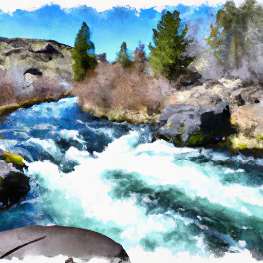
Source To Confluence With Deschutes River
As for regulations, the area is managed by the Bureau of Land Management (BLM), and a special permit is required for commercial or group use. The river is also closed to boating during the winter months to protect spawning fish. In addition, camping is only allowed in designated campsites, and all waste must be properly disposed of to protect the environment. Visitors are encouraged to follow Leave No Trace principles and respect the natural beauty of the area.
Plan your run down to the hour
Same weather feed Snoflo's iOS app uses -- updated continuously from NOAA / yr.no. Watch the precipitation column on the meteogram; rain ahead of a run typically lifts flows 12-48 hours later depending on the basin.
Next 5 days, hour by hour
Temperature line with weather symbols on top, snow + rain accumulation as columns, humidity as a dotted line.
5-day forecast table
Every 3 hours, broken out across temperature, snow, rain, humidity, and wind. Each cell is colour-coded relative to the column min/max.
| Time | Condition | Temp (°F) | Snow (in) | Rain (in) | Humidity (%) | Wind (mps) | Wind dir |
|---|---|---|---|---|---|---|---|
| Loading detailed forecast… | |||||||
15-day temperature & precipitation
Daily temperatures, snow, and rain projected over the next two weeks -- the upstream story that drives next week's flows.
Regional streamflow levels
USGS streamgauges around Source To Confluence With Deschutes River -- useful for spotting upstream pulses and gauging which tributary is contributing what.
| Streamgauge | Discharge | View |
|---|---|---|
| So Fk Mckenzie River Abv Cougar Lake Nr Rainbow Or | 225 cfs | → |
| Mckenzie R Blw Trail Br Dam Nr Belknap Springs | 641 cfs | → |
| Mckenzie River Bl Payne Cr | 186 cfs | → |
| Smith River Abv Trail Brdg Resv Nr Belknap Springs | 6 cfs | → |
| South Fork Mckenzie River Near Rainbow | 304 cfs | → |
| Crooked River Blw Osborne Canyon | 115 cfs | → |
Plan a longer trip
The closest boat launches, other paddle runs, and campgrounds so a day on the water can grow into a full weekend.
Boat launches
- Lapine State Park
- Big River Boating Site
- Big River Campground
- Tetherow Log Jam
- Tetherow Boat Launch
- Mid-Drift - Little Deschutes
Other river runs
- Big River To Benham Falls
- Pringle Falls To Big River Campground
- Roseland Park To Deschutes River
- Deschutes Nf Boundary To Paulina Lake
- Benham Falls To Dillon Falls
Campgrounds
- Lapine State Park
- Big River
- Big River Campground/Big River Group
- Pringle Falls Campground
- Pringle Falls
- Fall River Campground
Parks
Whitewater safety
- Check the flow before you run
- Use the linked-gauge card and Regional Flow panel above. Class ratings change with flow -- a Class III at low water can become Class IV+ at high water.
- Know your skill ceiling
- Pick runs comfortably below your ceiling. Cold-water and big-water runs raise the consequences of any mistake.
- Wear the right gear
- Helmet, PFD, drysuit / wetsuit when water is below 60°F. Throw bag, knife, and whistle on your person, not in the boat.
- Scout, set safety, and run with a team
- Scout new rapids on foot, set safety with throw bags above the consequence pool, and run with at least one other competent paddler.
- Respect the river
- Strainers, undercuts, low-head dams, and wood can kill at any class rating. When in doubt, portage.
Set push alerts in the Snoflo app
Save Source To Confluence With Deschutes River as a favorite, set a discharge threshold (e.g. "alert me when flow hits 600 cfs"), and the iOS app pushes the moment the linked gauge crosses.
About Source To Confluence With Deschutes River
What's the optimal flow for Source To Confluence With Deschutes River?
The optimal flow depends on the section and the craft. Check the Run Details panel for the linked gauge and current status.
How fresh is the cfs reading on this page?
The linked USGS streamgauge reports continuously (every 15 minutes); Snoflo refreshes throughout the day. Hover the streamflow sparkline to read individual datapoints.
What's the whitewater class?
See the Run Details panel for the class rating Snoflo tracks for this run. Class ratings change with flow -- a Class III at low water can become Class IV in high water.
Where do I put in / take out?
Tap Directions in the hero above to open driving directions to the put-in. For shuttle planning, check the Nearby Boat Launches panel and the river run operator's site.
Can I get alerts when flows hit the optimal range?
Yes -- alerts are managed in the Snoflo iOS app. Favorite this run, set a discharge threshold, and you'll get a push the moment the gauge crosses.
Other runs near here
Snoflo-tracked paddle runs within driving distance of Source To Confluence With Deschutes River.