Tualatin River River Run
Community Reviews
Been here? Share the conditions.
Reviews, ratings & photos are added in the free Snoflo iOS app — rate a spot, tag the conditions, and your visit is verified by location. Add or manage your reviews from the app.
Tualatin River
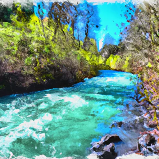
The Tualatin River, located in the state of Oregon, has a popular whitewater river run known as the "Whitewater Stretch." This segment of the river has a class rating of II-III and spans approximately 6 miles from Cook Park to West Linn.
The ideal streamflow range for this section of the river is between 500-1,000 cfs, although it is still runnable at higher levels. The river rapids and obstacles include several Class II and III rapids, including "Dimple Rapid," "Lava Falls," and "Bob's Falls." There are also some submerged logs and rocks that can pose a hazard to paddlers.
In terms of regulations, the Tualatin Riverkeepers organization has outlined specific guidelines for paddlers on the river. These include respecting private property along the river, avoiding disturbing wildlife, and practicing Leave No Trace principles. There are also rules in place regarding the use of personal watercraft and alcohol consumption on the river.
Overall, the Tualatin River Whitewater Stretch is a popular destination for paddlers seeking a moderate whitewater experience in the state of Oregon. It is important for paddlers to be aware of the ideal streamflow range, class rating, specific rapids and obstacles, and regulations in the area to ensure a safe and enjoyable experience.
Plan your run down to the hour
Same weather feed Snoflo's iOS app uses -- updated continuously from NOAA / yr.no. Watch the precipitation column on the meteogram; rain ahead of a run typically lifts flows 12-48 hours later depending on the basin.
Next 5 days, hour by hour
Temperature line with weather symbols on top, snow + rain accumulation as columns, humidity as a dotted line.
5-day forecast table
Every 3 hours, broken out across temperature, snow, rain, humidity, and wind. Each cell is colour-coded relative to the column min/max.
| Time | Condition | Temp (°F) | Snow (in) | Rain (in) | Humidity (%) | Wind (mps) | Wind dir |
|---|---|---|---|---|---|---|---|
| Loading detailed forecast… | |||||||
15-day temperature & precipitation
Daily temperatures, snow, and rain projected over the next two weeks -- the upstream story that drives next week's flows.
Regional streamflow levels
USGS streamgauges around Tualatin River -- useful for spotting upstream pulses and gauging which tributary is contributing what.
| Streamgauge | Discharge | View |
|---|---|---|
| Tualatin River Near Dilley | 223 cfs | → |
| Tucca Creek Near Blaine | 1 cfs | → |
| Trask River Above Cedar Creek | 105 cfs | → |
| Wilson River Near Tillamook | 98 cfs | → |
| South Yamhill River At Mcminnville | 24 cfs | → |
| East Fork Dairy Creek Near Meacham Corner | 21 cfs | → |
Plan a longer trip
The closest boat launches, other paddle runs, and campgrounds so a day on the water can grow into a full weekend.
Boat launches
Other river runs
- North Fork Trask River
- County Boudary (Confluence With Wsr) To Rm 47 (Lower End Mcguire Reservoir)
- Wilson River
- Trask River
- Rm 47 To Rm 52 (Upper End Of Nestucca River)
Campgrounds
- Elk Creek Campground
- Dovre Campground
- Trask River Park Campground
- Gales Creek Campground
- Gales Creek
- Jones Creek
Parks
Whitewater safety
- Check the flow before you run
- Use the linked-gauge card and Regional Flow panel above. Class ratings change with flow -- a Class III at low water can become Class IV+ at high water.
- Know your skill ceiling
- Pick runs comfortably below your ceiling. Cold-water and big-water runs raise the consequences of any mistake.
- Wear the right gear
- Helmet, PFD, drysuit / wetsuit when water is below 60°F. Throw bag, knife, and whistle on your person, not in the boat.
- Scout, set safety, and run with a team
- Scout new rapids on foot, set safety with throw bags above the consequence pool, and run with at least one other competent paddler.
- Respect the river
- Strainers, undercuts, low-head dams, and wood can kill at any class rating. When in doubt, portage.
Set push alerts in the Snoflo app
Save Tualatin River as a favorite, set a discharge threshold (e.g. "alert me when flow hits 600 cfs"), and the iOS app pushes the moment the linked gauge crosses.
About Tualatin River
What's the optimal flow for Tualatin River?
The optimal flow depends on the section and the craft. Check the Run Details panel for the linked gauge and current status.
How fresh is the cfs reading on this page?
The linked USGS streamgauge reports continuously (every 15 minutes); Snoflo refreshes throughout the day. Hover the streamflow sparkline to read individual datapoints.
What's the whitewater class?
See the Run Details panel for the class rating Snoflo tracks for this run. Class ratings change with flow -- a Class III at low water can become Class IV in high water.
Where do I put in / take out?
Tap Directions in the hero above to open driving directions to the put-in. For shuttle planning, check the Nearby Boat Launches panel and the river run operator's site.
Can I get alerts when flows hit the optimal range?
Yes -- alerts are managed in the Snoflo iOS app. Favorite this run, set a discharge threshold, and you'll get a push the moment the gauge crosses.
Other runs near here
Snoflo-tracked paddle runs within driving distance of Tualatin River.