Willamette River River Run
Community Reviews
Been here? Share the conditions.
Reviews, ratings & photos are added in the free Snoflo iOS app — rate a spot, tag the conditions, and your visit is verified by location. Add or manage your reviews from the app.
Willamette River
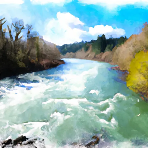
The Whitewater River Run on the Willamette River in Oregon offers a thrilling adventure for experienced paddlers. The ideal stream flow range for this section of the river is between 2,000 and 4,000 cubic feet per second (cfs), which typically occurs during the spring and early summer months. The class rating for this section of the river is between III and IV, which means that it includes moderate to difficult rapids with irregular waves and requires significant maneuvering.
The segment mileage for the Whitewater River Run is approximately 13 miles, starting at the Wheatland Ferry and ending at the Independence Bridge. Some of the specific rapids and obstacles in this section of the river include Mill City Falls, Scissors Rapids, and the notorious Lava Island Falls. Paddlers should be prepared for steep drops, large waves, and potentially hazardous rocks.
There are specific regulations that apply to the Whitewater River Run. For example, paddlers are required to wear a Coast Guard-approved personal flotation device (PFD) at all times while on the river. Additionally, camping is only allowed in designated areas, and fires are prohibited. Paddlers should also be aware of the potential presence of private property along the river and should respect the rights of landowners.
Plan your run down to the hour
Same weather feed Snoflo's iOS app uses -- updated continuously from NOAA / yr.no. Watch the precipitation column on the meteogram; rain ahead of a run typically lifts flows 12-48 hours later depending on the basin.
Next 5 days, hour by hour
Temperature line with weather symbols on top, snow + rain accumulation as columns, humidity as a dotted line.
5-day forecast table
Every 3 hours, broken out across temperature, snow, rain, humidity, and wind. Each cell is colour-coded relative to the column min/max.
| Time | Condition | Temp (°F) | Snow (in) | Rain (in) | Humidity (%) | Wind (mps) | Wind dir |
|---|---|---|---|---|---|---|---|
| Loading detailed forecast… | |||||||
15-day temperature & precipitation
Daily temperatures, snow, and rain projected over the next two weeks -- the upstream story that drives next week's flows.
Regional streamflow levels
USGS streamgauges around Willamette River -- useful for spotting upstream pulses and gauging which tributary is contributing what.
| Streamgauge | Discharge | View |
|---|---|---|
| Willamette River At Harrisburg | 3,710 cfs | → |
| Long Tom River At Monroe | 50 cfs | → |
| Long Tom River Near Alvadore | 62 cfs | → |
| Mckenzie River Near Coburg | 1,800 cfs | → |
| Mohawk River Near Springfield | 25 cfs | → |
| Marys River Near Philomath | 13 cfs | → |
Plan a longer trip
The closest boat launches, other paddle runs, and campgrounds so a day on the water can grow into a full weekend.
Boat launches
- Harrisburg Landing
- Mccartney Park
- Anderson Point
- Irish Bend
- Brown's Landing State Park
- Christensen's Landing
Other river runs
Campgrounds
- Richardson Park
- Armitage Park Campground
- Alsea Falls Recreation Site
- Willamettans
- Homeless Camp
- Upper Lake Creek Dispersed Camping
Parks
Whitewater safety
- Check the flow before you run
- Use the linked-gauge card and Regional Flow panel above. Class ratings change with flow -- a Class III at low water can become Class IV+ at high water.
- Know your skill ceiling
- Pick runs comfortably below your ceiling. Cold-water and big-water runs raise the consequences of any mistake.
- Wear the right gear
- Helmet, PFD, drysuit / wetsuit when water is below 60°F. Throw bag, knife, and whistle on your person, not in the boat.
- Scout, set safety, and run with a team
- Scout new rapids on foot, set safety with throw bags above the consequence pool, and run with at least one other competent paddler.
- Respect the river
- Strainers, undercuts, low-head dams, and wood can kill at any class rating. When in doubt, portage.
Set push alerts in the Snoflo app
Save Willamette River as a favorite, set a discharge threshold (e.g. "alert me when flow hits 600 cfs"), and the iOS app pushes the moment the linked gauge crosses.
About Willamette River
What's the optimal flow for Willamette River?
The optimal flow depends on the section and the craft. Check the Run Details panel for the linked gauge and current status.
How fresh is the cfs reading on this page?
The linked USGS streamgauge reports continuously (every 15 minutes); Snoflo refreshes throughout the day. Hover the streamflow sparkline to read individual datapoints.
What's the whitewater class?
See the Run Details panel for the class rating Snoflo tracks for this run. Class ratings change with flow -- a Class III at low water can become Class IV in high water.
Where do I put in / take out?
Tap Directions in the hero above to open driving directions to the put-in. For shuttle planning, check the Nearby Boat Launches panel and the river run operator's site.
Can I get alerts when flows hit the optimal range?
Yes -- alerts are managed in the Snoflo iOS app. Favorite this run, set a discharge threshold, and you'll get a push the moment the gauge crosses.
Other runs near here
Snoflo-tracked paddle runs within driving distance of Willamette River.