State Highway 21 To State Highwy 7 River Run
Community Reviews
Been here? Share the conditions.
Reviews, ratings & photos are added in the free Snoflo iOS app — rate a spot, tag the conditions, and your visit is verified by location. Add or manage your reviews from the app.
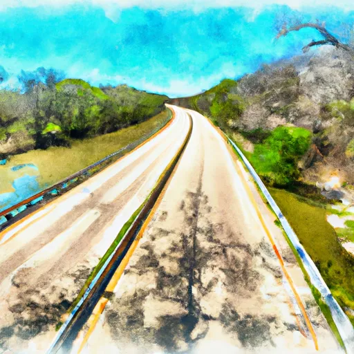
State Highway 21 To State Highwy 7
The segment mileage from State Highway 21 to State Highway 7 is approximately 10 miles, with several rapids and obstacles along the way. Some of the notable rapids include Big Rock, Rollercoaster, and Rock Garden. The river also features several large boulders and drops that require skillful navigation.
To ensure safety and protect the environment, there are several regulations in place for the Whitewater River run. All paddlers must wear personal flotation devices and helmets, and commercial outfitters must be licensed by the state. Camping is allowed in designated areas only, and fires are prohibited. Additionally, all trash must be packed out, and visitors are encouraged to practice Leave No Trace principles.
Overall, the Whitewater River run is an exciting and challenging destination for paddlers in Texas. However, it is important to be mindful of regulations and safety guidelines to ensure a fun and safe experience on the river.
Plan your run down to the hour
Same weather feed Snoflo's iOS app uses -- updated continuously from NOAA / yr.no. Watch the precipitation column on the meteogram; rain ahead of a run typically lifts flows 12-48 hours later depending on the basin.
Next 5 days, hour by hour
Temperature line with weather symbols on top, snow + rain accumulation as columns, humidity as a dotted line.
5-day forecast table
Every 3 hours, broken out across temperature, snow, rain, humidity, and wind. Each cell is colour-coded relative to the column min/max.
| Time | Condition | Temp (°F) | Snow (in) | Rain (in) | Humidity (%) | Wind (mps) | Wind dir |
|---|---|---|---|---|---|---|---|
| Loading detailed forecast… | |||||||
15-day temperature & precipitation
Daily temperatures, snow, and rain projected over the next two weeks -- the upstream story that drives next week's flows.
Regional streamflow levels
USGS streamgauges around State Highway 21 To State Highwy 7 -- useful for spotting upstream pulses and gauging which tributary is contributing what.
| Streamgauge | Discharge | View |
|---|---|---|
| Angelina Rv Nr Alto | 157 cfs | → |
| Neches Rv Nr Diboll | 441 cfs | → |
| Bayou Lanana At Nacogdoches | 9 cfs | → |
| E Fk Angelina Rv Nr Cushing | 8 cfs | → |
| Kickapoo Ck At Onalaska | 1 cfs | → |
| Trinity Rv Nr Crockett | 1,700 cfs | → |
Plan a longer trip
The closest boat launches, other paddle runs, and campgrounds so a day on the water can grow into a full weekend.
Boat launches
- Fm 2829 Bridge
- Texas 94 22801, Apple Springs
- Ratcliff Recreation Area
- Highway 7 Bridge
- Fm 1911/County 789 Bridge
- Us59 Bridge
Other river runs
- State Highway 7 To Us Highway 59
- Us Highway 59 To Us Highway 69
- Preserve Boundary Of The Big Sandy Unit To Confluence With Village Creek
- Us Highway 69 To Ba Steinhagen Reservoir
- Preserve Boundary In The Big Sandy Unit To Confluence With Trinity River
Campgrounds
- Ratcliff Lake
- Ratcliff Lake: (936) 655-2299
- Ratcliff Lake Recreation Area
- Walnut Creek Shelter
- Pond Camp
- Neches Bluff Overlook: (936) 655-2299
Parks
Points of interest
Whitewater safety
- Check the flow before you run
- Use the linked-gauge card and Regional Flow panel above. Class ratings change with flow -- a Class III at low water can become Class IV+ at high water.
- Know your skill ceiling
- Pick runs comfortably below your ceiling. Cold-water and big-water runs raise the consequences of any mistake.
- Wear the right gear
- Helmet, PFD, drysuit / wetsuit when water is below 60°F. Throw bag, knife, and whistle on your person, not in the boat.
- Scout, set safety, and run with a team
- Scout new rapids on foot, set safety with throw bags above the consequence pool, and run with at least one other competent paddler.
- Respect the river
- Strainers, undercuts, low-head dams, and wood can kill at any class rating. When in doubt, portage.
Set push alerts in the Snoflo app
Save State Highway 21 To State Highwy 7 as a favorite, set a discharge threshold (e.g. "alert me when flow hits 600 cfs"), and the iOS app pushes the moment the linked gauge crosses.
About State Highway 21 To State Highwy 7
What's the optimal flow for State Highway 21 To State Highwy 7?
The optimal flow depends on the section and the craft. Check the Run Details panel for the linked gauge and current status.
How fresh is the cfs reading on this page?
The linked USGS streamgauge reports continuously (every 15 minutes); Snoflo refreshes throughout the day. Hover the streamflow sparkline to read individual datapoints.
What's the whitewater class?
See the Run Details panel for the class rating Snoflo tracks for this run. Class ratings change with flow -- a Class III at low water can become Class IV in high water.
Where do I put in / take out?
Tap Directions in the hero above to open driving directions to the put-in. For shuttle planning, check the Nearby Boat Launches panel and the river run operator's site.
Can I get alerts when flows hit the optimal range?
Yes -- alerts are managed in the Snoflo iOS app. Favorite this run, set a discharge threshold, and you'll get a push the moment the gauge crosses.
Other runs near here
Snoflo-tracked paddle runs within driving distance of State Highway 21 To State Highwy 7.