Price River River Run
Community Reviews
Been here? Share the conditions.
Reviews, ratings & photos are added in the free Snoflo iOS app — rate a spot, tag the conditions, and your visit is verified by location. Add or manage your reviews from the app.
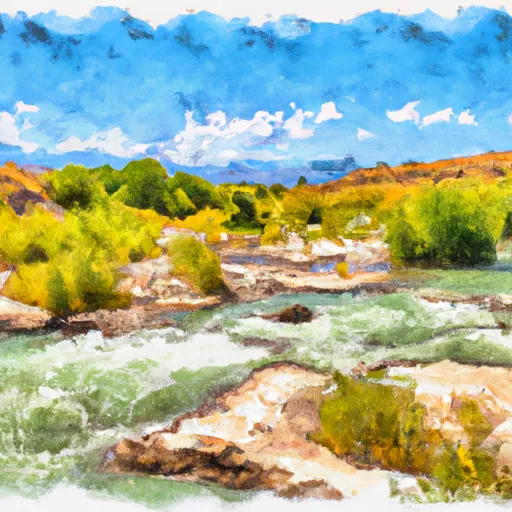
Price River
The river is rated as a Class III to IV run, with several challenging rapids and obstacles along the way. The segment mileage for the Price River run is approximately 21 miles, with the run typically taking around 1-3 days to complete, depending on water levels and individual paddling speed.
Some of the notable rapids and obstacles on the Price River include "Green River Falls," "The Chute," and "The Narrows." These sections of the river offer exciting challenges for experienced paddlers, but may be too difficult for beginners.
Specific regulations for the Price River include a permit requirement for overnight camping on the river. Additionally, all boaters are required to have proper safety equipment, including personal flotation devices and helmets. It is also important to note that the river can be dangerous during times of high water due to swift currents and submerged obstacles. As with all whitewater runs, it is important for paddlers to be experienced and knowledgeable about the river before attempting to navigate it.
Plan your run down to the hour
Same weather feed Snoflo's iOS app uses -- updated continuously from NOAA / yr.no. Watch the precipitation column on the meteogram; rain ahead of a run typically lifts flows 12-48 hours later depending on the basin.
Next 5 days, hour by hour
Temperature line with weather symbols on top, snow + rain accumulation as columns, humidity as a dotted line.
5-day forecast table
Every 3 hours, broken out across temperature, snow, rain, humidity, and wind. Each cell is colour-coded relative to the column min/max.
| Time | Condition | Temp (°F) | Snow (in) | Rain (in) | Humidity (%) | Wind (mps) | Wind dir |
|---|---|---|---|---|---|---|---|
| Loading detailed forecast… | |||||||
15-day temperature & precipitation
Daily temperatures, snow, and rain projected over the next two weeks -- the upstream story that drives next week's flows.
Regional streamflow levels
USGS streamgauges around Price River -- useful for spotting upstream pulses and gauging which tributary is contributing what.
| Streamgauge | Discharge | View |
|---|---|---|
| White River Bl Tabbyune C Near Soldier Summit | · | → |
| Mud Creek Bl Winter Quarters Canyon At Scofield | 2 cfs | → |
| Fish Creek Above Reservoir | 1 cfs | → |
| Fairview Tunnel Near Fairview | 2 cfs | → |
| Strawberry River At Pinnacles Near Fruitland | 37 cfs | → |
| Currant Creek Near Fruitland | 32 cfs | → |
Plan a longer trip
The closest boat launches, other paddle runs, and campgrounds so a day on the water can grow into a full weekend.
Campgrounds
- Price Canyon Recreation Site
- Price Canyon
- Ridge View Camp
- Spruces Camp
- Granite Park Camp
- Crescent Ridge Camp
Fishing spots
- Kyune Reservoir
- Gigliotti Pond
- Upper Huntington Creek
- Electric Lake
- Gooseberry Reservoir
- Boulger Reservoir Fishing Site
Whitewater safety
- Check the flow before you run
- Use the linked-gauge card and Regional Flow panel above. Class ratings change with flow -- a Class III at low water can become Class IV+ at high water.
- Know your skill ceiling
- Pick runs comfortably below your ceiling. Cold-water and big-water runs raise the consequences of any mistake.
- Wear the right gear
- Helmet, PFD, drysuit / wetsuit when water is below 60°F. Throw bag, knife, and whistle on your person, not in the boat.
- Scout, set safety, and run with a team
- Scout new rapids on foot, set safety with throw bags above the consequence pool, and run with at least one other competent paddler.
- Respect the river
- Strainers, undercuts, low-head dams, and wood can kill at any class rating. When in doubt, portage.
Set push alerts in the Snoflo app
Save Price River as a favorite, set a discharge threshold (e.g. "alert me when flow hits 600 cfs"), and the iOS app pushes the moment the linked gauge crosses.
About Price River
What's the optimal flow for Price River?
The optimal flow depends on the section and the craft. Check the Run Details panel for the linked gauge and current status.
How fresh is the cfs reading on this page?
The linked USGS streamgauge reports continuously (every 15 minutes); Snoflo refreshes throughout the day. Hover the streamflow sparkline to read individual datapoints.
What's the whitewater class?
See the Run Details panel for the class rating Snoflo tracks for this run. Class ratings change with flow -- a Class III at low water can become Class IV in high water.
Where do I put in / take out?
Tap Directions in the hero above to open driving directions to the put-in. For shuttle planning, check the Nearby Boat Launches panel and the river run operator's site.
Can I get alerts when flows hit the optimal range?
Yes -- alerts are managed in the Snoflo iOS app. Favorite this run, set a discharge threshold, and you'll get a push the moment the gauge crosses.
Other runs near here
Snoflo-tracked paddle runs within driving distance of Price River.