San Rafael River river run
Community Reviews
Been here? Share the conditions.
Reviews, ratings & photos are added in the free Snoflo iOS app — rate a spot, tag the conditions, and your visit is verified by location. Add or manage your reviews from the app.
San Rafael River
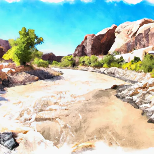
The San Rafael River, located in southern Utah, offers a challenging and remote whitewater experience for experienced paddlers. The ideal streamflow range for this river is between 150-400 cfs, which typically occurs in the spring during snowmelt or after heavy rainstorms. The river is rated as a Class III-IV, meaning it has moderate to difficult rapids with potential obstacles such as boulders, drops, and tight channels. The segment mileage for the San Rafael River run is approximately 28 miles, with the most popular section being the 13-mile stretch from Fuller Bottom to Swaseys Rapid.
Specific river rapids and obstacles on the San Rafael River include S-turn, Buckhorn, Little Grand Canyon, Devil's Racecourse, and Swaseys Rapid. These rapids range from Class III to IV, with Swaseys Rapid being the most challenging and requiring careful scouting before running.
The Bureau of Land Management (BLM) manages the San Rafael River and has specific regulations in place to protect the area and promote safe recreational use. These regulations include a permit system for overnight camping, restrictions on campfires, and guidelines for proper waste disposal. Additionally, the BLM advises visitors to be prepared for the remote and rugged nature of the area, with no services or cell phone coverage available once on the river.
Plan your run down to the hour
Same weather feed Snoflo's iOS app uses -- updated continuously from NOAA / yr.no. Watch the precipitation column on the meteogram; rain ahead of a run typically lifts flows 12-48 hours later depending on the basin.
Next 5 days, hour by hour
Temperature line with weather symbols on top, snow + rain accumulation as columns, humidity as a dotted line.
5-day forecast table
Every 3 hours, broken out across temperature, snow, rain, humidity, and wind. Each cell is colour-coded relative to the column min/max.
| Time | Condition | Temp (°F) | Snow (in) | Rain (in) | Humidity (%) | Wind (mps) | Wind dir |
|---|---|---|---|---|---|---|---|
| Loading detailed forecast… | |||||||
15-day temperature & precipitation
Daily temperatures, snow, and rain projected over the next two weeks -- the upstream story that drives next week's flows.
Regional streamflow levels
USGS streamgauges around San Rafael River -- useful for spotting upstream pulses and gauging which tributary is contributing what.
| Streamgauge | Discharge | View |
|---|---|---|
| San Rafael River Near Green River | · | → |
| Green River At Green River | 2,360 cfs | → |
| Price River At Woodside | · | → |
| San Rafael River At Mouth Near Green River | · | → |
| Desert Seep Wash Near Wellington | 2 cfs | → |
| Ferron Cr Bl Millsite Res & Divs Nr Ferron | · | → |
Plan a longer trip
The closest boat launches, other paddle runs, and campgrounds so a day on the water can grow into a full weekend.
Whitewater safety
- Check the flow before you run
- Use the linked-gauge card and Regional Flow panel above. Class ratings change with flow -- a Class III at low water can become Class IV+ at high water.
- Know your skill ceiling
- Pick runs comfortably below your ceiling. Cold-water and big-water runs raise the consequences of any mistake.
- Wear the right gear
- Helmet, PFD, drysuit / wetsuit when water is below 60°F. Throw bag, knife, and whistle on your person, not in the boat.
- Scout, set safety, and run with a team
- Scout new rapids on foot, set safety with throw bags above the consequence pool, and run with at least one other competent paddler.
- Respect the river
- Strainers, undercuts, low-head dams, and wood can kill at any class rating. When in doubt, portage.
Set push alerts in the Snoflo app
Save San Rafael River as a favorite, set a discharge threshold (e.g. "alert me when flow hits 600 cfs"), and the iOS app pushes the moment the linked gauge crosses.
About San Rafael River
What's the optimal flow for San Rafael River?
The optimal flow depends on the section and the craft. Check the Run Details panel for the linked gauge and current status.
How fresh is the cfs reading on this page?
The linked USGS streamgauge reports continuously (every 15 minutes); Snoflo refreshes throughout the day. Hover the streamflow sparkline to read individual datapoints.
What's the whitewater class?
See the Run Details panel for the class rating Snoflo tracks for this run. Class ratings change with flow -- a Class III at low water can become Class IV in high water.
Where do I put in / take out?
Tap Directions in the hero above to open driving directions to the put-in. For shuttle planning, check the Nearby Boat Launches panel and the river run operator's site.
Can I get alerts when flows hit the optimal range?
Yes -- alerts are managed in the Snoflo iOS app. Favorite this run, set a discharge threshold, and you'll get a push the moment the gauge crosses.
Other runs near here
Snoflo-tracked paddle runs within driving distance of San Rafael River.