Escalante River river run
Community Reviews
Been here? Share the conditions.
Reviews, ratings & photos are added in the free Snoflo iOS app — rate a spot, tag the conditions, and your visit is verified by location. Add or manage your reviews from the app.
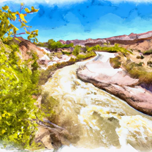
Escalante River
The Escalante River is rated as a Class III-IV river, which means that it has moderate to difficult rapids and requires advanced skill and experience. The river covers a distance of approximately 84 miles, and the segment used for whitewater runs is typically around 20 miles long.
Some of the major rapids and obstacles on the Escalante River include Hurricane Falls, Larry's Leap, and the Escalante Falls. These rapids are challenging and require careful navigation.
There are specific regulations that apply to the Escalante River. For instance, a permit is required to run the river, and there are limitations on group size. Additionally, campfires are not allowed, and all waste must be packed out.
In conclusion, the Escalante River is an exciting destination for whitewater enthusiasts. The ideal streamflow range is between 200 and 500 cfs, and the river is rated as Class III-IV. The segment used for whitewater runs covers around 20 miles and includes several challenging rapids. It is important to adhere to specific regulations when running the river, including obtaining a permit and packing out all waste.
Plan your run down to the hour
Same weather feed Snoflo's iOS app uses -- updated continuously from NOAA / yr.no. Watch the precipitation column on the meteogram; rain ahead of a run typically lifts flows 12-48 hours later depending on the basin.
Next 5 days, hour by hour
Temperature line with weather symbols on top, snow + rain accumulation as columns, humidity as a dotted line.
5-day forecast table
Every 3 hours, broken out across temperature, snow, rain, humidity, and wind. Each cell is colour-coded relative to the column min/max.
| Time | Condition | Temp (°F) | Snow (in) | Rain (in) | Humidity (%) | Wind (mps) | Wind dir |
|---|---|---|---|---|---|---|---|
| Loading detailed forecast… | |||||||
15-day temperature & precipitation
Daily temperatures, snow, and rain projected over the next two weeks -- the upstream story that drives next week's flows.
Regional streamflow levels
USGS streamgauges around Escalante River -- useful for spotting upstream pulses and gauging which tributary is contributing what.
| Streamgauge | Discharge | View |
|---|---|---|
| Escalante River Near Escalante | 0 cfs | → |
| Pine Creek Near Escalante | 0 cfs | → |
| Fremont River Near Bicknell | 45 cfs | → |
| Dirty Devil R Abv Poison Sp Wash Nr Hanksville | · | → |
| Paria River Near Kanab | 0 cfs | → |
| Paria River At Lees Ferry | 4 cfs | → |
Plan a longer trip
The closest boat launches, other paddle runs, and campgrounds so a day on the water can grow into a full weekend.
Other river runs
- Escalante River
- Northern Boundary Of Glen Canyon National Recreation Area To Confluence With Colorado River
Campgrounds
- Little Spencer Flat Dispersed - Grand Staircase Nat Mon
- Harris Wash - Grand Staircase Nat Mon
- Calf Creek
- Calf Creek Recreation Area
- Deer Creek- Burr Trail Rd - Grand Staircase Nat Mon
- Durffey Mesa Dispersed - Burr Trail Rd - Grand Staircase Nat Mon
Fishing spots
Whitewater safety
- Check the flow before you run
- Use the linked-gauge card and Regional Flow panel above. Class ratings change with flow -- a Class III at low water can become Class IV+ at high water.
- Know your skill ceiling
- Pick runs comfortably below your ceiling. Cold-water and big-water runs raise the consequences of any mistake.
- Wear the right gear
- Helmet, PFD, drysuit / wetsuit when water is below 60°F. Throw bag, knife, and whistle on your person, not in the boat.
- Scout, set safety, and run with a team
- Scout new rapids on foot, set safety with throw bags above the consequence pool, and run with at least one other competent paddler.
- Respect the river
- Strainers, undercuts, low-head dams, and wood can kill at any class rating. When in doubt, portage.
Set push alerts in the Snoflo app
Save Escalante River as a favorite, set a discharge threshold (e.g. "alert me when flow hits 600 cfs"), and the iOS app pushes the moment the linked gauge crosses.
About Escalante River
What's the optimal flow for Escalante River?
The optimal flow depends on the section and the craft. Check the Run Details panel for the linked gauge and current status.
How fresh is the cfs reading on this page?
The linked USGS streamgauge reports continuously (every 15 minutes); Snoflo refreshes throughout the day. Hover the streamflow sparkline to read individual datapoints.
What's the whitewater class?
See the Run Details panel for the class rating Snoflo tracks for this run. Class ratings change with flow -- a Class III at low water can become Class IV in high water.
Where do I put in / take out?
Tap Directions in the hero above to open driving directions to the put-in. For shuttle planning, check the Nearby Boat Launches panel and the river run operator's site.
Can I get alerts when flows hit the optimal range?
Yes -- alerts are managed in the Snoflo iOS app. Favorite this run, set a discharge threshold, and you'll get a push the moment the gauge crosses.
Other runs near here
Snoflo-tracked paddle runs within driving distance of Escalante River.