Make an Announcement

Communicate warnings, disperse advice, and share.


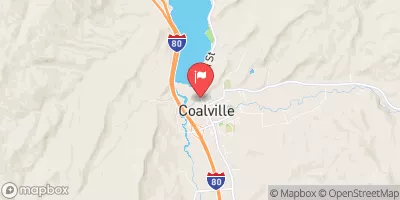
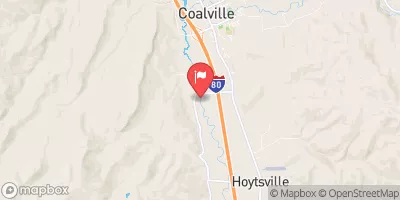
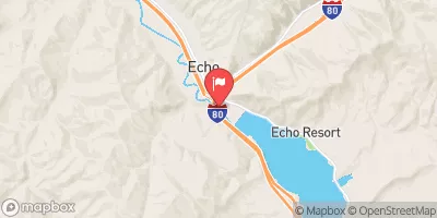
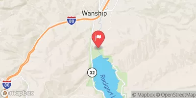
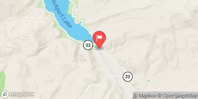
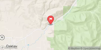
SOUTH FORK CONFLUENCE TO BELOW THE NARROWS

Whitewater River Run


Utah Chalk Creek

South Fork Confluence To Below The Narrows

Class II TO II+

STREAMFLOW: 417 CFS

Runnable
75°, Showers Likely

The South Fork Confluence to Below the Narrows river run in Utah is a 10-mile stretch of water with Class I and II rapids. The best time to float this section is from May to September, with peak flows in early June. The recommended flow is between 800-1,200 cfs. There are several obstacles to be aware of, including a couple of narrow channels that can be tricky to navigate and some sharp turns. Overall, this is a scenic and enjoyable float for all skill levels.

Weather today, A chance of showers before noon, then a chance of showers and thunderstorms between noon and 3pm, then showers likely and possibly a thunderstorm after 3pm. Partly sunny, with a high near 75. East southeast wind 6 to 13 mph becoming southwest in the afternoon. Chance of precipitation is 60%.

Status Runnable
Class Level II to II+
Elevation 5,574 ft
Run Length 3.7 Mi
Gradient 45 FPM
Streamflow Discharge 417 cfs
Gauge Height 4.8 ft
Reporting Streamgage Chalk Creek At Coalville
USGS 10131000

Nearby Snowpack and Streamflow Levels

Gauge Streamflow Stage
Provo River Near Woodland
USGS 10154200
2,330 cfs 6.5 ft
Strawberry River At Pinnacles Near Fruitland
USGS 09285900
267 cfs 3.3 ft
White River Bl Tabbyune C Near Soldier Summit
USGS 09312600
112 cfs 4.0 ft
Hobble Creek At 1650 West At Springville
USGS 10153100
131 cfs 5.4 ft
American Fk Ab Upper Powerplant Nr American Fk
USGS 10164500
401 cfs 7.5 ft
Provo River Near Charleston
USGS 10155500
1,840 cfs 7.1 ft
Summit Creek Abv Summit Cr Canal Nr Santaquin Ut
USGS 10147100
140 cfs 2.2 ft
Provo River Near Hailstone
USGS 10155000
1,930 cfs 7.1 ft
Daniels Creek At Charleston
USGS 10157500
58 cfs 4.1 ft
Rock Creek Near Mountain Home
USGS 09279000
767 cfs 4.2 ft
Snotel Site Snowpack 24hr Change
Huntington Horse
SNOTEL 1216
5" -6"
Clear Creek #1
SNOTEL 399
2" 0"
Beaver Divide
SNOTEL 330
3" 0"
Tony Grove Lake
SNOTEL 823
35" -5"
alta
SNOTEL ATAU1
36" -2"
Red Pine Ridge
SNOTEL 714
6" 0"
Thaynes Canyon
SNOTEL 814
16" -4"
Mill-D North
SNOTEL 628
15" -3"
Trial Lake
SNOTEL 828
22" -1"
Farmington
SNOTEL 474
33" -2"
Usu Doc Daniel
SNOTEL 1098
38" -2"
Snowbird
SNOTEL 766
42" -4"
Chalk Creek #1
SNOTEL 392
1" -6"
Emigrant Summit
SNOTEL 471
1" 1"
Timpanogos Divide
SNOTEL 820
5" 0"
Brighton
SNOTEL 366
2" 1"
Franklin Basin
SNOTEL 484
10" -6"
Daniels-Strawberry
SNOTEL 435
2" 0"
alta - guard house
SNOTEL AGD
34.9" 0"
Monte Cristo
SNOTEL 634
24" -4"
north holladay
SNOTEL HOL
5.31" 1.53"
Lookout Peak
SNOTEL 596
4" -6"
Indian Creek
SNOTEL 544
14" -3"
Mammoth-Cottonwood
SNOTEL 612
1" -1"

Popular Destinations

Campground Campsites Reservations Toilets Showers Elevation
Rockport State Park 86 6,059 ft
Mill Hollow 26 8,903 ft
Wasatch Mountain State Park 139 5,999 ft
Hailstone - Jordanelle State Park 230 6,223 ft
Ledgefork 73 7,731 ft
Shingle Creek ATV 21 7,448 ft
Deer Creek State Park 75 5,565 ft
Taylors Fork ATV 11 7,424 ft
Smith - Morehouse 34 7,662 ft
Lower Provo River 10 7,382 ft
Rock Cliff - Jordanelle State Park None 6,194 ft
Ski Area Snowpack Air Temperature 5 Day Forecast
DC Shoes Mountain Lab 15" 61° 0"
Park City Mountain Resort 16" 59° 0"
Deer Valley Resort 16" 59° 0"
Beaver Mountain Ski Area 0" 69° 0"
Snowbird Ski and Summer Resort 42" 63° 0"
Brighton Ski Resort 16" 59° 0"
Solitude Mountain Resort 15" 61° 0"
Cherry Peak 35" 64° 0"
Alta Ski Area 42" 63° 0"
Sundance 5" 65° 0"
Powder Mountain -1" 74° 0"
Canyons 16" 59° 0"
River Run Streamflow Length Class
Ricks Spring to Wood Camp Campground 1310.0cfs None Mi III+ to IV
Staircase Section - 2nd Dam to 1st Dam 1310.0cfs None Mi IV+ to V-
Sixth Water 50.8cfs 1.0 Mi V- to V
Bridal Veil (BV) 1930.0cfs 4.0 Mi III to IV
3rd Dam to 2nd Dam 1310.0cfs None Mi II+ to III
Round Valley 93.5cfs 5.5 Mi II
Morgan Waterfall 93.5cfs 0.1 Mi III+
Skeletor's Gorge 401.0cfs 1.4 Mi IV+
Upper Provo Falls 2330.0cfs 0.75 Mi V- to V+
Middle Provo (Jordanelle to Deer Creek) 2330.0cfs 25.0 Mi II+
Henefer to Taggert 93.5cfs 7.0 Mi II- to III
Spanish Fork 412.0cfs 1.6 Mi III-
South Fork Confluence to Below the Narrows 417.0cfs 3.7 Mi II to II+
Stillwater Camp - East Fork 1650.0cfs 3.5 Mi III+
Upper Slate Gorge 2330.0cfs 2.0 Mi IV

Log Your Visit

When was your last visit to South Fork Confluence to Below the Narrows?

Add a Photo

How was it? How were conditions?

Rate the paddle


Submit

Leave A Review

South Fork Confluence To Below The Narrows

Submit

Upload an Image

South Fork Confluence To Below The Narrows
Login

Need an Account?

Forgot Your Password?

Delete User Account

Welcome to Snoflo


Continue with a free account

Already Have an Account?


Snoflo Premium

Your first week's free. Cancel anytime

Have a Promo Code?


Already Have an Account?

Signup for Basic Access


Welcome to Snoflo


Continue with a free account

Add Snoflo Premium


Already Have an Account?


Please Verify Your Account

Favorite Limit Reached
Signup for a Free Account

Already Have an Account?