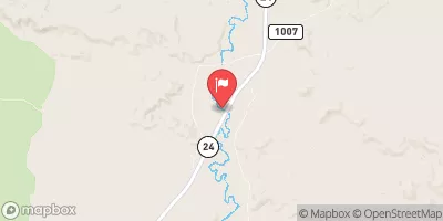
The Chute - Tomsich Butte To Hidden Splender
When the water is flowing this is one of the best kayak and IK floats in the entire state of Utah. It may not be big water with Class III to IV holes and waves but the scenery and experience is incomparable. When the chute cuts through the reef you are floating between sheer sandstone walls. Keep an eye out for possible wood hazards but for the most part this is a great class II cruiser.
Suggested river levels for paddling this section of the Muddy Creek are between a bare minimum of 180cfs and a high of 700cfs.
River conditions sourced from USGS 09330500, the Muddy Creek Near Emery
Remember only watercraft are permitted
at The Chute - Tomsich Butte to Hidden Splender.
Run Stats
Status | Too Low |
Class Level | II to II+ |
Elevation | 6,435 ft |
Run Length | 15.0 Mi |
Gradient | 27 FPM |
Streamflow Discharge | 34.8 cfs |
Gage Height | 4.1 ft |
Air Temperature | 83° |
River | Muddy Creek |
Reporting Streamgage |
Muddy Creek Near Emery
USGS 09330500 |
Gauge | Streamflow | Stage |
---|---|---|
San Rafael River Near Green River
USGS 09328500 |
50 cfs | 5.3 ft |
Salina Creek Near Emery
USGS 10205030 |
10 cfs | 2.4 ft |
Dirty Devil R Abv Poison Sp Wash Nr Hanksville
USGS 09333500 |
28 cfs | 5.4 ft |
Ferron Creek (Upper Station) Near Ferron
USGS 09326500 |
70 cfs | 6.4 ft |
Desert Seep Wash Near Wellington
USGS 09314280 |
2 cfs | 2.7 ft |
Muddy Creek Near Emery
USGS 09330500 |
35 cfs | 4.1 ft |
Manti Creek Below Dugway Creek
USGS 10215900 |
27 cfs | 3.4 ft |
Pine Creek Near Escalante
USGS 09337000 |
1 cfs | 1.3 ft |
Fremont River Near Bicknell
USGS 09330000 |
57 cfs | 3.9 ft |
Ephraim Tunnel Near Ephraim
USGS 09319000 |
4 cfs | 0.7 ft |
Snotel Site | Snowpack | 24hr Change |
---|
Campground | Campsites | Reservations | Toilets | Showers | Elevation |
---|---|---|---|---|---|
Coal Mine Wash Dispersed | None | 4,643 ft | |||
Swing Arm City OHV Dispersed | None | 4,498 ft | |||
Mix Pad Dispersed | None | 4,643 ft |
Ski Area | Snowpack | Air Temperature | 5 Day Forecast |
---|
River Run | Streamflow | Length | Class |
---|---|---|---|
The Chute - Tomsich Butte to Hidden Splender | 14.1cfs | 15.0 Mi | II to II+ |
I-70 to Tomsich Butte | 14.1cfs | 30.0 Mi | II to III- |