Segment B--Northern Boundary, Hidden Valley Tract To Southern Boundary Of Hidden Valley Tract River Run
Community Reviews
Been here? Share the conditions.
Reviews, ratings & photos are added in the free Snoflo iOS app — rate a spot, tag the conditions, and your visit is verified by location. Add or manage your reviews from the app.
Segment B--Northern Boundary, Hidden Valley Tract To Southern Boundary Of Hidden Valley Tract
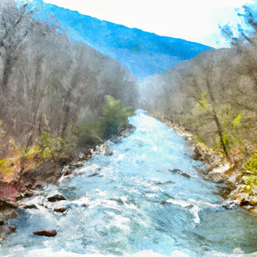
The river rapids in this segment include The Slot, which is a narrow chute with a drop that requires precise navigation, and Pinball, which has several large rocks that create obstacles for rafters and kayakers. This section also has several other class III and IV rapids that provide a thrilling whitewater experience.
Specific regulations to the area include a permit requirement to access the river, and a restriction on the number of people allowed per group. Additionally, all participants must wear a personal flotation device (PFD) and helmets are recommended. It is also important to note that this section of the river can be dangerous during high water levels and should only be attempted by experienced and properly equipped paddlers.
Overall, the Whitewater River Run Segment B is a challenging and exciting whitewater experience that requires skill, experience, and proper equipment. It is important to adhere to all regulations and safety guidelines to ensure a safe and enjoyable trip.
Plan your run down to the hour
Same weather feed Snoflo's iOS app uses -- updated continuously from NOAA / yr.no. Watch the precipitation column on the meteogram; rain ahead of a run typically lifts flows 12-48 hours later depending on the basin.
Next 5 days, hour by hour
Temperature line with weather symbols on top, snow + rain accumulation as columns, humidity as a dotted line.
5-day forecast table
Every 3 hours, broken out across temperature, snow, rain, humidity, and wind. Each cell is colour-coded relative to the column min/max.
| Time | Condition | Temp (°F) | Snow (in) | Rain (in) | Humidity (%) | Wind (mps) | Wind dir |
|---|---|---|---|---|---|---|---|
| Loading detailed forecast… | |||||||
15-day temperature & precipitation
Daily temperatures, snow, and rain projected over the next two weeks -- the upstream story that drives next week's flows.
Regional streamflow levels
USGS streamgauges around Segment B--Northern Boundary, Hidden Valley Tract To Southern Boundary Of Hidden Valley Tract -- useful for spotting upstream pulses and gauging which tributary is contributing what.
| Streamgauge | Discharge | View |
|---|---|---|
| Back Creek At Sunrise | 26 cfs | → |
| Little Back Creek Near Sunrise | 4 cfs | → |
| Back Creek Near Sunrise | 11 cfs | → |
| Back Creek Near Mountain Grove | 41 cfs | → |
| Bullpasture River At Williamsville | 39 cfs | → |
| Jackson River Near Bacova | 36 cfs | → |
Plan a longer trip
The closest boat launches, other paddle runs, and campgrounds so a day on the water can grow into a full weekend.
Boat launches
- Walton Tract Canoe Access Point
- Lake Moomaw Marina
- Lake Sherwood Road Greenbrier County
- Douthat State Park Road Bath County
- Coles Point
Other river runs
- Segment B--Pump Storage Lake To Blowing Springs Campground
- Segment C--Southern Boundary Hidden Valley Tract To Mcclintic Bridge
- Segment A--State Route 39 At Blowing Springs Campground To Lake Moomaw
- Ford Where Route 609 Departs From Route 678 To Confluence With Cowpasture River
- Segment B--Confluence With Bullpasture River To Route 42 Bridge
Campgrounds
- Hidden Valley Recreation Area
- Blowing Springs Campground
- Blowing Springs
- Bird Run
- Pocahontas Campground
- Pocahontas
Fishing spots
Whitewater safety
- Check the flow before you run
- Use the linked-gauge card and Regional Flow panel above. Class ratings change with flow -- a Class III at low water can become Class IV+ at high water.
- Know your skill ceiling
- Pick runs comfortably below your ceiling. Cold-water and big-water runs raise the consequences of any mistake.
- Wear the right gear
- Helmet, PFD, drysuit / wetsuit when water is below 60°F. Throw bag, knife, and whistle on your person, not in the boat.
- Scout, set safety, and run with a team
- Scout new rapids on foot, set safety with throw bags above the consequence pool, and run with at least one other competent paddler.
- Respect the river
- Strainers, undercuts, low-head dams, and wood can kill at any class rating. When in doubt, portage.
Set push alerts in the Snoflo app
Save Segment B--Northern Boundary, Hidden Valley Tract To Southern Boundary Of Hidden Valley Tract as a favorite, set a discharge threshold (e.g. "alert me when flow hits 600 cfs"), and the iOS app pushes the moment the linked gauge crosses.
About Segment B--Northern Boundary, Hidden Valley Tract To Southern Boundary Of Hidden Valley Tract
What's the optimal flow for Segment B--Northern Boundary, Hidden Valley Tract To Southern Boundary Of Hidden Valley Tract?
The optimal flow depends on the section and the craft. Check the Run Details panel for the linked gauge and current status.
How fresh is the cfs reading on this page?
The linked USGS streamgauge reports continuously (every 15 minutes); Snoflo refreshes throughout the day. Hover the streamflow sparkline to read individual datapoints.
What's the whitewater class?
See the Run Details panel for the class rating Snoflo tracks for this run. Class ratings change with flow -- a Class III at low water can become Class IV in high water.
Where do I put in / take out?
Tap Directions in the hero above to open driving directions to the put-in. For shuttle planning, check the Nearby Boat Launches panel and the river run operator's site.
Can I get alerts when flows hit the optimal range?
Yes -- alerts are managed in the Snoflo iOS app. Favorite this run, set a discharge threshold, and you'll get a push the moment the gauge crosses.
Other runs near here
Snoflo-tracked paddle runs within driving distance of Segment B--Northern Boundary, Hidden Valley Tract To Southern Boundary Of Hidden Valley Tract.