Whitetop Laurel--Jefferson Nf Boundary (Intersection Of Hwy 58 And Sr 859) To Jefferson Nf Boundary Above Damascus River Run
Community Reviews
Been here? Share the conditions.
Reviews, ratings & photos are added in the free Snoflo iOS app — rate a spot, tag the conditions, and your visit is verified by location. Add or manage your reviews from the app.
Whitetop Laurel--Jefferson Nf Boundary (Intersection Of Hwy 58 And Sr 859) To Jefferson Nf Boundary Above Damascus
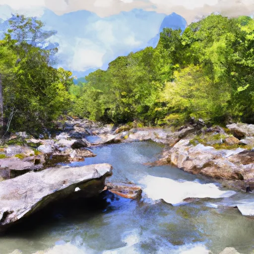
Some of the specific river rapids and obstacles that kayakers and rafters will encounter on this run are Double Drop, Triple Drop, and Pinball. Double Drop is a challenging rapid that features a steep drop followed by a sharp turn. Triple Drop is a series of three drops that require good technical skills to navigate. Pinball is a rapid that features multiple obstacles and requires precise maneuvering to avoid getting stuck.
In terms of regulations, kayakers and rafters are required to wear a personal flotation device (PFD) at all times while on the river. Additionally, anyone under the age of 16 must wear a helmet while on the river. It is also recommended that all participants have basic whitewater rescue skills and knowledge of river safety protocols.
Overall, the Whitewater River Run on Whitetop Laurel is an exciting and challenging adventure for experienced kayakers and rafters. It is important to check the streamflow range and class rating before embarking on this run and to follow all regulations and safety protocols to ensure a safe and enjoyable experience.
Plan your run down to the hour
Same weather feed Snoflo's iOS app uses -- updated continuously from NOAA / yr.no. Watch the precipitation column on the meteogram; rain ahead of a run typically lifts flows 12-48 hours later depending on the basin.
Next 5 days, hour by hour
Temperature line with weather symbols on top, snow + rain accumulation as columns, humidity as a dotted line.
5-day forecast table
Every 3 hours, broken out across temperature, snow, rain, humidity, and wind. Each cell is colour-coded relative to the column min/max.
| Time | Condition | Temp (°F) | Snow (in) | Rain (in) | Humidity (%) | Wind (mps) | Wind dir |
|---|---|---|---|---|---|---|---|
| Loading detailed forecast… | |||||||
15-day temperature & precipitation
Daily temperatures, snow, and rain projected over the next two weeks -- the upstream story that drives next week's flows.
Regional streamflow levels
USGS streamgauges around Whitetop Laurel--Jefferson Nf Boundary (Intersection Of Hwy 58 And Sr 859) To Jefferson Nf Boundary Above Damascus -- useful for spotting upstream pulses and gauging which tributary is contributing what.
| Streamgauge | Discharge | View |
|---|---|---|
| S F Holston River At Riverside Nr Chilhowie | 68 cfs | → |
| M F Holston River Near Meadowview | 255 cfs | → |
| S F Holston River Near Damascus | 248 cfs | → |
| M F Holston River At Seven Mile Ford | 171 cfs | → |
| N F Holston River Near Saltville | 413 cfs | → |
| South Fork New River Near Jefferson | 156 cfs | → |
Plan a longer trip
The closest boat launches, other paddle runs, and campgrounds so a day on the water can grow into a full weekend.
Boat launches
- Whitaker Hollow Road Washington County
- Parks Mill Road 22115, Washington County
- Hungry Mother State Park
- River Road 558, Saltville
- North Fork River Road Washington County
Other river runs
- Green Cove--Jefferson Nf Near Confluence Of Star Hill Branch To Confluence With Whitetop Laurel
- Headwaters To Tn/Va State Line
- Watauga Reservoir To Tn/Nc State Line
- Confluence With Guest River To Confluence With Little Stony Creek
- State Route 72 Bridge To Confluence With Clinch River
Campgrounds
- Beartree Recreation Area
- Beartree
- Grindstone
- Grindstone Recreation Area
- Backbone Rock Rec Area
- Grayson Highlands State Park
Whitewater safety
- Check the flow before you run
- Use the linked-gauge card and Regional Flow panel above. Class ratings change with flow -- a Class III at low water can become Class IV+ at high water.
- Know your skill ceiling
- Pick runs comfortably below your ceiling. Cold-water and big-water runs raise the consequences of any mistake.
- Wear the right gear
- Helmet, PFD, drysuit / wetsuit when water is below 60°F. Throw bag, knife, and whistle on your person, not in the boat.
- Scout, set safety, and run with a team
- Scout new rapids on foot, set safety with throw bags above the consequence pool, and run with at least one other competent paddler.
- Respect the river
- Strainers, undercuts, low-head dams, and wood can kill at any class rating. When in doubt, portage.
Set push alerts in the Snoflo app
Save Whitetop Laurel--Jefferson Nf Boundary (Intersection Of Hwy 58 And Sr 859) To Jefferson Nf Boundary Above Damascus as a favorite, set a discharge threshold (e.g. "alert me when flow hits 600 cfs"), and the iOS app pushes the moment the linked gauge crosses.
About Whitetop Laurel--Jefferson Nf Boundary (Intersection Of Hwy 58 And Sr 859) To Jefferson Nf Boundary Above Damascus
What's the optimal flow for Whitetop Laurel--Jefferson Nf Boundary (Intersection Of Hwy 58 And Sr 859) To Jefferson Nf Boundary Above Damascus?
The optimal flow depends on the section and the craft. Check the Run Details panel for the linked gauge and current status.
How fresh is the cfs reading on this page?
The linked USGS streamgauge reports continuously (every 15 minutes); Snoflo refreshes throughout the day. Hover the streamflow sparkline to read individual datapoints.
What's the whitewater class?
See the Run Details panel for the class rating Snoflo tracks for this run. Class ratings change with flow -- a Class III at low water can become Class IV in high water.
Where do I put in / take out?
Tap Directions in the hero above to open driving directions to the put-in. For shuttle planning, check the Nearby Boat Launches panel and the river run operator's site.
Can I get alerts when flows hit the optimal range?
Yes -- alerts are managed in the Snoflo iOS app. Favorite this run, set a discharge threshold, and you'll get a push the moment the gauge crosses.
Other runs near here
Snoflo-tracked paddle runs within driving distance of Whitetop Laurel--Jefferson Nf Boundary (Intersection Of Hwy 58 And Sr 859) To Jefferson Nf Boundary Above Damascus.