Big Horse Creek Fishing
As of July 17, 2026, the nearest streamgauge to Big Horse Creek — South Fork New River Near Jefferson — reports 135 cfs. Source: USGS gauge data, refreshed throughout the day.
Community Reviews
Been here? Share the conditions.
Reviews, ratings & photos are added in the free Snoflo iOS app — rate a spot, tag the conditions, and your visit is verified by location. Add or manage your reviews from the app.
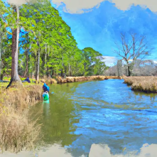
Big Horse Creek
What's biting at Big Horse Creek
Species commonly reported here -- tap any card for techniques, target seasons, and other waters where it's been caught.
Plan your trip down to the hour
Same weather feed Snoflo's iOS app uses -- updated continuously from NOAA / yr.no.
Next 5 days, hour by hour
Temperature line with weather symbols on top, snow + rain accumulation as columns, humidity as a dotted line.
5-day forecast table
Every 3 hours, broken out across temperature, snow, rain, humidity, and wind. Each cell is colour-coded relative to the column min/max so trends jump out at a glance.
| Time | Condition | Temp (°F) | Snow (in) | Rain (in) | Humidity (%) | Wind (mps) | Wind dir |
|---|---|---|---|---|---|---|---|
| Loading detailed forecast… | |||||||
15-day temperature & precipitation
Daily temperatures, snow, and rain projected over the next two weeks. Hover any point for the full breakdown.
Nearby streamflow
USGS streamgauges within reach of Big Horse Creek -- updated continuously from the National Water Information System.
| Streamgauge | Discharge | View |
|---|---|---|
| South Fork New River Near Jefferson | 135 cfs | → |
| S F Holston River At Riverside Nr Chilhowie | 38 cfs | → |
| S F Holston River Near Damascus | 174 cfs | → |
| M F Holston River At Seven Mile Ford | 65 cfs | → |
| M F Holston River Near Meadowview | 116 cfs | → |
| Watauga River Near Sugar Grove | 62 cfs | → |
Plan a longer trip
The closest campgrounds, parks, boat launches, and reservoirs so a fishing run can grow into a weekend.
Campgrounds
Parks
- Grayson Highlands State Park
- Pond Mountain Game Land
- Paddy Mountain Plant Conservation Preserve
- Wilderness Lewis Fork
- Wilderness Little Wilson Creek
- Mount Jefferson State Natural Area
Reservoirs
Boat launches
- Nc 16 3350, Jefferson
- Mouth Of Wilson
- Big Hill Road Watauga County
- Castle Ford Road Ashe County
- Cox's Chapel Road Grayson County
- River Road Watauga County
Points of interest
- Clark-Miller Roller Mill
- Big Pinnacle
- Whitetop Mountain Observation Site
- Jumpinoff Rocks Parking Area
- Sheets Gap Overlook
- Welcome Center And Museum
Paddle runs
- Green Cove--Jefferson Nf Near Confluence Of Star Hill Branch To Confluence With Whitetop Laurel
- Whitetop Laurel--Jefferson Nf Boundary (Intersection Of Hwy 58 And Sr 859) To Jefferson Nf Boundary Above Damascus
- Headwaters To Tn/Va State Line
- Watauga Reservoir To Tn/Nc State Line
- Headwaters Above Linville Gap To Blue Ridge Parkway Boundary
- Blue Ridge Parkway Boundary To Linville Gorge Boundary
Angling safety & ethics
- Know the regulations
- Check local fishing rules, seasons, size limits, and license requirements to ensure legal and sustainable angling.
- Handle fish responsibly
- Use wet hands, minimize air exposure, and release fish gently to improve survival rates when practicing catch-and-release.
- Choose the right gear
- Match your rod, line, and tackle to the species and conditions to increase success and reduce unnecessary harm to fish.
- Respect the waterway
- Avoid disturbing habitat, prevent bank erosion, and keep a safe distance from spawning areas to protect ecosystems.
- Keep it clean
- Pack out all line, hooks, bait containers, and trash. Discarded gear can injure wildlife and degrade waterways.
Set push alerts in the Snoflo app
Save Big Horse Creek as a favorite, set a custom threshold (water temperature, streamflow, snowpack), and the iOS app will push the moment conditions cross.
About Big Horse Creek
What fish species are found at Big Horse Creek?
Snoflo tracks the species commonly reported at Big Horse Creek -- see the Fish Species panel above for the live list with images and links to per-species pages.
How fresh is the weather data on this page?
The hourly forecast updates throughout the day from the NOAA / yr.no public feeds. Streamflow data comes live from USGS streamgauges, also refreshed continuously.
Can I get alerts when conditions change?
Yes -- alerts are managed through the Snoflo iOS app. Favorite this area, set a threshold (water temperature, streamflow, snowpack), and you'll get a push the moment it crosses.
Do I need a fishing license?
Yes. Check your state agency's regulations for license requirements, seasons, size limits, and any waterbody-specific rules before fishing Big Horse Creek.
How do I get to Big Horse Creek?
Tap Open in map in the hero above to center the Snoflo interactive map on this area, or grab the coordinates from the location facts panel.
Other angling spots near here
Snoflo-tracked fishing areas within driving distance of Big Horse Creek.