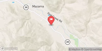
Summary
The ideal streamflow range for this segment is between 200-400 cubic feet per second (cfs), providing Class III-V rapids for kayakers and rafters. The segment consists of 9.2 miles with numerous rapids and obstacles, including Boulder Drop and The S-Turns. These rapids can be challenging, especially during high water levels, and require technical skill and experience to navigate.
As with any river run, safety is of utmost importance. The use of proper equipment and safety gear is mandatory, including life jackets, helmets, and appropriate footwear. The area is also subject to specific regulations, including a permit requirement for overnight camping and a strict leave-no-trace policy. The area is managed by the North Cascades National Park Service and is subject to closures during high water levels or other environmental concerns.
Overall, the Whitewater River Run is a challenging and exciting destination for experienced whitewater enthusiasts. Proper preparation and adherence to regulations are necessary to ensure a safe and enjoyable experience.
°F
°F
mph
Wind
%
Humidity
15-Day Weather Outlook
River Run Details
| Last Updated | 2026-02-16 |
| River Levels | 941 cfs (15.36 ft) |
| Percent of Normal | 97% |
| Status | |
| Class Level | iii-v |
| Elevation | ft |
| Run Length | 13.0 Mi |
| Streamflow Discharge | cfs |
| Gauge Height | ft |
| Reporting Streamgage | USGS 12447383 |
5-Day Hourly Forecast Detail
Nearby Streamflow Levels
Area Campgrounds
| Location | Reservations | Toilets |
|---|---|---|
 Fisher
|
||
 Cosho
Cosho
|
||
 Walker Park
|
||
 Thunder Basin Hiker
|
||
 Fireweed Camps
|
||
 Buckner
|


 Headwaters To Confluence With Thunder Creek
 Headwaters And Includes All Tributaries To Confluence With North Fork Bridge Creek
 Swamp Creek To Ruby Creek
 Headwaters And Includes All Tributaries To Confluence With Grizzly Creek