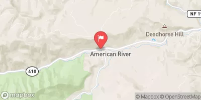
Confluence With Chinook Creek To Southern Boundary Of Mount Rainier National Park Paddle Report
Last Updated: 2026-02-10
The Whitewater River Run from Confluence with Chinook Creek to Southern Boundary of Mount Rainier National Park in the state of Washington is a popular destination for whitewater enthusiasts.
Summary
The ideal streamflow range for this run is between 800 and 1500 cubic feet per second (cfs). The class rating for this run is between III and IV, making it a moderately challenging run for experienced paddlers. The total segment mileage for this run is approximately 6.5 miles.
There are several notable rapids and obstacles on this run, including the Entrance Rapid, the S-Turn, the Pinball, the Slot, and the S-Turn Slide. Each of these rapids presents its own unique challenge to paddlers, and extra caution should be taken when navigating them.
In addition, there are specific regulations in place for this area. Paddlers are required to obtain a permit from Mount Rainier National Park before embarking on this run. Additionally, all paddlers must wear personal flotation devices (PFDs) at all times while on the river.
Overall, the Whitewater River Run from Confluence with Chinook Creek to Southern Boundary of Mount Rainier National Park provides a thrilling whitewater experience for paddlers with the necessary skills and experience. However, it is important to always prioritize safety and follow all regulations and guidelines to ensure a safe and enjoyable experience.
°F
°F
mph
Wind
%
Humidity
15-Day Weather Outlook
River Run Details
| Last Updated | 2026-02-10 |
| River Levels | 2230 cfs (2.36 ft) |
| Percent of Normal | 106% |
| Status | |
| Class Level | None |
| Elevation | ft |
| Run Length | 6.0 Mi |
| Streamflow Discharge | cfs |
| Gauge Height | ft |
| Reporting Streamgage | USGS 14226500 |
5-Day Hourly Forecast Detail
Nearby Streamflow Levels
 Cowlitz River At Packwood
|
1730cfs |
 American River Near Nile
|
244cfs |
 Puyallup River Near Electron
|
296cfs |
 Greenwater River At Greenwater
|
182cfs |
 Nisqually River Near National
|
621cfs |
 Cowlitz River At Randle
|
3030cfs |
Area Campgrounds
| Location | Reservations | Toilets |
|---|---|---|
 Olallie Creek Camp
|
||
 Deer Creek Camp
|
||
 Indian Bar Camp
|
||
 Ohanapecosh
|
||
 Ohanapecosh - Mount Rainier National Park
|
||
 Three Lakes Camp
|
River Runs
-
 Confluence With Chinook Creek To Southern Boundary Of Mount Rainier National Park
-
 Begins 1/4 Mile South Of Box Canyon To Southern Boundary Of Mount Rainier National Park
-
 Begins 1/4 Mile North Of Box Canyon To Ends 1/4 Mile South Of Box Canyon
-
 Headwaters On The Southeast Flank Of Mount Rainier At An Elevation Of 5500 Ft To Confluence With Chinook Creek
-
 Headwaters At The Terminus Of The Ingraham Glacier To Ends 1/4 Mile North Of Box Canyon
-
 Goat Rocks Wilderness Boundary To Confluence With Muddy Fork Cowlitz River

