Headwaters And Includes All Tributaries To Confluence With Elwha River river run
Community Reviews
Been here? Share the conditions.
Reviews, ratings & photos are added in the free Snoflo iOS app — rate a spot, tag the conditions, and your visit is verified by location. Add or manage your reviews from the app.
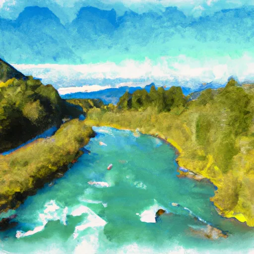
Headwaters And Includes All Tributaries To Confluence With Elwha River
There are several notable rapids and obstacles along the Whitewater River Run, including Boulder Drop, Pinball, and Wall Slammer. Boulder Drop is a particularly challenging rapid that requires precise maneuvering through a narrow channel and over large rocks. Pinball is a series of boulder-strewn drops that provide a fun and technical challenge for experienced kayakers and rafters. Wall Slammer is a steep and powerful rapid that requires a strong paddle stroke and good timing to navigate safely.
There are several regulations in place to protect the Whitewater River and its surrounding ecosystem. Visitors are required to obtain a permit from Olympic National Park before accessing the river, and are expected to practice Leave No Trace principles to minimize their impact on the environment. Additionally, motorized vehicles and camping are not permitted along the river, in order to preserve its natural beauty and wilderness character.
In summary, the Whitewater River Run in Washington State offers a challenging and exciting adventure for experienced kayakers and rafters. With a class rating of III-IV, an ideal streamflow range of 800-1200 cfs, and several notable rapids and obstacles, the run provides a thrilling experience for those seeking an adrenaline rush. Visitors should be aware of specific regulations in place to protect the river and its ecosystem, and should practice Leave No Trace principles to minimize their impact on the environment.
Plan your run down to the hour
Same weather feed Snoflo's iOS app uses -- updated continuously from NOAA / yr.no. Watch the precipitation column on the meteogram; rain ahead of a run typically lifts flows 12-48 hours later depending on the basin.
Next 5 days, hour by hour
Temperature line with weather symbols on top, snow + rain accumulation as columns, humidity as a dotted line.
5-day forecast table
Every 3 hours, broken out across temperature, snow, rain, humidity, and wind. Each cell is colour-coded relative to the column min/max.
| Time | Condition | Temp (°F) | Snow (in) | Rain (in) | Humidity (%) | Wind (mps) | Wind dir |
|---|---|---|---|---|---|---|---|
| Loading detailed forecast… | |||||||
15-day temperature & precipitation
Daily temperatures, snow, and rain projected over the next two weeks -- the upstream story that drives next week's flows.
Regional streamflow levels
USGS streamgauges around Headwaters And Includes All Tributaries To Confluence With Elwha River -- useful for spotting upstream pulses and gauging which tributary is contributing what.
| Streamgauge | Discharge | View |
|---|---|---|
| Elwha River Above Lake Mills Nr Port Angeles | 725 cfs | → |
| Dungeness River Near Sequim | 123 cfs | → |
| Elwha River At Mcdonald Br Near Port Angeles | 385 cfs | → |
| Big Quilcene River Below Diversion Nr Quilcene | 27 cfs | → |
| Duckabush River Near Brinnon | 60 cfs | → |
| Nf Skokomish R Bl Staircase Rpds Nr Hoodsport | 54 cfs | → |
Plan a longer trip
The closest boat launches, other paddle runs, and campgrounds so a day on the water can grow into a full weekend.
Other river runs
- Headwaters And Includes All Tributaries To Confluence With Gray Wolf River
- Headwaters- Includes All Tributaries To Confluence With Dosewallips River
- Headwaters In The Vicinity Of Hayden Pass In The East Central Part Of The Park Flowing East And South From An Elevation Of About 5700 Feet To Confluence With Station Creek
Whitewater safety
- Check the flow before you run
- Use the linked-gauge card and Regional Flow panel above. Class ratings change with flow -- a Class III at low water can become Class IV+ at high water.
- Know your skill ceiling
- Pick runs comfortably below your ceiling. Cold-water and big-water runs raise the consequences of any mistake.
- Wear the right gear
- Helmet, PFD, drysuit / wetsuit when water is below 60°F. Throw bag, knife, and whistle on your person, not in the boat.
- Scout, set safety, and run with a team
- Scout new rapids on foot, set safety with throw bags above the consequence pool, and run with at least one other competent paddler.
- Respect the river
- Strainers, undercuts, low-head dams, and wood can kill at any class rating. When in doubt, portage.
Set push alerts in the Snoflo app
Save Headwaters And Includes All Tributaries To Confluence With Elwha River as a favorite, set a discharge threshold (e.g. "alert me when flow hits 600 cfs"), and the iOS app pushes the moment the linked gauge crosses.
About Headwaters And Includes All Tributaries To Confluence With Elwha River
What's the optimal flow for Headwaters And Includes All Tributaries To Confluence With Elwha River?
The optimal flow depends on the section and the craft. Check the Run Details panel for the linked gauge and current status.
How fresh is the cfs reading on this page?
The linked USGS streamgauge reports continuously (every 15 minutes); Snoflo refreshes throughout the day. Hover the streamflow sparkline to read individual datapoints.
What's the whitewater class?
See the Run Details panel for the class rating Snoflo tracks for this run. Class ratings change with flow -- a Class III at low water can become Class IV in high water.
Where do I put in / take out?
Tap Directions in the hero above to open driving directions to the put-in. For shuttle planning, check the Nearby Boat Launches panel and the river run operator's site.
Can I get alerts when flows hit the optimal range?
Yes -- alerts are managed in the Snoflo iOS app. Favorite this run, set a discharge threshold, and you'll get a push the moment the gauge crosses.
Other runs near here
Snoflo-tracked paddle runs within driving distance of Headwaters And Includes All Tributaries To Confluence With Elwha River.