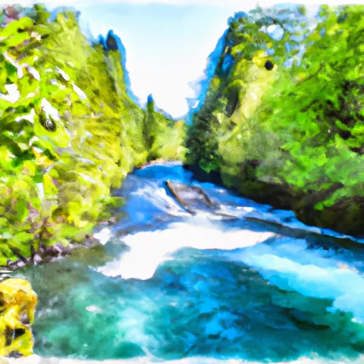
Straight Creek To Confluence With Lewis River River Run
Community Reviews
Been here? Share the conditions.
Reviews, ratings & photos are added in the free Snoflo iOS app — rate a spot, tag the conditions, and your visit is verified by location. Add or manage your reviews from the app.
Straight Creek To Confluence With Lewis River
Specific rapids and obstacles on this stretch of the river include the "Tunnel of Love," a narrow chute with a sharp turn, and "Satan's Eyeball," a large boulder in the middle of the river that creates a challenging obstacle. The run also features several eddies and pools, providing opportunities for rest and recovery.
Regulations for the area include a permit requirement for commercial outfitters and a Northwest Forest Pass for parking at the put-in and take-out locations. The use of alcohol and drugs is prohibited on the river, and all boaters must wear appropriate safety gear, including helmets and personal floatation devices. It is also recommended that boaters have prior experience or hire a professional guide for this challenging run.
Plan your run down to the hour
Same weather feed Snoflo's iOS app uses -- updated continuously from NOAA / yr.no. Watch the precipitation column on the meteogram; rain ahead of a run typically lifts flows 12-48 hours later depending on the basin.
Next 5 days, hour by hour
Temperature line with weather symbols on top, snow + rain accumulation as columns, humidity as a dotted line.
5-day forecast table
Every 3 hours, broken out across temperature, snow, rain, humidity, and wind. Each cell is colour-coded relative to the column min/max.
| Time | Condition | Temp (°F) | Snow (in) | Rain (in) | Humidity (%) | Wind (mps) | Wind dir |
|---|---|---|---|---|---|---|---|
| Loading detailed forecast… | |||||||
15-day temperature & precipitation
Daily temperatures, snow, and rain projected over the next two weeks -- the upstream story that drives next week's flows.
Regional streamflow levels
USGS streamgauges around Straight Creek To Confluence With Lewis River -- useful for spotting upstream pulses and gauging which tributary is contributing what.
| Streamgauge | Discharge | View |
|---|---|---|
| Muddy Creek Below Clear Creek Near Cougar | 140 cfs | → |
| Lewis River Above Muddy River Near Cougar | 262 cfs | → |
| Cispus River Ab Yellowjacket Creek Near Randle | 432 cfs | → |
| Cowlitz River Near Kosmos | 1,110 cfs | → |
| Cowlitz River At Randle | 940 cfs | → |
| Speelyai Creek Near Cougar | 5 cfs | → |
Plan a longer trip
The closest boat launches, other paddle runs, and campgrounds so a day on the water can grow into a full weekend.
Boat launches
Other river runs
- Headwaters In Sw 1/4 Of Sec 18, T9n, R9e To Confluence With Straight Creek
- Trail 80 Crossing In Nw1/4 Of Sec 28, T9n, R5e To Middle Of Sec 19 T8n, R7e
- Middle Of Sec 19, T8n, R7e To Confluence With Muddy River In Se1/4 Of Sec 1, T7n, R6e
- (Smith Creek Segment) Headwaters In Se 1/4 Of Sec 3, T8n, R5e To Confluence With Muddy River
- (Upper Muddy Segment) Headwaters In Se1/4 Of Sec 10, T8n, R5e To Conflence With Smith Creek
Campgrounds
Whitewater safety
- Check the flow before you run
- Use the linked-gauge card and Regional Flow panel above. Class ratings change with flow -- a Class III at low water can become Class IV+ at high water.
- Know your skill ceiling
- Pick runs comfortably below your ceiling. Cold-water and big-water runs raise the consequences of any mistake.
- Wear the right gear
- Helmet, PFD, drysuit / wetsuit when water is below 60°F. Throw bag, knife, and whistle on your person, not in the boat.
- Scout, set safety, and run with a team
- Scout new rapids on foot, set safety with throw bags above the consequence pool, and run with at least one other competent paddler.
- Respect the river
- Strainers, undercuts, low-head dams, and wood can kill at any class rating. When in doubt, portage.
Set push alerts in the Snoflo app
Save Straight Creek To Confluence With Lewis River as a favorite, set a discharge threshold (e.g. "alert me when flow hits 600 cfs"), and the iOS app pushes the moment the linked gauge crosses.
About Straight Creek To Confluence With Lewis River
What's the optimal flow for Straight Creek To Confluence With Lewis River?
The optimal flow depends on the section and the craft. Check the Run Details panel for the linked gauge and current status.
How fresh is the cfs reading on this page?
The linked USGS streamgauge reports continuously (every 15 minutes); Snoflo refreshes throughout the day. Hover the streamflow sparkline to read individual datapoints.
What's the whitewater class?
See the Run Details panel for the class rating Snoflo tracks for this run. Class ratings change with flow -- a Class III at low water can become Class IV in high water.
Where do I put in / take out?
Tap Directions in the hero above to open driving directions to the put-in. For shuttle planning, check the Nearby Boat Launches panel and the river run operator's site.
Can I get alerts when flows hit the optimal range?
Yes -- alerts are managed in the Snoflo iOS app. Favorite this run, set a discharge threshold, and you'll get a push the moment the gauge crosses.
Other runs near here
Snoflo-tracked paddle runs within driving distance of Straight Creek To Confluence With Lewis River.