Glacier Peak Wilderness Boundary To Confluence With Wenatchee River River Run
Community Reviews
Been here? Share the conditions.
Reviews, ratings & photos are added in the free Snoflo iOS app — rate a spot, tag the conditions, and your visit is verified by location. Add or manage your reviews from the app.
Glacier Peak Wilderness Boundary To Confluence With Wenatchee River
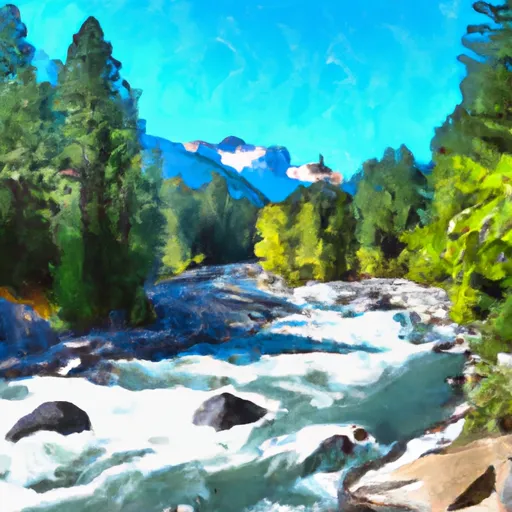
The Whitewater River run in the Glacier Peak Wilderness Boundary to Confluence with Wenatchee River in Washington State is an exciting adventure for experienced paddlers. The ideal streamflow range for this run is between 1,500 and 3,000 cubic feet per second (cfs). The Whitewater River run is rated as Class IV+, which means that it is challenging and demands advanced paddling skills, strength, and endurance. The total mileage of this segment is approximately 6.5 miles.
The river rapids and obstacles on this run are numerous and demanding. The most significant rapids on this stretch of the river are the Meatgrinder, which is a long and continuous rapid, and the Boulder Drop, which is a steep and technical drop. Other notable rapids on this run include the Pencil Sharpener, the House Rock, and the S-Turn. Additionally, there are several logjams and sweepers that paddlers must navigate around.
It is important to note that this river run is located within the Glacier Peak Wilderness Area, which is subject to specific regulations. Visitors to this area must obtain a permit and follow Leave No Trace principles to minimize their impact on the environment. Additionally, campfires are not permitted in the area, and all waste must be packed out. Overall, the Whitewater River run in Washington State is a thrilling and challenging adventure that demands experience, skill, and preparation.
Plan your run down to the hour
Same weather feed Snoflo's iOS app uses -- updated continuously from NOAA / yr.no. Watch the precipitation column on the meteogram; rain ahead of a run typically lifts flows 12-48 hours later depending on the basin.
Next 5 days, hour by hour
Temperature line with weather symbols on top, snow + rain accumulation as columns, humidity as a dotted line.
5-day forecast table
Every 3 hours, broken out across temperature, snow, rain, humidity, and wind. Each cell is colour-coded relative to the column min/max.
| Time | Condition | Temp (°F) | Snow (in) | Rain (in) | Humidity (%) | Wind (mps) | Wind dir |
|---|---|---|---|---|---|---|---|
| Loading detailed forecast… | |||||||
15-day temperature & precipitation
Daily temperatures, snow, and rain projected over the next two weeks -- the upstream story that drives next week's flows.
Regional streamflow levels
USGS streamgauges around Glacier Peak Wilderness Boundary To Confluence With Wenatchee River -- useful for spotting upstream pulses and gauging which tributary is contributing what.
| Streamgauge | Discharge | View |
|---|---|---|
| Wenatchee River At Plain | 516 cfs | → |
| Chiwawa River Near Plain | 148 cfs | → |
| Entiat River Near Ardenvoir | 115 cfs | → |
| Mad River At Ardenvoir | 18 cfs | → |
| Wenatchee River At Peshastin | 673 cfs | → |
| Icicle Creek Above Snow Creek Near Leavenworth | 168 cfs | → |
Plan a longer trip
The closest boat launches, other paddle runs, and campgrounds so a day on the water can grow into a full weekend.
Boat launches
- Lake Wenatchee State Park
- Cove Resort
- Cascade Hideaway Resort
- Leavenworth Public Boat Launch
- Icicle Creek
- Wenatchee River
Other river runs
- Point At East Section Line Of Sec 13, T28n, R15e To Lake Wenatchee
- Outlet Of Lake Wenatchee To Wenatchee Nf Boundary
- Headwaters In Sw1/4 Of Sec 21, T30n, R15e To Glacier Peak Wilderness Boundary And Including Twin Lakes Creek In Secs 16/17, T28n, R16e
- Glacier Peak Wilderness Boundary To Confluence With White River
- Glacier Peak Wilderness Boundary To A Point Approximately 0.5 Mile Above The Tall Timbers Range At East Section Line Of Sec 13, T28n, R15e
Campgrounds
- Nason Creek
- Nason Creek Campground
- Lake Wenatchee State Park Camp
- Deer Camp
- Goose Creek Campground
- Lake Wenatchee State Park
Parks
Whitewater safety
- Check the flow before you run
- Use the linked-gauge card and Regional Flow panel above. Class ratings change with flow -- a Class III at low water can become Class IV+ at high water.
- Know your skill ceiling
- Pick runs comfortably below your ceiling. Cold-water and big-water runs raise the consequences of any mistake.
- Wear the right gear
- Helmet, PFD, drysuit / wetsuit when water is below 60°F. Throw bag, knife, and whistle on your person, not in the boat.
- Scout, set safety, and run with a team
- Scout new rapids on foot, set safety with throw bags above the consequence pool, and run with at least one other competent paddler.
- Respect the river
- Strainers, undercuts, low-head dams, and wood can kill at any class rating. When in doubt, portage.
Set push alerts in the Snoflo app
Save Glacier Peak Wilderness Boundary To Confluence With Wenatchee River as a favorite, set a discharge threshold (e.g. "alert me when flow hits 600 cfs"), and the iOS app pushes the moment the linked gauge crosses.
About Glacier Peak Wilderness Boundary To Confluence With Wenatchee River
What's the optimal flow for Glacier Peak Wilderness Boundary To Confluence With Wenatchee River?
The optimal flow depends on the section and the craft. Check the Run Details panel for the linked gauge and current status.
How fresh is the cfs reading on this page?
The linked USGS streamgauge reports continuously (every 15 minutes); Snoflo refreshes throughout the day. Hover the streamflow sparkline to read individual datapoints.
What's the whitewater class?
See the Run Details panel for the class rating Snoflo tracks for this run. Class ratings change with flow -- a Class III at low water can become Class IV in high water.
Where do I put in / take out?
Tap Directions in the hero above to open driving directions to the put-in. For shuttle planning, check the Nearby Boat Launches panel and the river run operator's site.
Can I get alerts when flows hit the optimal range?
Yes -- alerts are managed in the Snoflo iOS app. Favorite this run, set a discharge threshold, and you'll get a push the moment the gauge crosses.
Other runs near here
Snoflo-tracked paddle runs within driving distance of Glacier Peak Wilderness Boundary To Confluence With Wenatchee River.