Fish Hatchery To Confluence With South Fork Nooksack River river run
Fish Hatchery To Confluence With South Fork Nooksack River
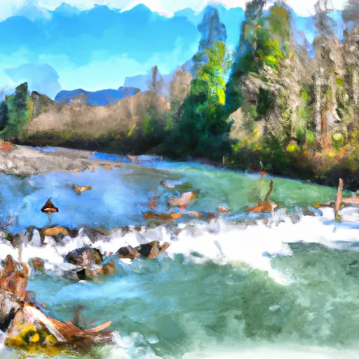
There are specific river rapids and obstacles on this run that are worth noting. The first significant rapids is called "Big Nasty," which is a Class IV rapid that requires precise maneuvering. There are also several other Class III and IV rapids, including "Little Nasty," "S-Turn," and "The Chute." Additionally, there are a few sections of flatwater, which provide a nice break between rapids.
It is important to note that there are specific regulations that apply to this area. For instance, all boaters must have a valid Washington State fishing license, and all boats must be equipped with a lifejacket for each person on board. Additionally, motorized boats are not permitted on this section of the river.
In conclusion, the Whitewater River Run from Fish Hatchery to Confluence with South Fork Nooksack River is a challenging and exciting whitewater destination in Washington. With its ideal streamflow range, Class III to IV rating, and specific river rapids and obstacles, it is a popular destination for experienced whitewater enthusiasts. However, visitors must be aware of the specific regulations that apply to this area and ensure that they are properly equipped before embarking on this adventure.
Plan your run down to the hour
Same weather feed Snoflo's iOS app uses -- updated continuously from NOAA / yr.no. Watch the precipitation column on the meteogram; rain ahead of a run typically lifts flows 12-48 hours later depending on the basin.
Next 5 days, hour by hour
Temperature line with weather symbols on top, snow + rain accumulation as columns, humidity as a dotted line.
5-day forecast table
Every 3 hours, broken out across temperature, snow, rain, humidity, and wind. Each cell is colour-coded relative to the column min/max.
| Time | Condition | Temp (°F) | Snow (in) | Rain (in) | Humidity (%) | Wind (mps) | Wind dir |
|---|---|---|---|---|---|---|---|
| Loading detailed forecast… | |||||||
15-day temperature & precipitation
Daily temperatures, snow, and rain projected over the next two weeks -- the upstream story that drives next week's flows.
Regional streamflow levels
USGS streamgauges around Fish Hatchery To Confluence With South Fork Nooksack River -- useful for spotting upstream pulses and gauging which tributary is contributing what.
| Streamgauge | Discharge | View |
|---|---|---|
| Nooksack River At North Cedarville | 3,650 cfs | → |
| Mf Nooksack River Near Deming | 433 cfs | → |
| Racehorse Creek At North Fork Road Nr Kendall | 23 cfs | → |
| Anderson Creek At Smith Road Near Goshen | 6 cfs | → |
| Carpenter Creek At N Shore Drive Nr Bellingham | 1 cfs | → |
| Olsen Creek Near Bellingham | 3 cfs | → |
Plan a longer trip
The closest boat launches, other paddle runs, and campgrounds so a day on the water can grow into a full weekend.
Boat launches
- South Bay Drive 3186-3234, Sedro-Woolley
- Galbriath Loop Bellingham
- East Wiser Lake Road 145, Lynden
- Guide Meridian Road Whatcom County
- Walmsley Avenue 31601, Abbotsford
- Mill Lake Road 32913, Mill Lake
Other river runs
- Nooksack Falls Power Plant To Fish Hatchery Near Kendall, Wa
- Douglas Fir Campground To Mt. Baker Highway
- Headwaters In Ne1/4 Of Sec 23, T37n, R7e To Confluence With Soufh Fork Nooksack River
- Headwaters To Confluence With Bell Creek
- Nooksack Falls Diversion Dam To Nooksack Falls Power Plant
Whitewater safety
- Check the flow before you run
- Use the linked-gauge card and Regional Flow panel above. Class ratings change with flow -- a Class III at low water can become Class IV+ at high water.
- Know your skill ceiling
- Pick runs comfortably below your ceiling. Cold-water and big-water runs raise the consequences of any mistake.
- Wear the right gear
- Helmet, PFD, drysuit / wetsuit when water is below 60°F. Throw bag, knife, and whistle on your person, not in the boat.
- Scout, set safety, and run with a team
- Scout new rapids on foot, set safety with throw bags above the consequence pool, and run with at least one other competent paddler.
- Respect the river
- Strainers, undercuts, low-head dams, and wood can kill at any class rating. When in doubt, portage.
Set push alerts in the Snoflo app
Save Fish Hatchery To Confluence With South Fork Nooksack River as a favorite, set a discharge threshold (e.g. "alert me when flow hits 600 cfs"), and the iOS app pushes the moment the linked gauge crosses.
About Fish Hatchery To Confluence With South Fork Nooksack River
What's the optimal flow for Fish Hatchery To Confluence With South Fork Nooksack River?
The optimal flow depends on the section and the craft. Check the Run Details panel for the linked gauge and current status.
How fresh is the cfs reading on this page?
The linked USGS streamgauge reports continuously (every 15 minutes); Snoflo refreshes throughout the day. Hover the streamflow sparkline to read individual datapoints.
What's the whitewater class?
See the Run Details panel for the class rating Snoflo tracks for this run. Class ratings change with flow -- a Class III at low water can become Class IV in high water.
Where do I put in / take out?
Tap Directions in the hero above to open driving directions to the put-in. For shuttle planning, check the Nearby Boat Launches panel and the river run operator's site.
Can I get alerts when flows hit the optimal range?
Yes -- alerts are managed in the Snoflo iOS app. Favorite this run, set a discharge threshold, and you'll get a push the moment the gauge crosses.
Other runs near here
Snoflo-tracked paddle runs within driving distance of Fish Hatchery To Confluence With South Fork Nooksack River.