Summary
The ideal streamflow range for this run is between 150 and 400 cubic feet per second (cfs), with the best time to paddle being in the spring or after heavy rainfall.
This section of the river is rated as Class II-III, with some Class IV rapids and obstacles, including the infamous "Perry's Ledge" and "Flipper". The segment mileage for this run is approximately 13 miles, with the trip taking around 4-5 hours to complete.
There are specific regulations that paddlers must follow when navigating this section of the river. For instance, paddlers must obtain a permit from the West Virginia Division of Natural Resources before entering the river. Additionally, all paddlers must wear a personal flotation device (PFD) at all times while on the water.
In conclusion, the Whitewater River Run from Wardensville to Capon Bridge offers a thrilling and challenging experience for experienced paddlers. With the ideal streamflow range, class rating, segment mileage, specific river rapids/obstacles, and specific regulations to the area, paddlers can safely navigate this section of the river while enjoying the beautiful scenery.
°F
°F
mph
Wind
%
Humidity
15-Day Weather Outlook
River Run Details
| Last Updated | 2026-02-07 |
| River Levels | 3 cfs (3.42 ft) |
| Percent of Normal | 14% |
| Status | |
| Class Level | ii-iii |
| Elevation | ft |
| Run Length | 26.0 Mi |
| Streamflow Discharge | cfs |
| Gauge Height | ft |
| Reporting Streamgage | USGS 01610400 |
5-Day Hourly Forecast Detail
Nearby Streamflow Levels
Area Campgrounds
| Location | Reservations | Toilets |
|---|---|---|
 Hawk Campground
|
||
 Hawk
Hawk
|
||
 Hawk Recreation Area
|
||
 Short Mountain WMA
|
||
 Trout Pond Campground
|
||
 Trout Pond Recreation Area
|



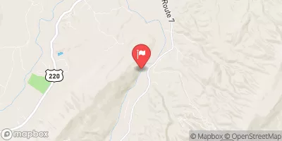
 Wardensville To The Town Of Capon Bridge
 Begins Where The Lost River Becomes The Cacapon River To Wardensville
 The West Virginia 259 Bridge South Of Wardensville To Ends Where The Lost River Becomes The Cacapon River