Source To End Of Forest Road River Run
Community Reviews
Been here? Share the conditions.
Reviews, ratings & photos are added in the free Snoflo iOS app — rate a spot, tag the conditions, and your visit is verified by location. Add or manage your reviews from the app.
Source To End Of Forest Road
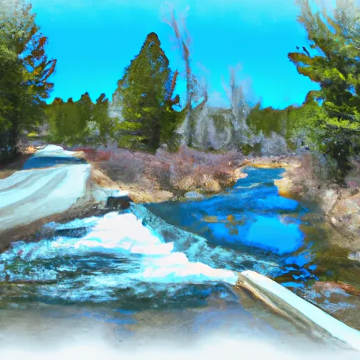
The Whitewater River Run Source To End Of Forest Road in Wyoming is a popular destination for whitewater enthusiasts. The ideal streamflow range for the river is between 1,000 and 3,000 cubic feet per second (cfs), which usually occurs in the spring and early summer. The river is rated as a Class III-IV run, with some Class V sections, and covers a total of 21 miles.
The first few miles of the run are relatively easy and consist of mostly Class II rapids. However, the river quickly becomes more challenging with several Class III and IV rapids, including "The Notch," a narrow and technical rapid that requires precise maneuvering. The most difficult sections of the river are located towards the end of the run, with several Class V rapids, such as "The Narrows" and "The Wall."
In terms of regulations, the Whitewater River Run is located within the Shoshone National Forest, and a permit is required to run the river. Additionally, all participants must wear a personal flotation device (PFD) and helmets are strongly recommended. The river is also subject to seasonal closures to protect fish spawning areas and other natural resources.
Plan your run down to the hour
Same weather feed Snoflo's iOS app uses -- updated continuously from NOAA / yr.no. Watch the precipitation column on the meteogram; rain ahead of a run typically lifts flows 12-48 hours later depending on the basin.
Next 5 days, hour by hour
Temperature line with weather symbols on top, snow + rain accumulation as columns, humidity as a dotted line.
5-day forecast table
Every 3 hours, broken out across temperature, snow, rain, humidity, and wind. Each cell is colour-coded relative to the column min/max.
| Time | Condition | Temp (°F) | Snow (in) | Rain (in) | Humidity (%) | Wind (mps) | Wind dir |
|---|---|---|---|---|---|---|---|
| Loading detailed forecast… | |||||||
15-day temperature & precipitation
Daily temperatures, snow, and rain projected over the next two weeks -- the upstream story that drives next week's flows.
Regional streamflow levels
USGS streamgauges around Source To End Of Forest Road -- useful for spotting upstream pulses and gauging which tributary is contributing what.
| Streamgauge | Discharge | View |
|---|---|---|
| Wind River Near Dubois | 135 cfs | → |
| Green River At Warren Bridge | 418 cfs | → |
| Pine Creek Above Fremont Lake | 176 cfs | → |
| Wind River Above Red Creek | 655 cfs | → |
| Dinwoody Creek Above Lakes | 388 cfs | → |
| Cache Creek Near Jackson | 11 cfs | → |
Plan a longer trip
The closest boat launches, other paddle runs, and campgrounds so a day on the water can grow into a full weekend.
Boat launches
- Green River Lake
- Green River Access Site 12 Boat Ramp
- New Fork Lake
- Green River Access Site 8 Boat Launch
- Green River Access Site 6 Boat Launch
Other river runs
- Forest Road To Confluence With Green River
- Lower Green River Lake Outlet To Nf Boundary
- Source To Confluence With Green River
- Source, Green River Pass To Lower Green River Lake
- Green River
Campgrounds
- Whiskey Grove Campground
- Whiskey Grove
- Green River Lake Campground
- Green River Lake Group Campground
- Green River Lake
- Green River Lake Lodge
Fishing spots
Whitewater safety
- Check the flow before you run
- Use the linked-gauge card and Regional Flow panel above. Class ratings change with flow -- a Class III at low water can become Class IV+ at high water.
- Know your skill ceiling
- Pick runs comfortably below your ceiling. Cold-water and big-water runs raise the consequences of any mistake.
- Wear the right gear
- Helmet, PFD, drysuit / wetsuit when water is below 60°F. Throw bag, knife, and whistle on your person, not in the boat.
- Scout, set safety, and run with a team
- Scout new rapids on foot, set safety with throw bags above the consequence pool, and run with at least one other competent paddler.
- Respect the river
- Strainers, undercuts, low-head dams, and wood can kill at any class rating. When in doubt, portage.
Set push alerts in the Snoflo app
Save Source To End Of Forest Road as a favorite, set a discharge threshold (e.g. "alert me when flow hits 600 cfs"), and the iOS app pushes the moment the linked gauge crosses.
About Source To End Of Forest Road
What's the optimal flow for Source To End Of Forest Road?
The optimal flow depends on the section and the craft. Check the Run Details panel for the linked gauge and current status.
How fresh is the cfs reading on this page?
The linked USGS streamgauge reports continuously (every 15 minutes); Snoflo refreshes throughout the day. Hover the streamflow sparkline to read individual datapoints.
What's the whitewater class?
See the Run Details panel for the class rating Snoflo tracks for this run. Class ratings change with flow -- a Class III at low water can become Class IV in high water.
Where do I put in / take out?
Tap Directions in the hero above to open driving directions to the put-in. For shuttle planning, check the Nearby Boat Launches panel and the river run operator's site.
Can I get alerts when flows hit the optimal range?
Yes -- alerts are managed in the Snoflo iOS app. Favorite this run, set a discharge threshold, and you'll get a push the moment the gauge crosses.
Other runs near here
Snoflo-tracked paddle runs within driving distance of Source To End Of Forest Road.