Headwaters Of North And South Forks And Mainstem To Boundary Of Jedediah Smith Wilderness River Run
Community Reviews
Been here? Share the conditions.
Reviews, ratings & photos are added in the free Snoflo iOS app — rate a spot, tag the conditions, and your visit is verified by location. Add or manage your reviews from the app.
Headwaters Of North And South Forks And Mainstem To Boundary Of Jedediah Smith Wilderness
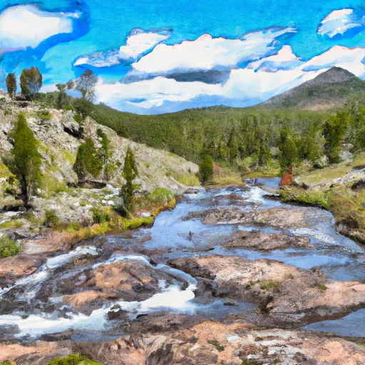
Some of the specific river rapids and obstacles on this river run include "The Elbow," "The Narrows," and the "Tight Squeeze." These areas require advanced kayaking skills and are best attempted by experienced kayakers. The river run also features beautiful scenery such as towering cliffs, lush forests, and wildlife.
Specific regulations to the area include obtaining a permit for overnight camping, as well as adhering to the regulations set by the Jedediah Smith Wilderness. Visitors are also required to practice Leave No Trace principles to preserve the natural environment of the river run.
In conclusion, the Whitewater River Run located in Wyoming provides an exciting and challenging kayaking experience for both novice and experienced kayakers. Visitors can enjoy the beautiful scenery, tackle challenging rapids, and adhere to specific regulations to preserve the natural environment of the area.
Plan your run down to the hour
Same weather feed Snoflo's iOS app uses -- updated continuously from NOAA / yr.no. Watch the precipitation column on the meteogram; rain ahead of a run typically lifts flows 12-48 hours later depending on the basin.
Next 5 days, hour by hour
Temperature line with weather symbols on top, snow + rain accumulation as columns, humidity as a dotted line.
5-day forecast table
Every 3 hours, broken out across temperature, snow, rain, humidity, and wind. Each cell is colour-coded relative to the column min/max.
| Time | Condition | Temp (°F) | Snow (in) | Rain (in) | Humidity (%) | Wind (mps) | Wind dir |
|---|---|---|---|---|---|---|---|
| Loading detailed forecast… | |||||||
15-day temperature & precipitation
Daily temperatures, snow, and rain projected over the next two weeks -- the upstream story that drives next week's flows.
Regional streamflow levels
USGS streamgauges around Headwaters Of North And South Forks And Mainstem To Boundary Of Jedediah Smith Wilderness -- useful for spotting upstream pulses and gauging which tributary is contributing what.
| Streamgauge | Discharge | View |
|---|---|---|
| Granite C Ab Granite C Supplemental | 62 cfs | → |
| Snake River At Moose | 6,550 cfs | → |
| Gros Ventre River At Zenith Wy | 229 cfs | → |
| Fish Creek At Wilson | 418 cfs | → |
| Teton River Ab South Leigh Creek Nr Driggs Id | 349 cfs | → |
| Gros Ventre River At Kelly Wy | 620 cfs | → |
Plan a longer trip
The closest boat launches, other paddle runs, and campgrounds so a day on the water can grow into a full weekend.
Boat launches
Other river runs
- Headwaters Of South And Roaring Forks And Mainstem To Confluence With South Fork
- Badger Creek
- Bitch Creek
- Headwaters Of North And South Fork And Mainstem To Targhee Nf Boundary
- Just West Of Crystal Lake To Trailhead
Campgrounds
Fishing spots
Whitewater safety
- Check the flow before you run
- Use the linked-gauge card and Regional Flow panel above. Class ratings change with flow -- a Class III at low water can become Class IV+ at high water.
- Know your skill ceiling
- Pick runs comfortably below your ceiling. Cold-water and big-water runs raise the consequences of any mistake.
- Wear the right gear
- Helmet, PFD, drysuit / wetsuit when water is below 60°F. Throw bag, knife, and whistle on your person, not in the boat.
- Scout, set safety, and run with a team
- Scout new rapids on foot, set safety with throw bags above the consequence pool, and run with at least one other competent paddler.
- Respect the river
- Strainers, undercuts, low-head dams, and wood can kill at any class rating. When in doubt, portage.
Set push alerts in the Snoflo app
Save Headwaters Of North And South Forks And Mainstem To Boundary Of Jedediah Smith Wilderness as a favorite, set a discharge threshold (e.g. "alert me when flow hits 600 cfs"), and the iOS app pushes the moment the linked gauge crosses.
About Headwaters Of North And South Forks And Mainstem To Boundary Of Jedediah Smith Wilderness
What's the optimal flow for Headwaters Of North And South Forks And Mainstem To Boundary Of Jedediah Smith Wilderness?
The optimal flow depends on the section and the craft. Check the Run Details panel for the linked gauge and current status.
How fresh is the cfs reading on this page?
The linked USGS streamgauge reports continuously (every 15 minutes); Snoflo refreshes throughout the day. Hover the streamflow sparkline to read individual datapoints.
What's the whitewater class?
See the Run Details panel for the class rating Snoflo tracks for this run. Class ratings change with flow -- a Class III at low water can become Class IV in high water.
Where do I put in / take out?
Tap Directions in the hero above to open driving directions to the put-in. For shuttle planning, check the Nearby Boat Launches panel and the river run operator's site.
Can I get alerts when flows hit the optimal range?
Yes -- alerts are managed in the Snoflo iOS app. Favorite this run, set a discharge threshold, and you'll get a push the moment the gauge crosses.
Other runs near here
Snoflo-tracked paddle runs within driving distance of Headwaters Of North And South Forks And Mainstem To Boundary Of Jedediah Smith Wilderness.