Make an Announcement

Communicate warnings, disperse advice, and share.


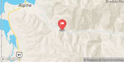
UPPER GREYS (LYNX CREEK TO LITTLE GREYS)

Whitewater River Run


Wyoming Greys River

Upper Greys (Lynx Creek To Little Greys)

Class II TO IV+

STREAMFLOW: 2,570 CFS

Runnable
65°, Scattered Showers Then Scattered T-Storms

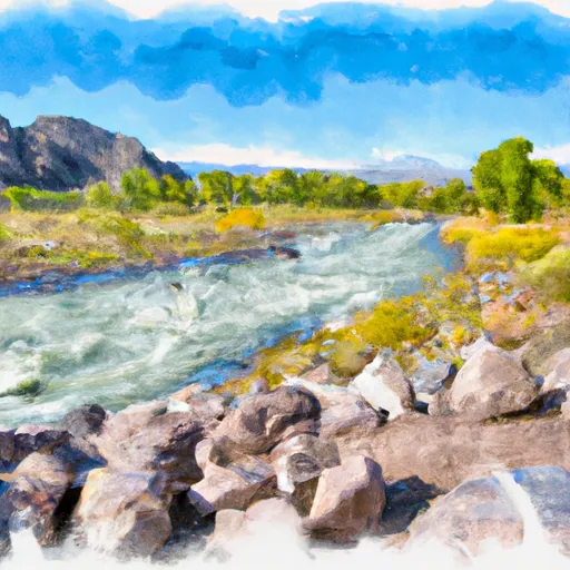
The Upper Greys Lynx Creek to Little Greys River run on the Greys River in Wyoming is a challenging but rewarding river trip. The river run difficulty ranges from Class II to Class III rapids, with river obstacles including several narrow sections, tight corners, and occasional logjams. The best time of year to float this section of water is in late spring or early summer when water levels are high enough, typically around 1,000 to 2,000 cfs. This section of the Greys River is best suited for experienced paddlers with solid Class III skills.

Weather today, Scattered showers, with thunderstorms also possible after noon. Some of the storms could produce small hail and gusty winds. Partly sunny, with a high near 65. Light and variable wind becoming southwest 6 to 11 mph in the morning. Chance of precipitation is 50%.

Status Runnable
Class Level II to IV+
Elevation 5,704 ft
Run Length 4.0 Mi
Gradient 40 FPM
Streamflow Discharge 2570 cfs
Gauge Height 4.0 ft
Reporting Streamgage Greys River Ab Reservoir Nr Alpine Wy
USGS 13023000

Nearby Snowpack and Streamflow Levels

Gauge Streamflow Stage
Hams Fork Below Pole Creek
USGS 09223000
682 cfs 4.9 ft
Salt River Ab Reservoir Nr Etna Wy
USGS 13027500
3,100 cfs 5.4 ft
Fontenelle C Nr Herschler Ranch
USGS 09210500
491 cfs 8.6 ft
Bear River At Pescadero
USGS 10068500
677 cfs 4.1 ft
Green River Near La Barge
USGS 09209400
8,240 cfs 8.2 ft
Blackfoot River Ab Reservoir Nr Henry Id
USGS 13063000
625 cfs 4.7 ft
Bear River At Border
USGS 10039500
2,980 cfs 8.6 ft
Smiths Fork Near Border
USGS 10032000
859 cfs 2.9 ft
Grays Lk Div To Blackfoot R Basin Nr Wayan Id
USGS 13057300
557 cfs 8.0 ft
Bear River Below Smiths Fork
USGS 10038000
2,350 cfs 5.2 ft
Snotel Site Snowpack 24hr Change
Salt River Summit
SNOTEL 730
1" 0"
Phillips Bench
SNOTEL 689
22" -2"
Two Ocean Plateau
SNOTEL 837
38" -2"
Madison Plateau
SNOTEL 609
29" -1"
Willow Creek
SNOTEL 868
20" -1"
White Elephant
SNOTEL 860
27" -2"
Grand Targhee
SNOTEL 1082
68" -3"
Bug Lake
SNOTEL 374
178" 0"
Black Bear
SNOTEL 347
59" -3"
Grassy Lake
SNOTEL 499
35" 0"
Cottonwood Creek
SNOTEL 419
12" -3"
Triple Peak
SNOTEL 831
12" -3"
Garden City Summit
SNOTEL 1114
10" -3"
Indian Creek
SNOTEL 544
31" -2"
Spring Creek Divide
SNOTEL 779
40" -1"
Pine Creek Pass
SNOTEL 695
2" 0"
Lewis Lake Divide
SNOTEL 577
29" -1"
Blind Bull Sum
SNOTEL 353
28" -1"

Popular Destinations

Campground Campsites Reservations Toilets Showers Elevation
Station Creek 15 5,813 ft
Curtis Canyon 12 7,049 ft
Alpine 16 5,687 ft
Lynx Creek 10 6,195 ft
Cabin Creek 10 5,850 ft
Elbow 7 5,779 ft
Moose Flat 10 6,415 ft
Allred Flat 32 6,779 ft
East Table Creek 17 5,789 ft
Trail Creek - Victor 11 6,726 ft
Murphy Creek 10 6,210 ft
Forest Park 12 6,947 ft
Gros Ventre - Grand Teton National Park 350 6,572 ft
Ski Area Snowpack Air Temperature 5 Day Forecast
Jackson Hole Mountain Resort 22" 58° 0"
Pine Creek Ski Area 0" 61° 0"
Grand Targhee Ski Resort 68" 53° 0"
Snow King Ski Area 22" 58° 0"
River Run Streamflow Length Class
Astoria to West Table 4170.0cfs 9.5 Mi I to II
Upper Greys (Murphy Creek Bridge to Lynx Creek Campground) 2570.0cfs 2.5 Mi II to II+
Upper Greys (Lynx Creek to Little Greys) 2570.0cfs 4.0 Mi II to IV+
Lower Greys (Squaw Creek to Bridge Campground) 2570.0cfs 2.5 Mi III+ to V-
Upper Greys (Murphy Creek Bridge to Lynx Creek Campground) 2570.0cfs 2.5 Mi II to II+
Granite Creek 475.0cfs 9.1 Mi II to III
Narrows 4170.0cfs 3.6 Mi III- to III+
Alpine Canyon (West Table to Sheep Gulch) 4170.0cfs 8.0 Mi III- to III+
Palisade Dam to Lorenzo (South Fork) 12400.0cfs 53.0 Mi II
Cave Falls Run 2150.0cfs 14.0 Mi III to III+

Log Your Visit

When was your last visit to Upper Greys (Lynx Creek to Little Greys)?

Add a Photo

How was it? How were conditions?

Rate the paddle


Submit

Leave A Review

Upper Greys (Lynx Creek To Little Greys)

Submit

Upload an Image

Upper Greys (Lynx Creek To Little Greys)
Login

Need an Account?

Forgot Your Password?

Delete User Account

Welcome to Snoflo


Continue with a free account

Already Have an Account?


Snoflo Premium

Your first week's free. Cancel anytime

Have a Promo Code?


Already Have an Account?

Signup for Basic Access


Welcome to Snoflo


Continue with a free account

Add Snoflo Premium


Already Have an Account?


Please Verify Your Account

Favorite Limit Reached
Signup for a Free Account

Already Have an Account?