Tumacacori National Historical Park
Community Reviews
Been here? Share the conditions.
Reviews, ratings & photos are added in the free Snoflo iOS app — rate a spot, tag the conditions, and your visit is verified by location. Add or manage your reviews from the app.
Tumacacori National Historical Park
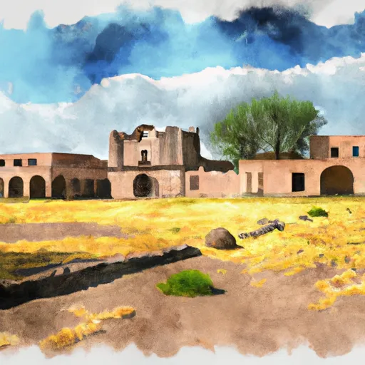
One of the main reasons to visit Tumacacori National Historical Park is to explore its cultural heritage. The park preserves the ruins of three Spanish mission communities that were established in the late 17th century. These missions, San José de Tumacácori, Los Santos Ángeles de Guevavi, and San Cayetano de Calabazas, offer a glimpse into the region's colonial history and the efforts of Spanish missionaries to convert and assimilate the local indigenous populations.
Visitors can explore the mission ruins, which feature preserved walls, courtyards, and religious artifacts. The Tumacácori Museum, located within the park, provides further insights into the history and cultural significance of the missions.
Apart from the missions, Tumacacori National Historical Park boasts beautiful natural surroundings and scenic landscapes. The park is situated along the Santa Cruz River, offering opportunities for hiking and enjoying the peacefulness of the riparian habitat. Visitors can take leisurely walks along the trails, observing the diverse flora and fauna that call the park home.
Interesting facts about the area include the fact that Tumacácori National Historical Park is part of a larger cultural landscape known as the Juan Bautista de Anza National Historic Trail. This trail commemorates the migration route of Spanish colonists and indigenous people from the region to California.
The best time to visit Tumacacori National Historical Park is during the cooler months, from November to April, as the summer months can be extremely hot in this part of Arizona. It is advisable to check the park's website or contact the visitor center for updated information on operating hours and events.
In order to ensure accuracy, it is recommended to verify the information provided by consulting multiple independent sources such as the official website of Tumacacori National Historical Park, publications from the National Park Service, or reputable travel guides.
Points of interest in Tumacacori National Historical Park
Landmarks and points of interest inside the park boundary.


Plan your visit down to the hour
Same weather feed Snoflo's iOS app uses -- updated continuously from NOAA / yr.no.
Next 5 days, hour by hour
Temperature line with weather symbols on top, snow + rain accumulation as columns, humidity as a dotted line.
5-day forecast table
Every 3 hours, broken out across temperature, snow, rain, humidity, and wind.
| Time | Condition | Temp (°F) | Snow (in) | Rain (in) | Humidity (%) | Wind (mps) | Wind dir |
|---|---|---|---|---|---|---|---|
| Loading detailed forecast… | |||||||
15-day temperature & precipitation
Daily temperatures, snow, and rain projected over the next two weeks.
Responsible recreation & Leave No Trace
- Know before you go
- Check the operator's site for hours, permit requirements, seasonal closures, and fire restrictions before heading out.
- Stay on trail
- Stick to marked paths to protect vegetation, prevent erosion, and avoid disturbing wildlife habitat.
- Respect wildlife
- Observe from a distance, never feed wildlife, and store food securely if camping is permitted on-site.
- Pack it in, pack it out
- Carry out all trash, food scraps, and gear. Many parks have limited or no trash service.
- Leave what you find
- Don't take rocks, plants, or artifacts. They make the park what it is for the next visitor.
Set push alerts in the Snoflo app
Save Tumacacori National Historical Park as a favorite, set a custom threshold (precipitation, freezing temperatures, fire-restriction days), and the iOS app will push the moment conditions cross.
About Tumacacori National Historical Park
What can I do at Tumacacori National Historical Park?
Most Snoflo-tracked parks support hiking, picnicking, and wildlife viewing. Check the operator's site for activity-specific rules (camping, fishing, paddling, hunting).
How fresh is the weather data?
The hourly forecast updates throughout the day from NOAA / yr.no. Streamflow comes live from USGS streamgauges.
When is the best time to visit?
Use the 15-day temperature & precipitation outlook on this page to plan -- pick a window with comfortable temperatures and low precipitation.
How do I get to Tumacacori National Historical Park?
Tap Directions in the hero above to open driving directions in Google Maps, or Open in map to center the Snoflo interactive map on the park.
Can I get alerts when conditions change?
Yes -- alerts are managed in the Snoflo iOS app. Favorite this park, set a threshold (temperature, precipitation), and you'll get a push the moment it crosses.
Park & land designation reference
A quick legend for the federal and state land categories Snoflo tracks. Each designation comes with different rules around access, recreation, and resource extraction.
- National Park
- Large protected natural areas managed by the federal government to preserve significant landscapes, ecosystems, and cultural resources; recreation is allowed but conservation is the priority.
- State Park
- Public natural or recreational areas managed by a state government, typically smaller than national parks and focused on regional natural features, recreation, and education.
- Local Park
- Community-level parks managed by cities or counties, emphasizing recreation, playgrounds, sports, and green space close to populated areas.
- Wilderness Area
- The highest level of land protection in the U.S.; designated areas where nature is left essentially untouched, with no roads, structures, or motorized motorized access permitted.
- National Recreation Area
- Areas set aside primarily for outdoor recreation (boating, hiking, fishing, often around reservoirs, rivers, or scenic landscapes); may allow more development.
- National Conservation Area (BLM)
- BLM-managed areas with special ecological, cultural, or scientific value; more protection than typical BLM land but less strict than Wilderness Areas.
- State Forest
- State-managed forests focused on habitat, watershed, recreation, and sustainable timber harvest.
- Bureau of Land Management (BLM) Land
- Vast federal lands managed for mixed use -- recreation, grazing, mining, conservation -- with fewer restrictions than national parks or forests.