Wilderness Miller Peak
Community Reviews
Been here? Share the conditions.
Reviews, ratings & photos are added in the free Snoflo iOS app — rate a spot, tag the conditions, and your visit is verified by location. Add or manage your reviews from the app.

Wilderness Miller Peak
One of the primary reasons to visit the Miller Peak Wilderness is its stunning natural beauty. Towering peaks, deep canyons, and lush forests characterize the landscape, providing opportunities for hiking, camping, and wildlife viewing. The wilderness is home to an array of diverse ecosystems, including pine and fir forests, as well as oak and aspen groves, making it a haven for nature lovers.
There are several iconic points of interest within the Miller Peak Wilderness that are worth exploring. At the heart of the wilderness lies the prominent Miller Peak, standing at an elevation of 9,466 feet (2,885 meters). Hiking to the summit rewards visitors with panoramic views of the surrounding mountain ranges and valleys. Additionally, the Hunter Canyon Trail leads adventurers through a picturesque canyon filled with splendid rock formations and serene waterfalls.
Interesting facts about the Miller Peak Wilderness include its designation as a wilderness area in 1984, as part of the Arizona Wilderness Act. The wilderness spans approximately 20,190 acres (8,174 hectares) within the Coronado National Forest and is managed by the U.S. Forest Service. Miller Peak itself is named after Captain Enoch Miller, a prominent local figure from the late 1800s.
The best time to visit the Miller Peak Wilderness is during the spring and fall months. Spring brings blooming wildflowers and pleasant temperatures, while fall showcases vibrant foliage colors. Summers can be hot, with temperatures reaching into the 90s°F (30s°C), while winters can be cold and snowy, making these seasons less ideal for outdoor activities.
To ensure accuracy, it is recommended to verify this information across multiple independent sources, such as official websites, travel guides, and local authorities.
Streamflow in Wilderness Miller Peak
Live USGS discharge at streamgauges inside the park boundary.
Trails in Wilderness Miller Peak
Named trails whose route falls inside the park.
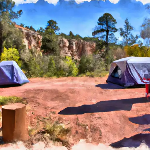
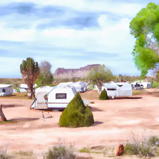
Camping in Wilderness Miller Peak
Campgrounds inside the park, with today's conditions score.


Plan your visit down to the hour
Same weather feed Snoflo's iOS app uses -- updated continuously from NOAA / yr.no.
Next 5 days, hour by hour
Temperature line with weather symbols on top, snow + rain accumulation as columns, humidity as a dotted line.
5-day forecast table
Every 3 hours, broken out across temperature, snow, rain, humidity, and wind.
| Time | Condition | Temp (°F) | Snow (in) | Rain (in) | Humidity (%) | Wind (mps) | Wind dir |
|---|---|---|---|---|---|---|---|
| Loading detailed forecast… | |||||||
15-day temperature & precipitation
Daily temperatures, snow, and rain projected over the next two weeks.
Responsible recreation & Leave No Trace
- Know before you go
- Check the operator's site for hours, permit requirements, seasonal closures, and fire restrictions before heading out.
- Stay on trail
- Stick to marked paths to protect vegetation, prevent erosion, and avoid disturbing wildlife habitat.
- Respect wildlife
- Observe from a distance, never feed wildlife, and store food securely if camping is permitted on-site.
- Pack it in, pack it out
- Carry out all trash, food scraps, and gear. Many parks have limited or no trash service.
- Leave what you find
- Don't take rocks, plants, or artifacts. They make the park what it is for the next visitor.
Set push alerts in the Snoflo app
Save Wilderness Miller Peak as a favorite, set a custom threshold (precipitation, freezing temperatures, fire-restriction days), and the iOS app will push the moment conditions cross.
About Wilderness Miller Peak
What can I do at Wilderness Miller Peak?
Most Snoflo-tracked parks support hiking, picnicking, and wildlife viewing. Check the operator's site for activity-specific rules (camping, fishing, paddling, hunting).
How fresh is the weather data?
The hourly forecast updates throughout the day from NOAA / yr.no. Streamflow comes live from USGS streamgauges.
When is the best time to visit?
Use the 15-day temperature & precipitation outlook on this page to plan -- pick a window with comfortable temperatures and low precipitation.
How do I get to Wilderness Miller Peak?
Tap Directions in the hero above to open driving directions in Google Maps, or Open in map to center the Snoflo interactive map on the park.
Can I get alerts when conditions change?
Yes -- alerts are managed in the Snoflo iOS app. Favorite this park, set a threshold (temperature, precipitation), and you'll get a push the moment it crosses.
Park & land designation reference
A quick legend for the federal and state land categories Snoflo tracks. Each designation comes with different rules around access, recreation, and resource extraction.
- National Park
- Large protected natural areas managed by the federal government to preserve significant landscapes, ecosystems, and cultural resources; recreation is allowed but conservation is the priority.
- State Park
- Public natural or recreational areas managed by a state government, typically smaller than national parks and focused on regional natural features, recreation, and education.
- Local Park
- Community-level parks managed by cities or counties, emphasizing recreation, playgrounds, sports, and green space close to populated areas.
- Wilderness Area
- The highest level of land protection in the U.S.; designated areas where nature is left essentially untouched, with no roads, structures, or motorized motorized access permitted.
- National Recreation Area
- Areas set aside primarily for outdoor recreation (boating, hiking, fishing, often around reservoirs, rivers, or scenic landscapes); may allow more development.
- National Conservation Area (BLM)
- BLM-managed areas with special ecological, cultural, or scientific value; more protection than typical BLM land but less strict than Wilderness Areas.
- State Forest
- State-managed forests focused on habitat, watershed, recreation, and sustainable timber harvest.
- Bureau of Land Management (BLM) Land
- Vast federal lands managed for mixed use -- recreation, grazing, mining, conservation -- with fewer restrictions than national parks or forests.