Winona Wildlife Management Area
Community Reviews
Been here? Share the conditions.
Reviews, ratings & photos are added in the free Snoflo iOS app — rate a spot, tag the conditions, and your visit is verified by location. Add or manage your reviews from the app.

Winona Wildlife Management Area
One of the primary reasons to visit WWMA is its remarkable biodiversity. The area covers approximately 160,000 acres, encompassing a mix of forests, wetlands, and grasslands. This variety of habitats supports a rich array of wildlife, including white-tailed deer, wild turkey, waterfowl, and numerous migratory bird species. It is a fantastic spot for birdwatching, with over 250 species recorded in the area.
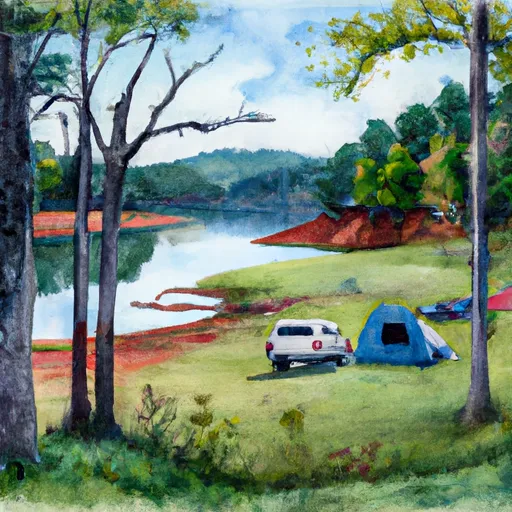
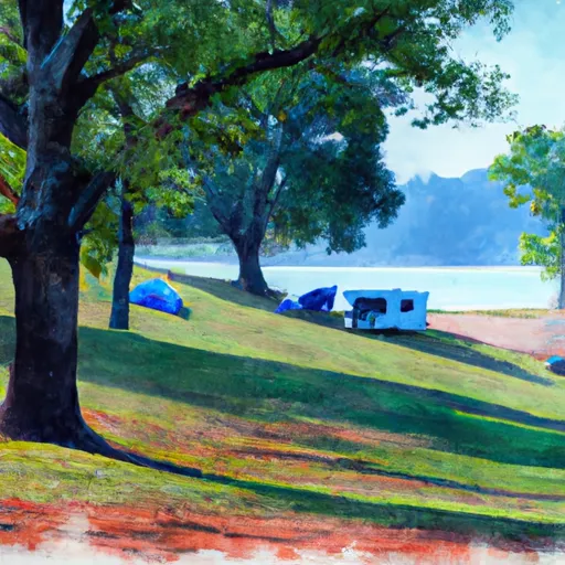
Nature lovers will find WWMA particularly captivating due to its scenic beauty. The landscape is characterized by rolling hills, picturesque lakes, and meandering streams, offering breathtaking views and unique photography opportunities. The area also boasts several designated hiking trails and primitive camping areas, allowing visitors to immerse themselves in the serenity of the surroundings.
One of the notable points of interest in WWMA is the Winona Reservoir. This man-made lake spans around 1,530 acres and provides excellent fishing opportunities for anglers. The reservoir is known for its abundant populations of largemouth bass, crappie, bluegill, and catfish, attracting fishing enthusiasts throughout the year.
Additionally, WWMA is home to the Mississippi River State Fish Hatchery, which plays a vital role in the conservation and management of fish populations in the region. Visitors can take guided tours to learn about the hatchery's operations and witness the various stages of fish production.
It is important to note that the best time to visit WWMA depends on the activities you wish to engage in. Spring and fall are generally considered the prime seasons for birdwatching, as numerous migratory species pass through the area during these times. For fishing, the spring and early summer months are ideal, as fish are most active during this period. However, WWMA remains open throughout the year, and each season offers unique experiences and natural beauty.
To ensure accuracy, it is recommended to verify information about specific activities, regulations, and current conditions from multiple independent sources, such as the Arkansas Game and Fish Commission's official website or local visitor centers.
Streamflow in Winona Wildlife Management Area
Live USGS discharge at streamgauges inside the park boundary.
Snowpack in Winona Wildlife Management Area
Current snow depth at SNOTEL stations inside the park boundary.
Trails in Winona Wildlife Management Area
Named trails whose route falls inside the park.
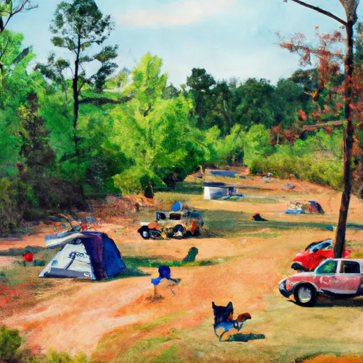
Camping in Winona Wildlife Management Area
Campgrounds inside the park, with today's conditions score.
Points of interest in Winona Wildlife Management Area
Landmarks and points of interest inside the park boundary.

Plan your visit down to the hour
Same weather feed Snoflo's iOS app uses -- updated continuously from NOAA / yr.no.
Next 5 days, hour by hour
Temperature line with weather symbols on top, snow + rain accumulation as columns, humidity as a dotted line.
5-day forecast table
Every 3 hours, broken out across temperature, snow, rain, humidity, and wind.
| Time | Condition | Temp (°F) | Snow (in) | Rain (in) | Humidity (%) | Wind (mps) | Wind dir |
|---|---|---|---|---|---|---|---|
| Loading detailed forecast… | |||||||
15-day temperature & precipitation
Daily temperatures, snow, and rain projected over the next two weeks.
Responsible recreation & Leave No Trace
- Know before you go
- Check the operator's site for hours, permit requirements, seasonal closures, and fire restrictions before heading out.
- Stay on trail
- Stick to marked paths to protect vegetation, prevent erosion, and avoid disturbing wildlife habitat.
- Respect wildlife
- Observe from a distance, never feed wildlife, and store food securely if camping is permitted on-site.
- Pack it in, pack it out
- Carry out all trash, food scraps, and gear. Many parks have limited or no trash service.
- Leave what you find
- Don't take rocks, plants, or artifacts. They make the park what it is for the next visitor.
Set push alerts in the Snoflo app
Save Winona Wildlife Management Area as a favorite, set a custom threshold (precipitation, freezing temperatures, fire-restriction days), and the iOS app will push the moment conditions cross.
About Winona Wildlife Management Area
What can I do at Winona Wildlife Management Area?
Most Snoflo-tracked parks support hiking, picnicking, and wildlife viewing. Check the operator's site for activity-specific rules (camping, fishing, paddling, hunting).
How fresh is the weather data?
The hourly forecast updates throughout the day from NOAA / yr.no. Streamflow comes live from USGS streamgauges.
When is the best time to visit?
Use the 15-day temperature & precipitation outlook on this page to plan -- pick a window with comfortable temperatures and low precipitation.
How do I get to Winona Wildlife Management Area?
Tap Directions in the hero above to open driving directions in Google Maps, or Open in map to center the Snoflo interactive map on the park.
Can I get alerts when conditions change?
Yes -- alerts are managed in the Snoflo iOS app. Favorite this park, set a threshold (temperature, precipitation), and you'll get a push the moment it crosses.
Park & land designation reference
A quick legend for the federal and state land categories Snoflo tracks. Each designation comes with different rules around access, recreation, and resource extraction.
- National Park
- Large protected natural areas managed by the federal government to preserve significant landscapes, ecosystems, and cultural resources; recreation is allowed but conservation is the priority.
- State Park
- Public natural or recreational areas managed by a state government, typically smaller than national parks and focused on regional natural features, recreation, and education.
- Local Park
- Community-level parks managed by cities or counties, emphasizing recreation, playgrounds, sports, and green space close to populated areas.
- Wilderness Area
- The highest level of land protection in the U.S.; designated areas where nature is left essentially untouched, with no roads, structures, or motorized motorized access permitted.
- National Recreation Area
- Areas set aside primarily for outdoor recreation (boating, hiking, fishing, often around reservoirs, rivers, or scenic landscapes); may allow more development.
- National Conservation Area (BLM)
- BLM-managed areas with special ecological, cultural, or scientific value; more protection than typical BLM land but less strict than Wilderness Areas.
- State Forest
- State-managed forests focused on habitat, watershed, recreation, and sustainable timber harvest.
- Bureau of Land Management (BLM) Land
- Vast federal lands managed for mixed use -- recreation, grazing, mining, conservation -- with fewer restrictions than national parks or forests.