Community Reviews
Been here? Share the conditions.
Reviews, ratings & photos are added in the free Snoflo iOS app — rate a spot, tag the conditions, and your visit is verified by location. Add or manage your reviews from the app.
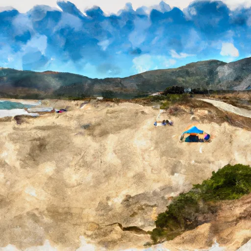
Salinas River State Beach
Reasons to Visit:
1. Natural Beauty: Salinas River State Beach boasts stunning scenic views, with miles of untouched sandy beaches, dunes, and coastal grasslands. The unspoiled landscape is perfect for relaxation and rejuvenation.
2. Wildlife Watching: The area is home to a diverse array of wildlife species, including migratory birds, harbor seals, sea otters, and various marine life. Birdwatchers will particularly enjoy observing the numerous species of birds that inhabit the beach and estuary.
3. Outdoor Activities: The beach offers ample opportunities for outdoor activities such as beachcombing, picnicking, horseback riding, and hiking. Fishing is also popular in the area, with anglers casting their lines from the shore or fishing off the nearby Salinas River mouth.
4. Privacy and Solitude: Unlike more crowded beaches in the region, Salinas River State Beach provides more secluded and peaceful surroundings, allowing visitors to enjoy the tranquility of the coastline.
Points of Interest:
1. Sand City Beach: Located within the state beach area, Sand City Beach is a popular spot for experienced surfers due to its consistent waves.
2. Salinas River Estuary: The river mouth and estuary provide a unique habitat for various bird species, making it an excellent spot for birdwatching and nature photography.
3. Dunes Preserve: The beach features a vast expanse of sand dunes, which can be explored through designated hiking trails. The dunes provide a glimpse into the unique ecology of the area.
Interesting Facts:
1. Salinas River State Beach is part of the larger Monterey Bay National Marine Sanctuary, protecting its rich marine ecosystem.
2. The beach is known to have strong currents and riptides, so it is important to exercise caution when swimming or engaging in water activities.
3. Salinas River State Beach was once home to the Esselen Native American tribe, who thrived in the region for thousands of years.
Best Time to Visit:
The best time to visit Salinas River State Beach is during the summer months, from June to August, when the weather is generally warm and sunny. However, it is important to note that coastal weather can be unpredictable, with fog and cool temperatures possible throughout the year. It is advisable to check the local weather forecast before planning a visit.
Please note that while efforts have been made to ensure accuracy, it is always recommended to verify information from multiple independent sources for the most up-to-date and reliable details.
Plan your visit down to the hour
Same weather feed Snoflo's iOS app uses -- updated continuously from NOAA / yr.no.
Next 5 days, hour by hour
Temperature line with weather symbols on top, snow + rain accumulation as columns, humidity as a dotted line.
5-day forecast table
Every 3 hours, broken out across temperature, snow, rain, humidity, and wind.
| Time | Condition | Temp (°F) | Snow (in) | Rain (in) | Humidity (%) | Wind (mps) | Wind dir |
|---|---|---|---|---|---|---|---|
| Loading detailed forecast… | |||||||
15-day temperature & precipitation
Daily temperatures, snow, and rain projected over the next two weeks.
Responsible recreation & Leave No Trace
- Know before you go
- Check the operator's site for hours, permit requirements, seasonal closures, and fire restrictions before heading out.
- Stay on trail
- Stick to marked paths to protect vegetation, prevent erosion, and avoid disturbing wildlife habitat.
- Respect wildlife
- Observe from a distance, never feed wildlife, and store food securely if camping is permitted on-site.
- Pack it in, pack it out
- Carry out all trash, food scraps, and gear. Many parks have limited or no trash service.
- Leave what you find
- Don't take rocks, plants, or artifacts. They make the park what it is for the next visitor.
Set push alerts in the Snoflo app
Save Salinas River State Beach as a favorite, set a custom threshold (precipitation, freezing temperatures, fire-restriction days), and the iOS app will push the moment conditions cross.
About Salinas River State Beach
What can I do at Salinas River State Beach?
Most Snoflo-tracked parks support hiking, picnicking, and wildlife viewing. Check the operator's site for activity-specific rules (camping, fishing, paddling, hunting).
How fresh is the weather data?
The hourly forecast updates throughout the day from NOAA / yr.no. Streamflow comes live from USGS streamgauges.
When is the best time to visit?
Use the 15-day temperature & precipitation outlook on this page to plan -- pick a window with comfortable temperatures and low precipitation.
How do I get to Salinas River State Beach?
Tap Directions in the hero above to open driving directions in Google Maps, or Open in map to center the Snoflo interactive map on the park.
Can I get alerts when conditions change?
Yes -- alerts are managed in the Snoflo iOS app. Favorite this park, set a threshold (temperature, precipitation), and you'll get a push the moment it crosses.
Park & land designation reference
A quick legend for the federal and state land categories Snoflo tracks. Each designation comes with different rules around access, recreation, and resource extraction.
- National Park
- Large protected natural areas managed by the federal government to preserve significant landscapes, ecosystems, and cultural resources; recreation is allowed but conservation is the priority.
- State Park
- Public natural or recreational areas managed by a state government, typically smaller than national parks and focused on regional natural features, recreation, and education.
- Local Park
- Community-level parks managed by cities or counties, emphasizing recreation, playgrounds, sports, and green space close to populated areas.
- Wilderness Area
- The highest level of land protection in the U.S.; designated areas where nature is left essentially untouched, with no roads, structures, or motorized motorized access permitted.
- National Recreation Area
- Areas set aside primarily for outdoor recreation (boating, hiking, fishing, often around reservoirs, rivers, or scenic landscapes); may allow more development.
- National Conservation Area (BLM)
- BLM-managed areas with special ecological, cultural, or scientific value; more protection than typical BLM land but less strict than Wilderness Areas.
- State Forest
- State-managed forests focused on habitat, watershed, recreation, and sustainable timber harvest.
- Bureau of Land Management (BLM) Land
- Vast federal lands managed for mixed use -- recreation, grazing, mining, conservation -- with fewer restrictions than national parks or forests.