Wilderness Pleasant View Ridge
Community Reviews
Been here? Share the conditions.
Reviews, ratings & photos are added in the free Snoflo iOS app — rate a spot, tag the conditions, and your visit is verified by location. Add or manage your reviews from the app.

Wilderness Pleasant View Ridge
Reasons to Visit:
1. Scenic Beauty: Wilderness Pleasant View Ridge boasts breathtaking vistas, including panoramic views of the surrounding mountains, lush forests, and wildflower meadows.
2. Hiking and Outdoor Activities: The wilderness area offers numerous hiking trails that cater to different skill levels, allowing visitors to explore its diverse landscapes and enjoy activities such as backpacking, camping, and backpacking.
3. Wildlife Viewing: The area is home to various wildlife species, including deer, mountain lions, bobcats, and a wide array of bird species, providing excellent opportunities for wildlife observation and photography.
Points of Interest:
1. Mount Islip: Standing at an elevation of 8,250 feet, Mount Islip offers incredible panoramic views of the wilderness and surrounding areas. Hiking to the summit is a popular activity among visitors.
2. Windy Gap: Located along the Pacific Crest Trail, Windy Gap is a picturesque spot known for its stunning view of the surrounding mountains and valleys. It's an excellent resting point for hikers and a favored spot for photography.
3. Little Jimmy Campground: Situated near the Angeles Crest Highway, the Little Jimmy Campground provides a convenient and scenic camping spot for visitors exploring the area.
Interesting Facts:
1. The Wilderness Pleasant View Ridge is part of the larger Angeles National Forest, which covers over 700,000 acres of diverse terrain, making it one of the largest national forests in California.
2. The area is rich in plant life, with over 1,000 different species of plants, including towering Jeffrey pines, oak woodlands, and stunning wildflower displays during the springtime.
3. The wilderness is traversed by several major trails, including the Pacific Crest Trail, which spans 2,650 miles from Mexico to Canada.
Best Time to Visit:
The best time to visit Wilderness Pleasant View Ridge is during the late spring to early fall. During this period, the weather is generally pleasant, with temperatures ranging from mild to warm, making hiking and outdoor activities more enjoyable. Springtime brings blooming wildflowers, while autumn offers vibrant foliage colors. However, it is essential to check weather conditions and trail information beforehand, as the area can experience occasional snowfall and closures during winter months.
Please note that while efforts have been made to ensure accuracy, it's always advisable to verify information from multiple independent sources, as details such as trail conditions and specific points of interest may vary over time.
Trails in Wilderness Pleasant View Ridge
Named trails whose route falls inside the park.
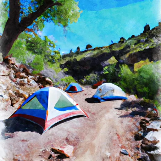
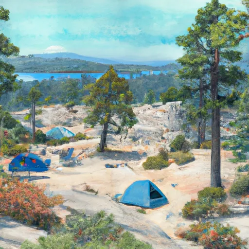
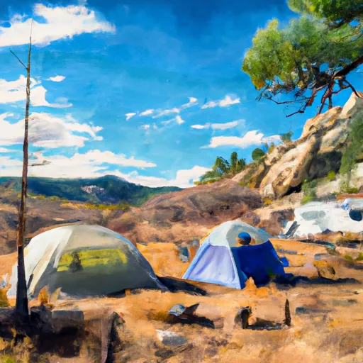
Camping in Wilderness Pleasant View Ridge
Campgrounds inside the park, with today's conditions score.
Plan your visit down to the hour
Same weather feed Snoflo's iOS app uses -- updated continuously from NOAA / yr.no.
Next 5 days, hour by hour
Temperature line with weather symbols on top, snow + rain accumulation as columns, humidity as a dotted line.
5-day forecast table
Every 3 hours, broken out across temperature, snow, rain, humidity, and wind.
| Time | Condition | Temp (°F) | Snow (in) | Rain (in) | Humidity (%) | Wind (mps) | Wind dir |
|---|---|---|---|---|---|---|---|
| Loading detailed forecast… | |||||||
15-day temperature & precipitation
Daily temperatures, snow, and rain projected over the next two weeks.
Responsible recreation & Leave No Trace
- Know before you go
- Check the operator's site for hours, permit requirements, seasonal closures, and fire restrictions before heading out.
- Stay on trail
- Stick to marked paths to protect vegetation, prevent erosion, and avoid disturbing wildlife habitat.
- Respect wildlife
- Observe from a distance, never feed wildlife, and store food securely if camping is permitted on-site.
- Pack it in, pack it out
- Carry out all trash, food scraps, and gear. Many parks have limited or no trash service.
- Leave what you find
- Don't take rocks, plants, or artifacts. They make the park what it is for the next visitor.
Set push alerts in the Snoflo app
Save Wilderness Pleasant View Ridge as a favorite, set a custom threshold (precipitation, freezing temperatures, fire-restriction days), and the iOS app will push the moment conditions cross.
About Wilderness Pleasant View Ridge
What can I do at Wilderness Pleasant View Ridge?
Most Snoflo-tracked parks support hiking, picnicking, and wildlife viewing. Check the operator's site for activity-specific rules (camping, fishing, paddling, hunting).
How fresh is the weather data?
The hourly forecast updates throughout the day from NOAA / yr.no. Streamflow comes live from USGS streamgauges.
When is the best time to visit?
Use the 15-day temperature & precipitation outlook on this page to plan -- pick a window with comfortable temperatures and low precipitation.
How do I get to Wilderness Pleasant View Ridge?
Tap Directions in the hero above to open driving directions in Google Maps, or Open in map to center the Snoflo interactive map on the park.
Can I get alerts when conditions change?
Yes -- alerts are managed in the Snoflo iOS app. Favorite this park, set a threshold (temperature, precipitation), and you'll get a push the moment it crosses.
Park & land designation reference
A quick legend for the federal and state land categories Snoflo tracks. Each designation comes with different rules around access, recreation, and resource extraction.
- National Park
- Large protected natural areas managed by the federal government to preserve significant landscapes, ecosystems, and cultural resources; recreation is allowed but conservation is the priority.
- State Park
- Public natural or recreational areas managed by a state government, typically smaller than national parks and focused on regional natural features, recreation, and education.
- Local Park
- Community-level parks managed by cities or counties, emphasizing recreation, playgrounds, sports, and green space close to populated areas.
- Wilderness Area
- The highest level of land protection in the U.S.; designated areas where nature is left essentially untouched, with no roads, structures, or motorized motorized access permitted.
- National Recreation Area
- Areas set aside primarily for outdoor recreation (boating, hiking, fishing, often around reservoirs, rivers, or scenic landscapes); may allow more development.
- National Conservation Area (BLM)
- BLM-managed areas with special ecological, cultural, or scientific value; more protection than typical BLM land but less strict than Wilderness Areas.
- State Forest
- State-managed forests focused on habitat, watershed, recreation, and sustainable timber harvest.
- Bureau of Land Management (BLM) Land
- Vast federal lands managed for mixed use -- recreation, grazing, mining, conservation -- with fewer restrictions than national parks or forests.