Theodore Roosevelt Island
Community Reviews
Been here? Share the conditions.
Reviews, ratings & photos are added in the free Snoflo iOS app — rate a spot, tag the conditions, and your visit is verified by location. Add or manage your reviews from the app.

Theodore Roosevelt Island
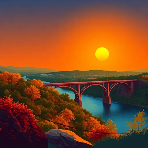
There are several compelling reasons to visit Theodore Roosevelt Island. Firstly, it provides a serene natural environment amidst the urban landscape of Washington, D.C. Visitors can explore the island's hiking trails, which wind through dense forests and marshy wetlands, offering a peaceful retreat and an opportunity for solitude. Additionally, the island serves as a sanctuary for a variety of wildlife, making it a fantastic place for birdwatching and observing other native creatures.
Several points of interest make Theodore Roosevelt Island worth a visit. The most notable attraction is the impressive Memorial Plaza, featuring a larger-than-life statue of President Roosevelt. The plaza offers an excellent vantage point to admire the stunning views of the Potomac River and the surrounding landscape. Furthermore, the island boasts various informative panels and exhibits that highlight President Roosevelt's contributions to conservation, showcasing his commitment to preserving natural spaces for future generations.
Interesting facts about Theodore Roosevelt Island further enhance its appeal. For instance, the island was originally known as Analostan Island, but in 1932, it was renamed in honor of President Roosevelt. The island's design incorporates elements to reflect Roosevelt's love for the outdoors and his passion for conservation. This tribute to the president's legacy helps educate visitors about his significant contributions to environmental preservation.
The best time of year to visit Theodore Roosevelt Island is during the spring and fall seasons. Spring brings lush greenery and blooming flowers, making it an ideal time to enjoy the island's natural beauty. Autumn paints the landscape with vibrant foliage, creating a picturesque setting for visitors to explore.
To ensure accuracy, it is advisable to verify information about Theodore Roosevelt Island from multiple independent sources, such as the National Park Service website, reputable travel guides, and official tourism websites. These sources can provide comprehensive and up-to-date information to plan an enjoyable visit to this remarkable island in the District of Columbia.
Trails in Theodore Roosevelt Island
Named trails whose route falls inside the park.
Points of interest in Theodore Roosevelt Island
Landmarks and points of interest inside the park boundary.

Plan your visit down to the hour
Same weather feed Snoflo's iOS app uses -- updated continuously from NOAA / yr.no.
Next 5 days, hour by hour
Temperature line with weather symbols on top, snow + rain accumulation as columns, humidity as a dotted line.
5-day forecast table
Every 3 hours, broken out across temperature, snow, rain, humidity, and wind.
| Time | Condition | Temp (°F) | Snow (in) | Rain (in) | Humidity (%) | Wind (mps) | Wind dir |
|---|---|---|---|---|---|---|---|
| Loading detailed forecast… | |||||||
15-day temperature & precipitation
Daily temperatures, snow, and rain projected over the next two weeks.
Responsible recreation & Leave No Trace
- Know before you go
- Check the operator's site for hours, permit requirements, seasonal closures, and fire restrictions before heading out.
- Stay on trail
- Stick to marked paths to protect vegetation, prevent erosion, and avoid disturbing wildlife habitat.
- Respect wildlife
- Observe from a distance, never feed wildlife, and store food securely if camping is permitted on-site.
- Pack it in, pack it out
- Carry out all trash, food scraps, and gear. Many parks have limited or no trash service.
- Leave what you find
- Don't take rocks, plants, or artifacts. They make the park what it is for the next visitor.
Set push alerts in the Snoflo app
Save Theodore Roosevelt Island as a favorite, set a custom threshold (precipitation, freezing temperatures, fire-restriction days), and the iOS app will push the moment conditions cross.
About Theodore Roosevelt Island
What can I do at Theodore Roosevelt Island?
Most Snoflo-tracked parks support hiking, picnicking, and wildlife viewing. Check the operator's site for activity-specific rules (camping, fishing, paddling, hunting).
How fresh is the weather data?
The hourly forecast updates throughout the day from NOAA / yr.no. Streamflow comes live from USGS streamgauges.
When is the best time to visit?
Use the 15-day temperature & precipitation outlook on this page to plan -- pick a window with comfortable temperatures and low precipitation.
How do I get to Theodore Roosevelt Island?
Tap Directions in the hero above to open driving directions in Google Maps, or Open in map to center the Snoflo interactive map on the park.
Can I get alerts when conditions change?
Yes -- alerts are managed in the Snoflo iOS app. Favorite this park, set a threshold (temperature, precipitation), and you'll get a push the moment it crosses.
Park & land designation reference
A quick legend for the federal and state land categories Snoflo tracks. Each designation comes with different rules around access, recreation, and resource extraction.
- National Park
- Large protected natural areas managed by the federal government to preserve significant landscapes, ecosystems, and cultural resources; recreation is allowed but conservation is the priority.
- State Park
- Public natural or recreational areas managed by a state government, typically smaller than national parks and focused on regional natural features, recreation, and education.
- Local Park
- Community-level parks managed by cities or counties, emphasizing recreation, playgrounds, sports, and green space close to populated areas.
- Wilderness Area
- The highest level of land protection in the U.S.; designated areas where nature is left essentially untouched, with no roads, structures, or motorized motorized access permitted.
- National Recreation Area
- Areas set aside primarily for outdoor recreation (boating, hiking, fishing, often around reservoirs, rivers, or scenic landscapes); may allow more development.
- National Conservation Area (BLM)
- BLM-managed areas with special ecological, cultural, or scientific value; more protection than typical BLM land but less strict than Wilderness Areas.
- State Forest
- State-managed forests focused on habitat, watershed, recreation, and sustainable timber harvest.
- Bureau of Land Management (BLM) Land
- Vast federal lands managed for mixed use -- recreation, grazing, mining, conservation -- with fewer restrictions than national parks or forests.